Connor Downs
Coordinates: 50°12′14″N 5°22′27″W / 50.2039°N 5.3741°W
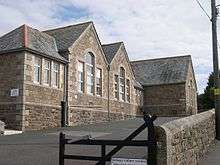
Connor Downs Primary School
Connor Downs is a village in west Cornwall, England, United Kingdom, in the civil parish of Gwinear-Gwithian. It is situated approximately two miles (3 km) east of Hayle and about two miles south-southeast of Gwithian churchtown.[1] The name "Connor" was originally the name of Connerton, the medieval manor of the parish of Gwithian.
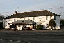
The Turnpike Inn, Connor Downs
The village straddles the old course of the A30 road but has now been bypassed and the new road passes to the north. Facilities include a school (Connor Downs Primary School), a petrol station and a fish-and-chip shop.
References
External links
![]()
Cornwall Portal | |
| Unitary authorities | |
| Major settlements |
|
| Rivers | |
| Topics | |
This article is issued from
Wikipedia.
The text is licensed under Creative Commons - Attribution - Sharealike.
Additional terms may apply for the media files.