Columbia Historic District II
|
Columbia Historic District II | |
.jpg) Crawford-Clarkson House, HABS Photo, April 1960 | |
  | |
| Location | Roughly bounded by Taylor, Richland, Pickens, and Barnwell Sts.; Blanding, Laurel, Richland, Calhoun, Marion, Bull, Pickens, Henderson, and Barnwell Sts.; 1328 Blanding Street, Columbia, South Carolina |
|---|---|
| Coordinates | 34°00′39″N 81°02′01″W / 34.01083°N 81.03361°WCoordinates: 34°00′39″N 81°02′01″W / 34.01083°N 81.03361°W |
| Area | 41 acres (17 ha) |
| Built | 1820 |
| Architect | Mills, Robert,et al. |
| Architectural style | Early Republic, Greek Revival, Columbia Cottage |
| NRHP reference # |
71000799 (original) 82003901[1] (increase 1) 100003002 (increase 2) |
| Significant dates | |
| Added to NRHP | May 6, 1971 |
| Boundary increases |
June 28, 1982 October 2, 2018 |
Columbia Historic District II is a national historic district located at Columbia, South Carolina. The district encompasses 113 contributing buildings and 1 contributing site in a former residential section of Columbia. They were built between the early-19th century and the 1930s (majority between 1900 and 1918) and are now mostly used for commercial purposes. The buildings are in the Greek Revival, Gothic Revival, Classical Revival, and the “Columbia Cottage” styles. Notable buildings include the Robert Mills House, Debruhl-Marshall House, Hampton-Preston House, Episcopal Church of the Good Shepherd, Crawford-Clarkson House, Maxcy Gregg House, Hale-Elmore-Seibels House, St. Paul's Lutheran Church, and Ebenezer Lutheran Church.[2][3][4]
It was added to the National Register of Historic Places in 1971. It was enlarged in 1982, and underwent a boundary adjustment in 2018.[1]
References
- 1 2 National Park Service (2010-07-09). "National Register Information System". National Register of Historic Places. National Park Service.
- ↑ Dollie McGrath (March 1971). "Columbia Historic District II" (pdf). National Register of Historic Places - Nomination and Inventory. Retrieved 2014-01-07.
- ↑ "Columbia Historic District II, Richland County (Columbia)". National Register Properties in South Carolina. South Carolina Department of Archives and History. Retrieved 2014-01-07. and accompanying map
- ↑ John Wells; et al. (December 1981). "Columbia Historic District II (Boundary Increase)" (pdf). National Register of Historic Places - Nomination and Inventory. Retrieved 2014-01-07.
External links
- Historic American Buildings Survey (HABS) No. SC-250, "Crawford-Clarkson House, Bull & Blanding Streets, Columbia, Richland County, SC", 15 photos, 6 data pages
| Topics |  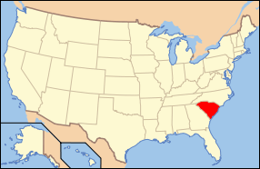 | |
|---|---|---|
| Lists by county |
| |
| Lists by city | ||
| Other lists | ||