| [3] |
Name on the Register[4] |
Image |
Date listed[5] |
Location |
City or town |
Description |
|---|
| 1 |
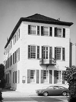
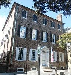
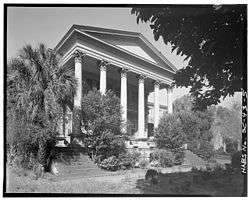
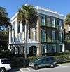
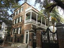
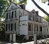
Gov. William Aiken House |
|
November 21, 1979
(#77001216) |
48 Elizabeth St.
32°47′29″N 79°56′06″W / 32.7914°N 79.935°W / 32.7914; -79.935 (Gov. William Aiken House) |
Peninsula |
|
| 2 |
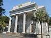
William Aiken House and Associated Railroad Structures |
|
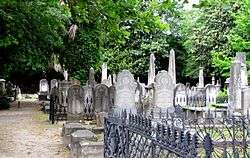
October 15, 1966
(#66000698) |
456 King St.
32°47′22″N 79°56′17″W / 32.7894°N 79.9381°W / 32.7894; -79.9381 (William Aiken House and Associated Railroad Structures) |
Peninsula |
|
| 3 |
Ashley River Historic District |
|
September 12, 1994
(#93001514) |
Roughly along the Ashley River from just east of South Carolina Highway 165 to the Seaboard Coast Line railroad bridge
32°53′58″N 80°07′00″W / 32.8994°N 80.1167°W / 32.8994; -80.1167 (Ashley River Historic District) |
West Ashley |
Extends into other parts of Charleston and into Dorchester counties; boundary increase (listed October 22, 2010): Northwest of Charleston between the northeast bank of the Ashley River and the Ashley-Stono Canal and east of Delmar Highway (Highway 165) |
| 4 |
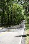
Ashley River Road |
|
November 21, 1983
(#83003831) |
South Carolina Highway 61 between Church Creek and South Carolina Highway 165
32°53′43″N 80°08′08″W / 32.8953°N 80.1356°W / 32.8953; -80.1356 (Ashley River Road) |
West Ashley |
Extends into other parts of Charleston and into Dorchester counties |
| 5 |
Battery Cheves |
|
August 11, 1982
(#82003841) |
James Island
32°44′17″N 79°54′22″W / 32.7381°N 79.9061°W / 32.7381; -79.9061 (Battery Cheves) |
James Island |
|
| 6 |
Battery LeRoy |
|
August 11, 1982
(#82004786) |
Riverland Dr.
32°42′50″N 79°58′52″W / 32.7139°N 79.9811°W / 32.7139; -79.9811 (Battery LeRoy) |
James Island |
|
| 7 |
Battery No. 1 |
|
August 11, 1982
(#82004787) |
Riverland Dr.
32°42′52″N 79°58′42″W / 32.7144°N 79.9783°W / 32.7144; -79.9783 (Battery No. 1) |
James Island |
|
| 8 |
Battery No. 5 |
|
August 11, 1982
(#82004788) |
Stonefield Subdivision
32°42′30″N 79°57′18″W / 32.7083°N 79.955°W / 32.7083; -79.955 (Battery No. 5) |
James Island |
|
| 9 |
Battery Tynes |
|
August 11, 1982
(#82004789) |
Stono River
32°43′28″N 79°59′23″W / 32.7244°N 79.9897°W / 32.7244; -79.9897 (Battery Tynes) |
James Island |
|
| 10 |
Battery Wilkes |
|
October 21, 1982
(#82001516) |
St. Andrew's Parish
32°47′38″N 80°03′56″W / 32.7939°N 80.0656°W / 32.7939; -80.0656 (Battery Wilkes) |
West Ashley |
|
| 11 |
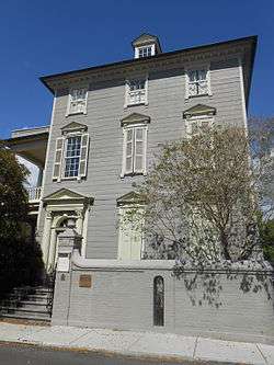
Gov. Thomas Bennett House |
|
January 31, 1978
(#78002496) |
69 Barre St.
32°46′53″N 79°56′50″W / 32.7814°N 79.9472°W / 32.7814; -79.9472 (Gov. Thomas Bennett House) |
Peninsula |
|
| 12 |
Bethel Methodist Church |
|
November 20, 1974
(#74002260) |
57 Pitt St.
32°47′02″N 79°56′29″W / 32.7839°N 79.9414°W / 32.7839; -79.9414 (Bethel Methodist Church) |
Peninsula |
|
| 13 |
William Blacklock House |
|
November 7, 1973
(#73001681) |
18 Bull St.
32°47′00″N 79°56′22″W / 32.7833°N 79.9394°W / 32.7833; -79.9394 (William Blacklock House) |
Peninsula |
|
| 14 |
Blake Tenements |
|
August 25, 1970
(#70000572) |
2-4 Courthouse Sq.
32°46′36″N 79°55′55″W / 32.7767°N 79.9319°W / 32.7767; -79.9319 (Blake Tenements) |
Peninsula |
|
| 15 |
Branford-Horry House |
|
October 15, 1970
(#70000573) |
59 Meeting St.
32°46′28″N 79°55′53″W / 32.7744°N 79.9314°W / 32.7744; -79.9314 (Branford-Horry House) |
Peninsula |
|
| 16 |
Miles Brewton House |
|
October 15, 1966
(#66000699) |
27 King St.
32°46′21″N 79°55′59″W / 32.7725°N 79.9331°W / 32.7725; -79.9331 (Miles Brewton House) |
Peninsula |
|
| 17 |
Robert Brewton House |
|
October 15, 1966
(#66000700) |
71 Church St.
32°46′28″N 79°55′46″W / 32.7744°N 79.9294°W / 32.7744; -79.9294 (Robert Brewton House) |
Peninsula |
|
| 18 |
Castle Pinckney |
|
July 16, 1970
(#70000574) |
Shute's Folly Island
32°46′25″N 79°54′41″W / 32.7736°N 79.9114°W / 32.7736; -79.9114 (Castle Pinckney) |
Shute's Folly Island |
|
| 19 |
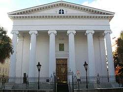
Central Baptist Church |
|
August 16, 1977
(#77001217) |
26 Radcliffe St.
32°47′18″N 79°56′28″W / 32.7883°N 79.9411°W / 32.7883; -79.9411 (Central Baptist Church) |
Peninsula |
|
| 20 |
Charleston Cemeteries Historic District |
|
July 24, 2017
(#100001367) |
Huguenin Ave., roughly bounded by Algonquin Rd., CSXRR, N. Romney & Meeting Sts.
32°48′56″N 79°56′49″W / 32.815486°N 79.946952°W / 32.815486; -79.946952 (Charleston Cemeteries Historic District) |
Peninsula |
|
| 21 |
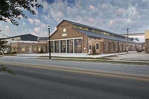
Charleston Consolidated Railway, Electric and Gas Company Car House |
|
February 28, 2017
(#100000686) |
649 Meeting St.
32°48′18″N 79°56′49″W / 32.805087°N 79.946926°W / 32.805087; -79.946926 (Charleston Consolidated Railway, Electric and Gas Company Car House) |
Peninsula |
|
| 22 |
Charleston Historic District |
|
October 15, 1966
(#66000964) |
An area roughly bounded by Broad, Bay, S. Battery, and Ashley, and an area along Church bounded by Cumberland and Chalmers; also an area roughly bounded by Calhoun, Archdale, Cumberland, E. Battery, Broad, and Gadsden, and an area along Anson St.; also incorporating most of the area south of Bee, Morris, and Mary Sts. to the waterfront; also King and Calhoun Sts.; also 25 and 25½ Warren and 114 St. Phillip Sts.; also 280 E. Bay St.
32°46′47″N 79°56′05″W / 32.7797°N 79.9347°W / 32.7797; -79.9347 (Charleston Historic District) |
Peninsula |
Semicolons separate the original boundaries and boundary increases of January 30, 1970, July 16, 1978, August 2, 1984, August 13, 1985, and March 27, 1986. The increase of 1978 is denominated "Charleston Historic District", and the increases of 1985 and 1986 are denominated "Charleston Old and Historic District". |
| 23 |
Charleston's French Quarter District |
|
September 19, 1973
(#73001682) |
Bounded by Lodge Alley and Cumberland, E. Bay, and State Sts.
32°46′45″N 79°55′41″W / 32.7792°N 79.9281°W / 32.7792; -79.9281 (Charleston's French Quarter District) |
Peninsula |
|
| 24 |
Cigar Factory |
|
November 25, 1980
(#80003658) |
Block bounded by East Bay, Columbus, Blake, and Drake Sts.
32°47′52″N 79°56′05″W / 32.7978°N 79.9347°W / 32.7978; -79.9347 (Cigar Factory) |
Peninsula |
|
| 25 |
Circular Congregational Church and Parish House |
|
November 7, 1973
(#73001683) |
150 Meeting St.
32°46′44″N 79°55′52″W / 32.7789°N 79.9311°W / 32.7789; -79.9311 (Circular Congregational Church and Parish House) |
Peninsula |
|
| 26 |
Citizens and Southern National Bank of South Carolina |
|
May 6, 1971
(#71000747) |
50 Broad St.
32°46′36″N 79°55′48″W / 32.7767°N 79.93°W / 32.7767; -79.93 (Citizens and Southern National Bank of South Carolina) |
Peninsula |
|
| 27 |
College of Charleston |
|
November 11, 1971
(#71000748) |
Glebe, George, St. Philip, and Green Sts.
32°47′04″N 79°56′15″W / 32.7844°N 79.9375°W / 32.7844; -79.9375 (College of Charleston) |
Peninsula |
|
| 28 |
Coming Street Cemetery |
|
November 5, 1996
(#96001223) |
189 Coming St.
32°47′23″N 79°56′34″W / 32.7897°N 79.9428°W / 32.7897; -79.9428 (Coming Street Cemetery) |
Peninsula |
|
| 29 |
Dock Street Theatre |
|
June 19, 1973
(#73001684) |
135 Church St.
32°46′40″N 79°55′48″W / 32.7778°N 79.93°W / 32.7778; -79.93 (Dock Street Theatre) |
Peninsula |
|
| 30 |
Drayton Hall |
|
October 15, 1966
(#66000701) |
12 miles west of Charleston on South Carolina Highway 61
32°52′16″N 80°04′34″W / 32.8711°N 80.0761°W / 32.8711; -80.0761 (Drayton Hall) |
West Ashley |
|
| 31 |
William Enston Home |
|
April 25, 1996
(#96000493) |
900 King St.
32°48′06″N 79°56′55″W / 32.8017°N 79.9486°W / 32.8017; -79.9486 (William Enston Home) |
Peninsula |
|
| 32 |
Exchange and Provost |
|
December 17, 1969
(#69000160) |
E. Bay and Broad Sts.
32°46′31″N 79°55′38″W / 32.7753°N 79.9272°W / 32.7753; -79.9272 (Exchange and Provost) |
Peninsula |
|
| 33 |
Farmers' and Exchange Bank |
|
November 7, 1973
(#73001685) |
141 East Bay Street
32°46′39″N 79°55′38″W / 32.7775°N 79.927222°W / 32.7775; -79.927222 (Farmers' and Exchange Bank) |
Peninsula |
|
| 34 |
Farmfield Plantation House |
|
October 29, 1982
(#82001517) |
Farmfield Rd.
32°46′30″N 79°59′36″W / 32.775°N 79.9933°W / 32.775; -79.9933 (Farmfield Plantation House) |
West Ashley |
|
| 35 |
Fenwick Hall |
|
February 23, 1972
(#72001196) |
South of Charleston on Johns Island, U.S. Route 17
32°45′02″N 80°02′20″W / 32.7506°N 80.0389°W / 32.7506; -80.0389 (Fenwick Hall) |
Johns Island |
|
| 36 |
Fireproof Building |
|
July 29, 1969
(#69000161) |
100 Meeting St.
32°46′36″N 79°55′55″W / 32.7767°N 79.9319°W / 32.7767; -79.9319 (Fireproof Building) |
Peninsula |
|
| 37 |
Florence Crittenton Home |
|
September 25, 1997
(#97001157) |
19 St. Margaret St.
32°48′12″N 79°57′18″W / 32.8033°N 79.955°W / 32.8033; -79.955 (Florence Crittenton Home) |
Peninsula |
|
| 38 |
Fort Pringle |
|
August 11, 1982
(#82004790) |
Riverland Dr.
32°42′50″N 79°59′07″W / 32.7139°N 79.9853°W / 32.7139; -79.9853 (Fort Pringle) |
James Island |
|
| 39 |
Fort Sumter National Monument |
|
October 15, 1966
(#66000101) |
Charleston Harbor
32°45′08″N 79°52′29″W / 32.7522°N 79.8747°W / 32.7522; -79.8747 (Fort Sumter National Monument) |
Harbor |
|
| 40 |
Fort Trenholm |
|
August 11, 1982
(#82004791) |
Johns Island Airport
32°42′29″N 79°59′49″W / 32.7081°N 79.9969°W / 32.7081; -79.9969 (Fort Trenholm) |
Johns Island |
|
| 41 |
William Gibbes House |
|
April 15, 1970
(#70000575) |
64 S. Battery
32°46′14″N 79°55′59″W / 32.7706°N 79.9331°W / 32.7706; -79.9331 (William Gibbes House) |
Peninsula |
|
| 42 |
Greek Orthodox Church of the Holy Trinity |
|
October 22, 2004
(#04001164) |
30 Race St.
32°47′52″N 79°56′55″W / 32.7978°N 79.9486°W / 32.7978; -79.9486 (Greek Orthodox Church of the Holy Trinity) |
Peninsula |
|
| 43 |
Hampton Park Terrace Historic District |
|
September 26, 1997
(#97001186) |
Roughly bounded by Hagood and Rutledge Aves., and Moltrie and Congress Sts.
32°47′48″N 79°57′19″W / 32.7967°N 79.9553°W / 32.7967; -79.9553 (Hampton Park Terrace Historic District) |
Peninsula |
|
| 44 |
Dubose Heyward House |
|
November 11, 1971
(#71000749) |
76 Church St.
32°46′26″N 79°55′44″W / 32.7739°N 79.9289°W / 32.7739; -79.9289 (Dubose Heyward House) |
Peninsula |
|
| 45 |
Heyward-Washington House |
|
April 15, 1970
(#70000576) |
87 Church St.
32°46′33″N 79°55′46″W / 32.7758°N 79.9294°W / 32.7758; -79.9294 (Heyward-Washington House) |
Peninsula |
|
| 46 |
Hibernian Hall |
|
November 7, 1973
(#73001686) |
105 Meeting St.
32°46′38″N 79°55′54″W / 32.7772°N 79.9317°W / 32.7772; -79.9317 (Hibernian Hall) |
Peninsula |
|
| 47 |
Cleland Kinloch and Burnet R. Maybank Huger House |
|
October 5, 2015
(#15000705) |
8 Legare St.
32°46′20″N 79°56′02″W / 32.7722°N 79.9338°W / 32.7722; -79.9338 (Cleland Kinloch and Burnet R. Maybank Huger House) |
|
|
| 48 |
Huguenot Church |
|
November 7, 1973
(#73001687) |
136 Church St.
32°46′50″N 79°55′45″W / 32.7806°N 79.9292°W / 32.7806; -79.9292 (Huguenot Church) |
Peninsula |
|
| 49 |
Kahal Kadosh Beth Elohim Synagogue |
|
April 4, 1978
(#78002499) |
90 Hasell St.
32°46′56″N 79°55′58″W / 32.7822°N 79.9328°W / 32.7822; -79.9328 (Kahal Kadosh Beth Elohim Synagogue) |
Peninsula |
|
| 50 |
Jackson Street Freedman's Cottages |
|
June 5, 2017
(#100001037) |
193-199 Jackson St.
32°47′57″N 79°56′29″W / 32.799241°N 79.941503°W / 32.799241; -79.941503 (Jackson Street Freedman's Cottages) |
|
|
| 51 |
Lowndes Grove |
|
August 30, 1978
(#78002500) |
260 St. Margaret St.
32°48′06″N 79°57′58″W / 32.8017°N 79.9661°W / 32.8017; -79.9661 (Lowndes Grove) |
Peninsula |
|
| 52 |
Jonathan Lucas House |
|
February 23, 1978
(#78002501) |
286 Calhoun St.
32°46′57″N 79°56′54″W / 32.7825°N 79.9483°W / 32.7825; -79.9483 (Jonathan Lucas House) |
Peninsula |
|
| 53 |
Magnolia Cemetery |
|
March 24, 1978
(#78002502) |
North of Charleston off U.S. Route 52
32°49′06″N 79°56′32″W / 32.8183°N 79.9422°W / 32.8183; -79.9422 (Magnolia Cemetery) |
Peninsula |
|
| 54 |
Joseph Manigault House |
|
November 7, 1973
(#73001688) |
350 Meeting St.
32°47′19″N 79°56′08″W / 32.7886°N 79.9356°W / 32.7886; -79.9356 (Joseph Manigault House) |
Peninsula |
|
| 55 |
Market Hall and Sheds |
|
June 4, 1973
(#73001689) |
188 Meeting St.
32°46′49″N 79°55′53″W / 32.7803°N 79.9314°W / 32.7803; -79.9314 (Market Hall and Sheds) |
Peninsula |
Also known as the Old City Market; market stalls are located on the first story of Market Hall, and continue in a series of sheds stretching behind Market Hall all the way to E. Bay St. |
| 56 |
McCrady's Tavern and Long Room |
|
September 14, 1972
(#72001199) |
153 E. Bay St.
32°46′41″N 79°55′38″W / 32.7781°N 79.9272°W / 32.7781; -79.9272 (McCrady's Tavern and Long Room) |
Peninsula |
|
| 57 |
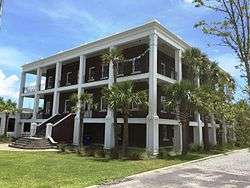
McLeod Plantation |
|
August 13, 1974
(#74001831) |
325 Country Club Dr.
32°45′46″N 79°58′21″W / 32.7628°N 79.9725°W / 32.7628; -79.9725 (McLeod Plantation) |
James Island |
|
| 58 |
Isaac Jenkins Mikell House |
|
March 11, 2014
(#14000056) |
94 Rutledge Ave.
32°46′51″N 79°56′31″W / 32.780825°N 79.94205°W / 32.780825; -79.94205 (Isaac Jenkins Mikell House) |
Peninsula |
|
| 59 |
Clark Mills Studio |
|
October 15, 1966
(#66000703) |
51 Broad St.
32°46′34″N 79°55′48″W / 32.7761°N 79.93°W / 32.7761; -79.93 (Clark Mills Studio) |
Peninsula |
A studio of the self-taught sculptor Clark Mills on Broad Street. |
| 60 |
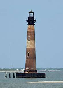
Morris Island Lighthouse |
|
June 28, 1982
(#82003837) |
6 miles (10 km) southeast of Charleston
32°41′43″N 79°53′01″W / 32.695278°N 79.883611°W / 32.695278; -79.883611 (Morris Island Lighthouse) |
Morris Island |
|
| 61 |
Andrew B. Murray Vocational School |
|
May 30, 2002
(#02000569) |
3 Chisolm St.
32°46′26″N 79°56′33″W / 32.7739°N 79.9425°W / 32.7739; -79.9425 (Andrew B. Murray Vocational School) |
Peninsula |
|
| 62 |
James Nicholson House |
|
August 30, 1974
(#74001832) |
172 Rutledge Ave.
32°47′12″N 79°56′44″W / 32.7867°N 79.9456°W / 32.7867; -79.9456 (James Nicholson House) |
Peninsula |
|
| 63 |
Old Bethel United Methodist Church |
|
April 21, 1975
(#75001693) |
222 Calhoun St.
32°47′03″N 79°56′33″W / 32.7842°N 79.9425°W / 32.7842; -79.9425 (Old Bethel United Methodist Church) |
Peninsula |
|
| 64 |
Old Marine Hospital |
|
November 7, 1973
(#73001690) |
20 Franklin St.
32°46′40″N 79°56′14″W / 32.7778°N 79.9372°W / 32.7778; -79.9372 (Old Marine Hospital) |
Peninsula |
|
| 65 |
Old Slave Mart |
|
May 2, 1975
(#75001694) |
6 Chalmers St.
32°46′38″N 79°55′48″W / 32.7772°N 79.93°W / 32.7772; -79.93 (Old Slave Mart) |
Peninsula |
|
| 66 |
Porter Military Academy |
|
June 21, 1996
(#96000685) |
175-181 Ashley Ave.
32°47′12″N 79°56′52″W / 32.7867°N 79.9478°W / 32.7867; -79.9478 (Porter Military Academy) |
Peninsula |
|
| 67 |
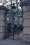
Powder Magazine |
|
January 5, 1972
(#72001200) |
79 Cumberland St.
32°46′45″N 79°55′51″W / 32.7792°N 79.9308°W / 32.7792; -79.9308 (Powder Magazine) |
Peninsula |
|
| 68 |
Presqui'ile |
|
December 8, 1978
(#78002503) |
2 Amherst St.
32°47′43″N 79°56′00″W / 32.795278°N 79.933333°W / 32.795278; -79.933333 (Presqui'ile) |
Peninsula |
|
| 69 |
Robert Barnwell Rhett House |
|
November 7, 1973
(#73001691) |
6 Thomas St.
32°47′10″N 79°56′33″W / 32.7861°N 79.9425°W / 32.7861; -79.9425 (Robert Barnwell Rhett House) |
Peninsula |
|
| 70 |
William Robb House |
|
September 8, 1983
(#83002186) |
12 Bee St.
32°47′14″N 79°56′50″W / 32.7872°N 79.9472°W / 32.7872; -79.9472 (William Robb House) |
Peninsula |
|
| 71 |
Robert William Roper House |
|
November 7, 1973
(#73001692) |
9 E. Battery St.
32°46′15″N 79°55′43″W / 32.7708°N 79.9286°W / 32.7708; -79.9286 (Robert William Roper House) |
Peninsula |
|
| 72 |
Thomas Rose House |
|
October 15, 1970
(#70000892) |
57-59 Church St.
32°46′24″N 79°55′46″W / 32.7733°N 79.9294°W / 32.7733; -79.9294 (Thomas Rose House) |
Peninsula |
|
| 73 |
Nathaniel Russell House |
|
August 19, 1971
(#71000750) |
51 Meeting St.
32°46′26″N 79°55′53″W / 32.7739°N 79.9314°W / 32.7739; -79.9314 (Nathaniel Russell House) |
Peninsula |
|
| 74 |
Edward Rutledge House |
|
November 11, 1971
(#71000751) |
117 Broad St.
32°46′34″N 79°56′02″W / 32.7761°N 79.9339°W / 32.7761; -79.9339 (Edward Rutledge House) |
Peninsula |
|
| 75 |
Gov. John Rutledge House |
|
November 7, 1971
(#71000752) |
116 Broad St.
32°46′34″N 79°56′01″W / 32.7761°N 79.9336°W / 32.7761; -79.9336 (Gov. John Rutledge House) |
Peninsula |
|
| 76 |
St. Andrew's Episcopal Church |
|
October 15, 1973
(#73001694) |
5 miles northwest of Charleston on South Carolina Highway 61
32°50′19″N 80°02′57″W / 32.8386°N 80.0492°W / 32.8386; -80.0492 (St. Andrew's Episcopal Church) |
West Ashley |
|
| 77 |
St. Mary's Roman Catholic Church |
|
November 7, 1976
(#76001697) |
93 Hasell St.
32°46′54″N 79°55′58″W / 32.7817°N 79.9328°W / 32.7817; -79.9328 (St. Mary's Roman Catholic Church) |
Peninsula |
|
| 78 |
St. Michael's Episcopal Church |
|
October 15, 1966
(#66000704) |
80 Meeting St.
32°46′34″N 79°55′51″W / 32.7761°N 79.9308°W / 32.7761; -79.9308 (St. Michael's Episcopal Church) |
Peninsula |
|
| 79 |
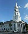
St. Philip's Episcopal Church |
|
November 7, 1973
(#73001695) |
146 Church St.
32°46′45″N 79°55′45″W / 32.7792°N 79.9292°W / 32.7792; -79.9292 (St. Philip's Episcopal Church) |
Peninsula |
|
| 80 |
Secessionville Historic District |
|
October 1, 1979
(#79002378) |
North of Folly Beach
32°42′18″N 79°56′35″W / 32.705°N 79.9431°W / 32.705; -79.9431 (Secessionville Historic District) |
James Island |
Extends into Folly Beach, elsewhere in Charleston County |
| 81 |
Simmons-Edwards House |
|
January 25, 1971
(#71000753) |
12-14 Legare St.
32°46′21″N 79°56′03″W / 32.7725°N 79.9342°W / 32.7725; -79.9342 (Simmons-Edwards House) |
Peninsula |
|
| 82 |
Site of Old Charles Towne |
|
December 17, 1969
(#69000162) |
Albemarle Point
32°48′27″N 79°59′13″W / 32.8075°N 79.9869°W / 32.8075; -79.9869 (Site of Old Charles Towne) |
West Ashley |
Now part of a state historic site |
| 83 |
Sixth Naval District Training Aids Library |
|
October 16, 2017
(#100001747) |
1056 King St.
32°48′18″N 79°57′03″W / 32.805066°N 79.950852°W / 32.805066; -79.950852 (Sixth Naval District Training Aids Library) |
|
|
| 84 |
South Carolina National Bank of Charleston |
|
June 4, 1973
(#73001693) |
16 Broad St.
32°46′37″N 79°55′39″W / 32.7769°N 79.9275°W / 32.7769; -79.9275 (South Carolina National Bank of Charleston) |
Peninsula |
|
| 85 |
South Carolina State Arsenal |
|
July 16, 1970
(#70000577) |
2 Tobacco Street, Marion Square
32°47′14″N 79°56′11″W / 32.787222°N 79.936389°W / 32.787222; -79.936389 (South Carolina State Arsenal) |
Peninsula |
|
| 86 |
James Sparrow House |
|
January 30, 1998
(#98000045) |
65 Cannon St.
32°47′20″N 79°56′42″W / 32.7889°N 79.945°W / 32.7889; -79.945 (James Sparrow House) |
Peninsula |
|
| 87 |
Standard Oil Company Headquarters |
|
February 3, 2015
(#14001243) |
1600 Meeting St.
32°49′18″N 79°57′05″W / 32.8216°N 79.9513°W / 32.8216; -79.9513 (Standard Oil Company Headquarters) |
|
|
| 88 |
Stiles-Hinson House |
|
October 9, 1974
(#74001833) |
940 Paul Revere Dr.
32°45′06″N 79°55′45″W / 32.7517°N 79.9292°W / 32.7517; -79.9292 (Stiles-Hinson House) |
James Island |
|
| 89 |
Col. John Stuart House |
|
October 22, 1970
(#70000578) |
104-106 Tradd St.
32°46′27″N 79°56′01″W / 32.7742°N 79.9336°W / 32.7742; -79.9336 (Col. John Stuart House) |
Peninsula |
|
| 90 |
Sword Gate House |
|
December 18, 1970
(#70000579) |
32 Legare St. and 111 Tradd St.
32°46′25″N 79°56′03″W / 32.7736°N 79.9342°W / 32.7736; -79.9342 (Sword Gate House) |
Peninsula |
|
| 91 |
Josiah Smith Tennent House |
|
November 27, 1979
(#79002377) |
729 E. Bay St.
32°47′55″N 79°56′06″W / 32.7986°N 79.935°W / 32.7986; -79.935 (Josiah Smith Tennent House) |
Peninsula |
|
| 92 |
U.S. Customhouse |
|
October 9, 1974
(#74001834) |
200 E. Bay St.
32°46′50″N 79°55′37″W / 32.7806°N 79.9269°W / 32.7806; -79.9269 (U.S. Customhouse) |
Peninsula |
|
| 93 |
U.S. Post Office and Courthouse |
|
August 13, 1974
(#74001835) |
83 Broad Street
32°46′33″N 79°55′54″W / 32.775833°N 79.931667°W / 32.775833; -79.931667 (U.S. Post Office and Courthouse) |
Peninsula |
|
| 94 |
Unitarian Church |
|
November 7, 1973
(#73001696) |
6 Archdale St.
32°46′20″N 79°56′02″W / 32.7722°N 79.9339°W / 32.7722; -79.9339 (Unitarian Church) |
Peninsula |
|
| 95 |
Unnamed Battery |
|
August 11, 1982
(#82003846) |
St. Andrew
32°48′07″N 80°03′14″W / 32.8019°N 80.0539°W / 32.8019; -80.0539 (Unnamed Battery) |
West Ashley |
|
| 96 |
Denmark Vesey House |
|
May 11, 1976
(#76001698) |
56 Bull St.
32°46′56″N 79°56′28″W / 32.7822°N 79.9411°W / 32.7822; -79.9411 (Denmark Vesey House) |
Peninsula |
|
| 97 |
West Point Rice Mill |
|
January 20, 1995
(#94001569) |
Junction of Lockwood Dr. and Calhoun St.
32°46′44″N 79°57′04″W / 32.7789°N 79.9511°W / 32.7789; -79.9511 (West Point Rice Mill) |
Peninsula |
|


.jpg)
.jpg)
_1.jpg)
.jpg)
.jpg)
.jpg)

.jpg)
_2.jpg)
.jpg)
%2C_Saint_Margaret_Street_%26_Sixth_Avenue%2C_Charleston_(Charleston_County%2C_South_Carolina).jpg)
.jpg)
.jpg)
.jpg)
.jpg)
.jpg)
.jpg)
.jpg)


.JPG)
.jpg)
.jpg)
.jpg)
.jpg)

.jpg)
.jpg)

.jpg)