Clate
Clate
| |
|---|---|
.jpg) Vanessa Trig On Ward of Clett | |
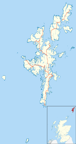 Clate Clate shown within Shetland | |
| OS grid reference | HU540615 |
| Civil parish | |
| Council area | |
| Lieutenancy area | |
| Country | Scotland |
| Sovereign state | United Kingdom |
| Post town | SHETLAND |
| Postcode district | ZE2 |
| Dialling code | 01806 |
| Police | Scottish |
| Fire | Scottish |
| Ambulance | Scottish |
| EU Parliament | Scotland |
| UK Parliament | |
| Scottish Parliament | |
Clate (also known as Clett)[1] is a hamlet and ward in southwestern Whalsay in the parish of Nesting in the Shetland Islands of Scotland.
Geography
Clate it is located south of the largest village of the island, Symbister, along the main road out of the village, just south of Sandwick. Haa Ness and Dimni Geo are coastal features at Clate, and the Holm of Sandwick lies off the coast.[2] There are several caves to the southeast. From Clate, a track leads to the southeast, up to a quarry, then leads uphill, passing the southwestern ridge of the Ward of Clett.[3]
History
The British military established a radar camp in Clate during wartime. Tanks and sheds built by the military were still in use in 1986.[4] A Catalina bomber crashed in the vicinity in the early part of World War II.[4]
References
- ↑ "Overview of Clate". Scottish Places. Retrieved 14 December 2014.
- ↑ 544612 "Brough, HU 544 612 GB Grid" Check
|url=value (help). Ordnance Survey. Retrieved 1 February 2013. - ↑ Uney, Graham (9 September 2010). Walking on the Orkney and Shetland Isles: 80 Walks in the Northern Isles. Cicerone Press Limited. p. 164. ISBN 978-1-85284-572-8. Retrieved 1 February 2013.
- 1 2 Cohen, Anthony Paul (1986). Symbolising Boundaries: Identity and Diversity in British Cultures. Manchester University Press. p. 15. ISBN 978-0-7190-2201-2. Retrieved 1 February 2013.
External links
| Wikimedia Commons has media related to Clate. |
| Settlements | ||
|---|---|---|
| Geography |
| |
| Archaeological sites | ||
| Buildings | ||