Clark Township, Holmes County, Ohio
| Clark Township, Holmes County, Ohio | |
|---|---|
| Township | |
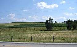 Fields east of Charm on State Route 557 | |
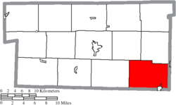 Location of Clark Township in Holmes County | |
| Coordinates: 40°28′24″N 81°44′21″W / 40.47333°N 81.73917°WCoordinates: 40°28′24″N 81°44′21″W / 40.47333°N 81.73917°W | |
| Country | United States |
| State | Ohio |
| County | Holmes |
| Area | |
| • Total | 34.6 sq mi (89.5 km2) |
| • Land | 34.5 sq mi (89.4 km2) |
| • Water | 0.04 sq mi (0.1 km2) |
| Elevation[1] | 1,056 ft (322 m) |
| Population (2010) | |
| • Total | 4,080 |
| • Density | 118/sq mi (45.6/km2) |
| Time zone | UTC-5 (Eastern (EST)) |
| • Summer (DST) | UTC-4 (EDT) |
| FIPS code | 39-15280[2] |
| GNIS feature ID | 1086328[1] |
Clark Township is one of the fourteen townships of Holmes County, Ohio, United States. As of the 2010 census the population of the township was 4,080,[3] up from 3,728 at the 2000 census. As of 2010, 3,936 of the population lived in the unincorporated portion of the township.[4]
Geography
Located in the southeastern corner of the county, it borders the following townships:
- Walnut Creek Township - north
- Sugar Creek Township, Tuscarawas County - northeast
- Auburn Township, Tuscarawas County - east
- Bucks Township, Tuscarawas County - southeast
- Crawford Township, Coshocton County - south
- Mill Creek Township, Coshocton County - southwest corner
- Mechanic Township - west
- Berlin Township - northwest
Part of the village of Baltic is located in southeastern Clark Township, and the unincorporated communities of Charm, Farmerstown, and Unionville lie in the northwestern, central, and northeastern parts of the township.
Name and history
Statewide, other Clark Townships are located in Brown, Clinton, and Coshocton counties. It was originally named German Township, but its name was changed to Clark Township in the 1910s.[5]
Government
The township is governed by a three-member board of trustees, who are elected in November of odd-numbered years to a four-year term beginning on the following January 1. Two are elected in the year after the presidential election and one is elected in the year before it. There is also an elected township fiscal officer,[6] who serves a four-year term beginning on April 1 of the year after the election, which is held in November of the year before the presidential election. Vacancies in the fiscal officership or on the board of trustees are filled by the remaining trustees.
References
- 1 2 "US Board on Geographic Names". United States Geological Survey. 2007-10-25. Retrieved 2008-01-31.
- ↑ "American FactFinder". United States Census Bureau. Archived from the original on 2013-09-11. Retrieved 2008-01-31.
- ↑ "Geographic Identifiers: 2010 Census Summary File 1 (G001): Clark township, Holmes County, Ohio". American Factfinder. U.S. Census Bureau. Retrieved January 9, 2018.
- ↑ "Geographic Identifiers: 2010 Census Summary File 1 (G001): Remainder of Clark township, Clark township, Holmes County, Ohio". American Factfinder. U.S. Census Bureau. Retrieved January 9, 2018.
- ↑ Fourteenth Census of the United States: State Compendium, Volume 34: Ohio: Statistics of population occupations, agriculture, manufactures, and mines and quarries for the State, counties, and cities. Footnote 10. Bureau of the Census, United States Department of Commerce. 1925.
- ↑ §503.24, §505.01, and §507.01 of the Ohio Revised Code. Accessed 4/30/2009.
External links
Municipalities and communities of Holmes County, Ohio, United States | ||
|---|---|---|
| Villages | 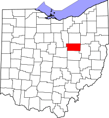 | |
| Townships | ||
| CDPs | ||
| Unincorporated communities | ||
| Footnotes | ‡This populated place also has portions in an adjacent county or counties | |