Cirque Peak (Alberta)
| Cirque Peak | |
|---|---|
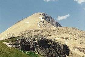 Cirque Peak from Helen Lake, July 1994 | |
| Highest point | |
| Elevation | 2,993 m (9,820 ft) [1] |
| Prominence | 341 m (1,119 ft) [2] |
| Listing | Mountains of Alberta |
| Coordinates | 51°41′59″N 116°25′04″W / 51.69972°N 116.41778°WCoordinates: 51°41′59″N 116°25′04″W / 51.69972°N 116.41778°W [2] |
| Geography | |
| Parent range | Canadian Rockies |
| Topo map | NTS 82N/09 |
| Climbing | |
| First ascent | 1899[2] |
| Easiest route | Easy Scramble |

Cirque Peak is a peak located directly west of Dolomite Pass in Banff National Park, Alberta, Canada.
Scrambling Route
The scrambling route (rated easy) begins just beyond Helen Lake which can be reached by following the Helen Lake/Dolomite Pass trail 6 km from the trail head beside the Icefields Parkway. From the lake, follow the trail into Dolomite Pass and then choose a line up the peak.[4]
References
- ↑ Bow Lake and Saskatchewan Crossing (Map). 1:70,000. Gem Trek Publishing. 2000. ISBN 1-895526-10-8.
- 1 2 3 "Cirque Peak". Bivouac.com. Retrieved 2012-07-01.
- ↑ Place-names of Alberta. Ottawa: Geographic Board of Canada. 1928. p. 34.
- ↑ Alan Kane (1999). "Cirque Peak". Scrambles in the Canadian Rockies. Rocky Mountain Books. p. 297. ISBN 0-921102-67-4.
This article is issued from
Wikipedia.
The text is licensed under Creative Commons - Attribution - Sharealike.
Additional terms may apply for the media files.