Jiuquan
| Jiuquan 酒泉市 | |
|---|---|
| Prefecture-level city | |
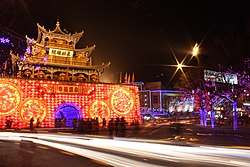 Jiuquan Bell Tower | |
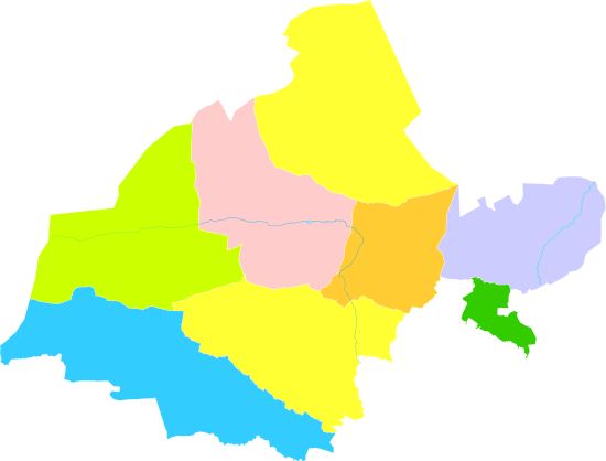
.png) Location of Jiuquan City jurisdiction in Gansu | |
| Coordinates: 39°46′N 98°34′E / 39.767°N 98.567°ECoordinates: 39°46′N 98°34′E / 39.767°N 98.567°E | |
| Country | People's Republic of China |
| Province | Gansu |
| Area | |
| • Total | 191,342 km2 (73,878 sq mi) |
| Elevation | 1,483 m (4,865 ft) |
| Population (2010)[1] | |
| • Total | 1,095,947 |
| • Density | 5.7/km2 (15/sq mi) |
| Time zone | UTC+8 (China Standard) |
| Postal code | 735000 |
| Area code(s) | 0937 |
| ISO 3166 code | CN-GS-09 |
| Licence plate prefixes | 甘F |
| Website |
www |
| Jiuquan | |||||||||||||||
| Chinese | 酒泉 | ||||||||||||||
|---|---|---|---|---|---|---|---|---|---|---|---|---|---|---|---|
| Literal meaning | "Alcohol Spring(s)" | ||||||||||||||
| |||||||||||||||
| Former names | |||||||||
| Fulu | |||||||||
|---|---|---|---|---|---|---|---|---|---|
| Traditional Chinese | 福祿 | ||||||||
| Simplified Chinese | 福禄 | ||||||||
| Literal meaning | Fortunate & Lucky | ||||||||
| |||||||||
| Suzhou | |||||||||
| Traditional Chinese | 肅州 | ||||||||
| Simplified Chinese | 肃州 | ||||||||
| Literal meaning | Solemn Prefectural [Capital] | ||||||||
| |||||||||
Jiuquan, formerly known as Suzhou,[2] is a prefecture-level city in the northwesternmost part of Gansu Province in the People's Republic of China. It is more than 600 km (370 mi) wide from east to west, occupying 191,342 km2 (73,878 sq mi), although its built-up area is mostly located in its Suzhou District. Its population was 962,000 in 2002.
Name
The city was formerly known as Fulu, which became known as Suzhou (Suchow, Su-chow,[2] &c.) after it became the seat of Su Prefecture under the Sui.[3] As the seat of Jiuquan Commandery, it eventually became known by that name in turn. The name Jiuquan —"wine spring(s)" — derives from a legendary story of the young Han general Huo Qubing, who was said to have poured a vat of precious wine into a local creek to share its taste with his troops after a victory over the Xiongnu nomads.[4]
History
Fulu was founded in 111 BC as an outpost in the Hexi Corridor near the Jade Gate[2] along the overland Silk Road. Jiuquan was a Han prefecture and, under the Eastern Han, an active military garrison.[4] Su Prefecture was established under the Sui and renamed Jiuquan Commandery under the Tang.[3] In 624, Jiuquan County was established. In 763, it was occupied by Tibetan Empire. After the fall of the Tibetan Empire, it was controlled by the Ganzhou Uyghur Kingdom. In 1028, it was seized by Xixia. During the Yuan Dynasty, Suzhou Lu was established under Gansu Province. It sometimes served as the capital of the province of Gansu.[2] Along with its role protecting trade along the Silk Road, Suzhou was the great center of the rhubarb trade.[2]
Under the Qing, Suzhou was the site where the Portuguese Jesuit missionary Bento de Góis was robbed and died in 1607[5] during the exploration that finally established that Cathay and China were a single country. Meng Qiaofang took it from Ding Guodong in 1649. The Hui under Ma Wenlu held it during the Dungan Revolt. It was completely destroyed by the time it was recovered[6] by the Qing general Zuo Zongtang in 1873 but it was swiftly rebuilt.[2]
Winchester reported that, in 2008, a large billboard at the entrance to the city read "Without Haste, Without Fear, We Conquer the World".[5]
Administrative divisions
Jiuquan is made up of one district, two counties, two autonomous counties and two cities.[1][7][8]
| Map | |||||
|---|---|---|---|---|---|
| Name | Hanzi | Hanyu Pinyin | Population (2004 est.) |
Area (km²) | Density (/km²) |
| Suzhou District | 肃州区 | Sùzhōu Qū | 350,000 | 3,349 | 105 |
| Yumen City | 玉门市 | Yùmén Shì | 170,000 | 13,500 | 13 |
| Dunhuang City | 敦煌市 | Dūnhuáng Shì | 140,000 | 26,960 | 5 |
| Jinta County | 金塔县 | Jīntǎ Xiàn | 140,000 | 14,663 | 9 |
| Guazhou County | 瓜州县 | Guāzhōu Xiàn | 90,000 | 21,350 | 4 |
| Subei Mongol Autonomous County | 肃北蒙古族 自治县 |
Sùběi Měnggǔzú Zìzhìxiàn |
10,000 | 55,000 | <1 |
| Aksai Kazakh Autonomous County | 阿克塞哈萨克族 自治县 |
Ākèsài Hāsàkèzú Zìzhìxiàn |
10,000 | 31,374 | <1 |
Geography
Jiuquan occupies the westernmost part of Gansu, bordering Zhangye City to the east, Qinghai to the south, Xinjiang to the west, Ejin Banner of Inner Mongolia and Mongolia to the north. Its administrative area ranges in latitude from 37° 58' to 42° 48' N and in longitude from 92° 09' to 100° 20' E, and reaches a maximal north-south extent of 550 km (340 mi) and maximal east-west width of 680 km (420 mi). Suzhou District is approximately 1,500 meters (4,900 ft) above sea level.
Jiuquan has a cold desert climate (Köppen BWk), with long, cold winters, and hot, somewhat dry summers. Monthly average temperatures range from −9.0 °C (15.8 °F) in January to 21.7 °C (71.1 °F) in July, with an annual mean of 7.47 °C (45.4 °F). The diurnal temperature variation is relatively large, averaging 13.8 °C (24.8 °F) annually. With sunny weather and low humidity dominating year-round, the area hosts one of the launch sites for the PRC's space programme. With monthly percent possible sunshine ranging from 62% in July to 77% in October, the city receives 3,031 hours of bright sunshine annually.
| Climate data for Jiuquan (1971−2000) | |||||||||||||
|---|---|---|---|---|---|---|---|---|---|---|---|---|---|
| Month | Jan | Feb | Mar | Apr | May | Jun | Jul | Aug | Sep | Oct | Nov | Dec | Year |
| Average high °C (°F) | −1.6 (29.1) |
2.3 (36.1) |
9.1 (48.4) |
17.4 (63.3) |
23.2 (73.8) |
26.8 (80.2) |
28.6 (83.5) |
27.8 (82) |
22.7 (72.9) |
15.3 (59.5) |
6.5 (43.7) |
−0.1 (31.8) |
14.8 (58.7) |
| Average low °C (°F) | −14.9 (5.2) |
−11.3 (11.7) |
−4.4 (24.1) |
2.8 (37) |
8.4 (47.1) |
12.7 (54.9) |
14.7 (58.5) |
13.4 (56.1) |
8.2 (46.8) |
1.2 (34.2) |
−6.1 (21) |
−12.6 (9.3) |
1 (33.8) |
| Average precipitation mm (inches) | 1.2 (0.047) |
1.4 (0.055) |
4.8 (0.189) |
3.7 (0.146) |
7.9 (0.311) |
14.8 (0.583) |
20.5 (0.807) |
19.7 (0.776) |
8.8 (0.346) |
2.3 (0.091) |
1.6 (0.063) |
1.1 (0.043) |
87.8 (3.457) |
| Average precipitation days (≥ 0.1 mm) | 2.0 | 2.0 | 2.6 | 2.1 | 3.0 | 5.8 | 7.9 | 6.5 | 3.2 | 1.3 | 1.5 | 1.9 | 39.8 |
| Average relative humidity (%) | 53 | 45 | 40 | 35 | 37 | 47 | 53 | 52 | 51 | 47 | 49 | 56 | 47 |
| Mean monthly sunshine hours | 219.0 | 211.5 | 240.6 | 259.0 | 293.3 | 283.0 | 279.1 | 276.9 | 267.5 | 265.1 | 227.1 | 208.6 | 3,030.7 |
| Percent possible sunshine | 74 | 71 | 65 | 66 | 66 | 63 | 62 | 65 | 72 | 77 | 76 | 72 | 68 |
| Source: China Meteorological Administration[9] | |||||||||||||
Transport
Jiuquan is served by China National Highway 312 and the Lanzhou-Xinjiang (Lanxin) Railway. The Lanxin Railway has several side branches within Jiuquan Prefecture. In particular, a railway branch runs from the Liugou Station in Guazhou County to Dunhuang, serving both Guazhou county seat and Dunhuang. There are plans to expand it further south into Qinghai; the extension, known as the Golmud–Dunhuang Railway, will connect Dunhuang to Golmud on the Qingzang Railway.[10] There is also the Jiayuguan–Ceke branch, which runs through the desert areas of Jiuquan Prefecture's Jinta County.
Jiuquan is also served by Jiuquan Airport. There is also Dunhuang Airport in Dunhuang.
Space launch center
Jiuquan is the closest major city to the Jiuquan Satellite Launch Center. Still, the space launch center is more than 100 km (62 mi) away from the city, and is actually located not in Gansu province, but in the neighboring Inner Mongolia Autonomous Region. It was built in 1958; the first Chinese human spaceflight, Shenzhou 5 was launched there on 15 October 2003, making Yang Liwei China's first astronaut and a national hero.[11] The second was in 2005.
Culture
Jiuquan is known within China as the first site of rhubarb cultivation.[5]
See also
Notes
- 1 2 酒泉市历史沿革 [Jiuquan City Historical Development]. www.xzqh.org (行政区划网站) (in Simplified Chinese). Administrative Divisions Web/District Geographic Names Web (行政区划网站/区划地名网站). 27 June 2016. Retrieved 26 May 2018.
2010年第六次人口普查,酒泉市常住总人口1095947人,其中,肃州区428346人,金塔县147460人,瓜州县148798人,肃北蒙古族自治县14979人,阿克塞哈萨克族自治县10545人,玉门市159792人,敦煌市186027人。
- 1 2 3 4 5 6 EB (1887).
- 1 2 485.
- 1 2 Hill (2009), pp. 124, 126.
- 1 2 3 Winchester (2008), p. 264.
- ↑ EB (1878).
- ↑ 2016年统计用区划代码和城乡划分代码:酒泉市 [2016 Statistical Area Numbers and Rural-Urban Area Numbers: Jiuquan City]. National Bureau of Statistics Online (中华人民共和国国家统计局信息网) (in Simplified Chinese). National Bureau of Statistics of the People's Republic of China. 2016. Retrieved 26 May 2018.
统计用区划代码 名称 620901000000 市辖区 620902000000 肃州区 620921000000 金塔县 620922000000 瓜州县 620923000000 肃北蒙古族自治县 620924000000 阿克塞哈萨克族自治县 620981000000 玉门市 620982000000 敦煌市"
- ↑ 酒泉概况 [Jiuquan Overview]. Jiuquan People's Government (酒泉市人民政府网) (in Simplified Chinese). Jiuquan People's government Office (酒泉市人民政府办公室). 28 March 2017. Retrieved 26 May 2018.
全市辖“一区两市四县”(肃州区,玉门市、敦煌市,金塔县、瓜州县、肃北县和阿克塞县)
- ↑ 中国地面国际交换站气候标准值月值数据集(1971-2000年) (in Chinese). China Meteorological Administration. Archived from the original on 2013-09-21. Retrieved 2010-05-04.
- ↑ 格尔木至敦煌铁路开工 Archived 2012-12-09 at the Wayback Machine., Renmin Tielu Bao, 2012-10-20
- ↑ Winchester (2008), 264.
References

- Hill, John E. (2009) Through the Jade Gate to Rome: A Study of the Silk Routes during the Later Han Dynasty, 1st to 2nd Centuries CE. BookSurge, Charleston, South Carolina. ISBN 978-1-4392-2134-1.
- Winchester, Simon (2008). The Man Who Loved China. HarperCollins, New York. ISBN 978-0-06-088459-8.
External links
| Wikimedia Commons has media related to Jiuquan. |
- Official website
- Rocket launch site—Astronautix