Chews Landing, New Jersey
| Chews Landing, New Jersey | |
|---|---|
| Unincorporated community | |
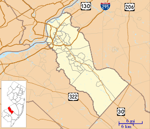 Chews Landing Location in Camden County (Inset: Camden County in New Jersey)  Chews Landing Chews Landing (New Jersey)  Chews Landing Chews Landing (the US) | |
| Coordinates: 39°50′00″N 75°03′47″W / 39.83333°N 75.06306°WCoordinates: 39°50′00″N 75°03′47″W / 39.83333°N 75.06306°W | |
| Country |
|
| State |
|
| County | Camden |
| Township | Gloucester |
| Named for | Jeremiah Chew |
| Elevation | 12 m (39 ft) |
| Time zone | UTC-5 (Eastern (EST)) |
| • Summer (DST) | UTC-4 (EDT) |
| Area code(s) | 856 |
| GNIS feature ID | 882408[1] |
Chews Landing (or Chews) is an unincorporated community within Gloucester Township, in Camden County, New Jersey, United States.[2]
Located near the Big Timber Creek, Chews Landing is named after Jeremiah Chew, a revolutionary officer.[3] It is also home to St. John's Episcopal Church and Burying Ground; a historic church that was built in 1880 and added to the National Register of Historic Places in 1980.
References
- ↑ U.S. Geological Survey Geographic Names Information System: Chews Landing, New Jersey
- ↑ Locality Search, State of New Jersey. Accessed June 9, 2016.
- ↑ Federal Writers' Project (2007). New Jersey, a Guide to Its Present and Past. US History Publishers. ISBN 1-60354-029-6. Retrieved June 26, 2011.
Municipalities and communities of Camden County, New Jersey, United States | ||
|---|---|---|
| Cities | 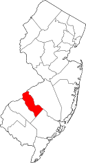 | |
| Boroughs | ||
| Townships | ||
| CDPs | ||
| Other unincorporated communities | ||
This article is issued from
Wikipedia.
The text is licensed under Creative Commons - Attribution - Sharealike.
Additional terms may apply for the media files.