Chestnut Grove, Kentucky
| Chestnut Grove | |
|---|---|
| Unincorporated community | |
 Chestnut Grove Location within the state of Kentucky  Chestnut Grove Chestnut Grove (the US) | |
| Coordinates: 38°18′00″N 85°15′50″W / 38.30000°N 85.26389°WCoordinates: 38°18′00″N 85°15′50″W / 38.30000°N 85.26389°W | |
| Country | United States |
| State | Kentucky |
| County | Shelby |
| Elevation | 804 ft (245 m) |
| Time zone | UTC-5 (Eastern (EST)) |
| • Summer (DST) | UTC-4 (EDT) |
| GNIS feature ID | 507695[1] |
Chestnut Grove is an unincorporated community within Shelby County, Kentucky, United States. It was also known as Gleneyrie. Their post office [2] has been closed.
References
Municipalities and communities of Shelby County, Kentucky, United States | ||
|---|---|---|
| Cities | 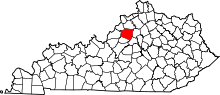 | |
| Unincorporated communities | ||
| Footnotes | ‡This populated place also has portions in an adjacent county or counties | |
This article is issued from
Wikipedia.
The text is licensed under Creative Commons - Attribution - Sharealike.
Additional terms may apply for the media files.