Chepuwa
| Thangmuchhyi थाङमुछ्यी थाङमुछ्यी Chepuwa | |
|---|---|
| Village development committee | |
| Nickname(s): Chhongdi(छोङदी) | |
 Thangmuchhyi थाङमुछ्यी Location in Nepal | |
| Coordinates: 27°46′N 87°31′E / 27.77°N 87.52°ECoordinates: 27°46′N 87°31′E / 27.77°N 87.52°E | |
| Country |
|
| Zone | Kosi Zone |
| District | Sankhuwasabha District |
| Population (1991) | |
| • Total | 1,949 |
| Time zone | UTC+5:45 (Nepal Time) |
Thangmuchhyi (Chepuwa) is a village development committee in Sankhuwasabha District in the Kosi Zone of north-eastern Nepal. At the time of the 1991 Nepal census it had a population of 1949 people living in 425 individual households. Thangmuchhyi divided into 3 toles called Dhongdek, Syarkijong (Syarkidang) and Orokchhen and Gangdok and Chhulung also sub tole of Thangmuchhyi. People from Thangmuchhyi are mostly Nuppa clan of Lhomi. Among Nuppa also there are 3 main family groups called Mi-Ngo(Identity). Sonarinjen (Dhongtoek) Mi-Ngo, Ueohok (lower village) Mi-Ngo and Hamo Mi-Ngo. In Dhongtoek (upper household) tole, Sonarinjen clans are living and from Sonarinjen there were 3 brothers called Nangang Angchuk, Chhiyang Chhedar and Dhinakpa (real name forgotten).[1]
It borders Tibet, China.
References
- ↑ "Nepal Census 2001". Nepal's Village Development Committees. Digital Himalaya. Archived from the original on 12 October 2008. Retrieved 19 November 2008.
- ↑ Nuppa, Shangbu.2015. Pahichanko Seroferoma Lhomi Jaati. National Foundation for Development Indigenous Nationalities. Government of Nepal
External links
Headquarter: Khandbari | ||
| Rural Municipalities | 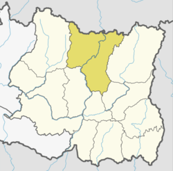 | |
| Municipalities | ||