Chemin Vert (Paris Métro)
Chemin Vert | |||||||||||
|---|---|---|---|---|---|---|---|---|---|---|---|
| Paris Métro station | |||||||||||
 | |||||||||||
| Location |
3rd arrondissement of Paris Île-de-France France | ||||||||||
| Coordinates | 48°51′24″N 2°22′06″E / 48.856778°N 2.368348°ECoordinates: 48°51′24″N 2°22′06″E / 48.856778°N 2.368348°E | ||||||||||
| Owned by | RATP | ||||||||||
| Operated by | RATP | ||||||||||
| Other information | |||||||||||
| Fare zone | 1 | ||||||||||
| History | |||||||||||
| Opened | 5 May 1931 | ||||||||||
| Services | |||||||||||
| |||||||||||
| Location | |||||||||||
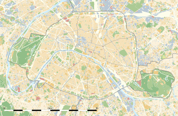 Chemin Vert Location within Paris | |||||||||||
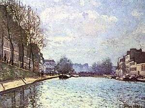
View of the Canal Saint-Martin at Paris (Alfred Sisley - Musée d'Orsay, 1870)
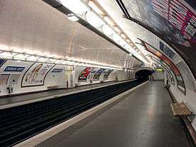
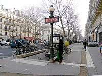
Chemin Vert is a station of the Paris Métro on Line 8, named after the Rue de Chemin Vert.
It is located in between Bastille station and Saint Sébastien - Froissart.
The station opened on 5 May 1931 with the extension of the line from Richelieu - Drouot to Porte de Charenton. The Rue de Chemin Vert (green path) follows the route of an old footpath through the middle of market gardens. In 1868 the Rue de Chemin Vert was extended from the Rue des Amandiers-Popincourt to the Barrier des Amandiers, a gate on the former Wall of the Farmers-General.
In 2011, 1,448,436 passengers entered this station.[1]
Nearby are the Canal Saint-Martin and the Place des Vosges.
Station layout
| Street Level |
| B1 | Mezzanine for platform connection |
| Platform level | Side platform, doors will open on the right | |
| toward Balard | ← | |
| toward Pointe du Lac | | |
| Side platform, doors will open on the right | ||
| Wikimedia Commons has media related to Chemin Vert (Paris Metro). |

References
- ↑ Entrants annuels provenant de l'extérieur de la station (voie publique, correspondances bus, réseau SNCF, etc.) Archived July 18, 2014, at the Wayback Machine., sur le site data.ratp.fr. Consulté le 5 novembre 2012.
Sources
- Roland, Gérard (2003). Stations de métro. D’Abbesses à Wagram. Éditions Bonneton.
This article is issued from
Wikipedia.
The text is licensed under Creative Commons - Attribution - Sharealike.
Additional terms may apply for the media files.