Charshanga
| Charshanga | |
|---|---|
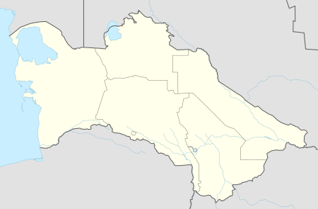 Charshanga Location in Turkmenistan | |
| Coordinates: 37°31′N 66°1′E / 37.517°N 66.017°E | |
| Country |
|
| Province | Lebap Province |
| Elevation | 265 m (869 ft) |
| Population (1989 census)[1] | |
| • Total | 8,654 |
Charshanga, sometimes written Carsanga or Charshangngy, is a town in Lebap, Turkmenistan. As of 1989, it had a population of 8,654.[1]
Geography
Charshanga is located at an altitude of 265 meters on the banks of the Amu-Darya River, which forms the border with Jowzjan Province, Afghanistan. The Afghan town of Qarqin is on the opposite side of the river. Charshanga is near the eastern end of Lebap Province, and indeed all of Turkmenistan. The plains surrounding the river are quite flat. Near the river the land is quite fertile and arable, supporting some farming, but further from the river the land is arid. To the northeast the Köýtendag Range rises dramatically, including Turkmenistan's highest mountain, Aýrybaba, at a height of 3,138 metres (10,295 ft).[2]
Climate
Charshanga has a hot desert climate (Köppen climate classification BWh), with cool winters and very hot summers. Rainfall is generally light and erratic, and occurs mainly in the winter and autumn months.
| Climate data for Charshanga | |||||||||||||
|---|---|---|---|---|---|---|---|---|---|---|---|---|---|
| Month | Jan | Feb | Mar | Apr | May | Jun | Jul | Aug | Sep | Oct | Nov | Dec | Year |
| Record high °C (°F) | 26.0 (78.8) |
29.4 (84.9) |
34.8 (94.6) |
39.6 (103.3) |
43.5 (110.3) |
49.0 (120.2) |
48.0 (118.4) |
49.0 (120.2) |
41.6 (106.9) |
36.7 (98.1) |
34.1 (93.4) |
27.0 (80.6) |
49 (120.2) |
| Average high °C (°F) | 10.2 (50.4) |
12.7 (54.9) |
18.7 (65.7) |
26.2 (79.2) |
32.1 (89.8) |
38.0 (100.4) |
39.5 (103.1) |
37.8 (100) |
32.6 (90.7) |
25.6 (78.1) |
18.1 (64.6) |
12.3 (54.1) |
25.3 (77.6) |
| Daily mean °C (°F) | 5.2 (41.4) |
7.6 (45.7) |
13.1 (55.6) |
20.1 (68.2) |
25.5 (77.9) |
30.7 (87.3) |
32.1 (89.8) |
29.7 (85.5) |
24.2 (75.6) |
17.7 (63.9) |
11.5 (52.7) |
7.0 (44.6) |
18.7 (65.7) |
| Average low °C (°F) | 0.7 (33.3) |
2.5 (36.5) |
7.6 (45.7) |
13.7 (56.7) |
18.2 (64.8) |
22.4 (72.3) |
23.7 (74.7) |
21.0 (69.8) |
15.5 (59.9) |
9.9 (49.8) |
5.3 (41.5) |
2.3 (36.1) |
11.9 (53.4) |
| Record low °C (°F) | −20.6 (−5.1) |
−14.0 (6.8) |
−5.4 (22.3) |
0.2 (32.4) |
4.4 (39.9) |
8.0 (46.4) |
7.7 (45.9) |
10.0 (50) |
4.0 (39.2) |
−5.1 (22.8) |
−8.0 (17.6) |
−15.7 (3.7) |
−20.6 (−5.1) |
| Average precipitation mm (inches) | 15.4 (0.606) |
9.2 (0.362) |
22.9 (0.902) |
15.3 (0.602) |
12.3 (0.484) |
0.4 (0.016) |
3.2 (0.126) |
1.5 (0.059) |
6.6 (0.26) |
6.9 (0.272) |
6.8 (0.268) |
21.8 (0.858) |
122.3 (4.815) |
| Average precipitation days (≥ 0.1 mm) | 7.8 | 8.9 | 6.0 | 3.8 | 1.8 | 0.4 | 0.0 | 0.0 | 0.3 | 1.6 | 5.1 | 6.8 | 42.5 |
| Average relative humidity (%) | 69.9 | 63.0 | 51.6 | 45.6 | 35.0 | 25.6 | 24.8 | 27.0 | 32.1 | 41.5 | 58.9 | 70.0 | 45.4 |
| Source: climatebase.ru[3] | |||||||||||||
Transportation
Charshanga is on a branch of the Trans-Caspian railway that leads from Samarqand in Uzbekistan, through the far east of Turkmenistan, and then back to Termez in Uzbekistan and finally Dushanbe in Tajikistan. Charshanga is one of three stations on this line in Turkmenistan, along with Amu Dar'ya and Kirova.
A local road connects the city to Atamurat to the west and the border with Uzbekistan in the east.
References
- 1 2 Population census 1989 Archived 2012-02-04 at WebCite, Demoscope Weekly, No. 359-360, 1–18 January 2009 (search for пгт Чаршанга) (in Russian)
- ↑ Peaklist.org, listed as "Gora Ayribaba" Retrieved 22 September 2011
- ↑ "Carsanga, Turkmenistan". Climatebase.ru. Retrieved 10 February 2013.