Chamonate Airport
| Chamonate Airport | |||||||||||
|---|---|---|---|---|---|---|---|---|---|---|---|
 | |||||||||||
| Summary | |||||||||||
| Airport type | Public | ||||||||||
| Serves | Copiapó, Chile | ||||||||||
| Elevation AMSL | 954 ft / 291 m | ||||||||||
| Coordinates | 27°17′48″S 70°24′50″W / 27.29667°S 70.41389°WCoordinates: 27°17′48″S 70°24′50″W / 27.29667°S 70.41389°W | ||||||||||
| Map | |||||||||||
 SCHA Location of Chamonate Airport in Chile | |||||||||||
| Runways | |||||||||||
| |||||||||||
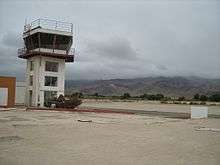
Chamonate Airport Spanish: Aeródromo Chamonate, (ICAO: SCHA) is an airport serving Copiapó, the capital of the Atacama Region of Chile.
The airport is in the valley of the Copiapó River, 11 kilometres (6.8 mi) downstream from the city. There is rising terrain in all quadrants.
The Atacama VOR-DME (Ident: DAT) is 19.4 nautical miles (35.9 km) west of the airport.[4]
See also


- Transport in Chile
- List of airports in Chile
References
- ↑ Airport record for Chamonate Airport at Landings.com. Retrieved 2013-09-06
- ↑ Google (2013-09-06). "location of Chamonate Airport" (Map). Google Maps. Google. Retrieved 2013-09-06.
- ↑ Airport information for Chamonate Airport at Great Circle Mapper.
- ↑ Atacama VOR
External links
- OpenStreetMap - Chamonate
- OurAirports - Chamonate
- SkyVector - Chamonate
- FallingRain - Chamonate Airport
- Accident history for Chamonate Airport at Aviation Safety Network
This article is issued from
Wikipedia.
The text is licensed under Creative Commons - Attribution - Sharealike.
Additional terms may apply for the media files.