Chalkwell
| Chalkwell | |
|---|---|
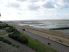 Chalkwell Esplanade | |
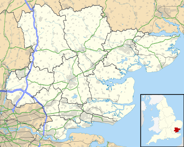 Chalkwell Chalkwell shown within Essex | |
| Population | 10,045 (2011 Census)[1] |
| OS grid reference | TQ889640 |
| Unitary authority | |
| Ceremonial county | |
| Region | |
| Country | England |
| Sovereign state | United Kingdom |
| Post town | WESTCLIFF-ON-SEA |
| Postcode district | SS0 |
| Dialling code | 01702 |
| Police | Essex |
| Fire | Essex |
| Ambulance | East of England |
| EU Parliament | East of England |
| UK Parliament | |
Chalkwell is an area in the Southend-on-Sea borough and unitary district in Essex, England. It forms part of the built-up area of Southend-on-Sea and is included in the Westcliff-on-Sea post town.
History
_-_geograph.org.uk_-_316119.jpg)
The Crow Stone, which stands on the mud on the Thames Estuary foreshore opposite the end of Chalkwell Avenue, marks the limit of the Port of London Authority's jurisdiction. It was erected in 1837 and replaced a smaller stone, dating from 1755. The older stone was removed to Priory Park in Southend where it remains today. The line, known as the Yantlet Line, between the Crow Stone and the London Stone, Yantlet Creek, almost due south on the other bank of the Thames is used as the eastern boundary of the jurisdiction of the Port of London Authority.
In 2009 an open water swimming club, the "Chalkwell Redcaps" was established and has quickly grown to be one of the UK's largest open water swimming groups. The Crow Stone is used as an assembly point for some of their swims.
Chalkwell railway station is located here, as well as Chalkwell Park, which has previously played home to Essex County Cricket Club matches.
Demography
| Chalkwell compared | |||
|---|---|---|---|
| 2001 UK Census | Chalkwell ward | Southend-on-Sea UA | England |
| Population | 9,207 | 160,257 | 49,138,831 |
| Foreign born | 8.9% | 6.0% | 9.2% |
| White | 94.6% | 95.8% | 90.9% |
| Asian | 2.7% | 2.2% | 4.6% |
| Black | 1.1% | 0.7% | 2.3% |
| Christian | 63.4% | 68.7% | 71.7% |
| Muslim | 2.0% | 1.2% | 3.1% |
| Hindu | 0.8% | 0.6% | 1.1% |
| No religion | 17.6% | 18.8% | 14.6% |
| Unemployed | 4.2% | 3.7% | 3.3% |
| Retired | 11.2% | 14.8% | 13.5% |
At the 2001 UK census, the Chalkwell electoral ward had a population of 9,207, increasing to 10,045 at the 2011 Census.[2] The ethnicity was 94.6% White, 1.2% Mixed, 2.7% Asian, 1.1% Black and 0.4% Other. The place of birth of residents was 91.1% United Kingdom, 1.3% Republic of Ireland, 1.6% other Western European countries and 6.0% elsewhere. Religion was recorded as 63.4% Christian, 0.3% Buddhist, 0.8% Hindu, 0% Sikh, 6.7% Jewish, and 2% Muslim. 17.6% were recorded as having no religion, 0.5% had an alternative religion and 8.7% did not state any religion.[3]
The economic activity of residents aged 16–74 was 41.5% in full-time employment, 10.2% in part-time employment, 11.4% self-employed, 4.2% unemployed, 2.1% students with jobs, 3.6% students without jobs, 11.2% retired, 6.7% looking after home or family, 5.9% permanently sick or disabled and 3.2% economically inactive for other reasons.
The industry of employment of residents was 13.2% retail, 8.8% manufacturing, 5% construction, 15.8% real estate, 11.3% health and social work, 9.3% education, 6% transport and communications, 5.4% public administration, 4.2% hotels and restaurants, 14.3% finance, 0.3% agriculture and 6.4% other. Compared with national figures, the ward had a relatively high proportion of workers in finance and education. Of the ward's residents aged 16–74, 21.9% had a higher education qualification or the equivalent, compared with 19.9% nationwide. According to Office for National Statistics estimates, during the period of April 2004 to March 2005 the average gross weekly income of households was £670, compared with an average of £650 in South East England.[3]
References
- ↑ "Southend Ward population 2011". Retrieved 11 May 2017.
- ↑ "Southend Ward population 2011". Retrieved 21 September 2015.
- 1 2 "Neighbourhood Statistics". Statistics.gov.uk. Retrieved 2008-04-20.
External links
- Images on geograph
- The PLA page of thames.me.uk
- Chalkwell Park – The Park
- Chalkwell Hall – Metal Culture