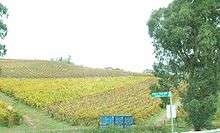
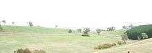
Chain of Ponds, South Australia
| Chain of Ponds South Australia | |||||||||||||||
|---|---|---|---|---|---|---|---|---|---|---|---|---|---|---|---|
 Chain of Ponds Location in South Australia | |||||||||||||||
| Coordinates | 34°49′24″S 138°49′54″E / 34.82333°S 138.83167°ECoordinates: 34°49′24″S 138°49′54″E / 34.82333°S 138.83167°E | ||||||||||||||
| Population | 22 (2016 census)[1] | ||||||||||||||
| Postcode(s) | 5231 | ||||||||||||||
| Location | 29 km (18 mi) from Adelaide | ||||||||||||||
| LGA(s) | Adelaide Hills Council | ||||||||||||||
| State electorate(s) | |||||||||||||||
| Federal Division(s) | Mayo | ||||||||||||||
| |||||||||||||||
Chain of Ponds is a locality and former town near Adelaide, South Australia. It is located in the Adelaide Hills Council local government area.
History
The settlement was established by the South Australia Company, and was originally called Philptown after founding publican Oliver Philp. First settled early in the 1840s, the township was laid out after the opening of the North East Road in the 1850s. By this time, the town was reported to include two post office buildings, institute, church, service station, a handful of cottages and the old Morning Star Hotel.[2] In 1864, the town was renamed Chain of Ponds, after a series of nearby ponds which were connected underground.[3]
There was also a nearby township at Millbrook, but it was demolished to make way for the Millbrook Reservoir, which was constructed between 1914 and 1918 to control the flow of the upper Torrens River and supply the eastern suburbs of Adelaide from an appropriate elevation. In the 1970s, Chain of Ponds was also demolished to safeguard against water pollution in the reservoir.[4] Little more than a cemetery exists as a reminder of Chain of Ponds, though it appears on maps as a navigation point.[3]
Geography
Chain of Ponds is located between Inglewood and Gumeracha along the Adelaide-Mannum Road, and south of Kersbrook along the Little Para Road.
Facilities
The few remaining residents (22 people according to the 2016 Australian census) are served by facilities in Inglewood. The Millbrook reservoir has a capacity of 16,500 megalitres.
Transport
The area is not serviced by Adelaide public transport. A coach is operated from Tea Tree Plaza Interchange to Gumeracha and Mount Pleasant by Affordable Coachlines.[5]
References
- ↑ Australian Bureau of Statistics (27 June 2017). "Chain of Ponds (State Suburb)". 2016 Census QuickStats.

- ↑ Adelaide Hills Council - Historical Town Information Archived 25 June 2006 at the Wayback Machine.
- 1 2 Crouch, Brad (7 November 2010). "The town they killed with a pen". Sunday Mail. Retrieved 6 March 2018.
- ↑ SA Water – Millbrook Reservoir Archived 25 June 2006 at the Wayback Machine.
- ↑ Timetable Accessed 15 June 2006