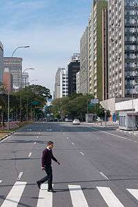
Central Zone of São Paulo
| Central Zone of São Paulo Zona Central | |
|---|---|
 | |
.png) Location of Central Zone of São Paulo | |
| Country |
|
| State |
|
| City |
|
| Subprefectures |
Central Zone
|
| Area | |
| • Total | 8 km2 (3.2 sq mi) |
The Central Zone (Portuguese: Zona Central de São Paulo) is an administrative zone of the city of São Paulo, Brazil.
One of the largest commercial and business districts in South America, the region is administered by the subprefecture of Sé. It is not concurrent, although often confused, with the regions known as Centro Expandido ("Expanded Center"), a broader area used by the city government for urban planning and road space rationing actions and Centro Histórico de São Paulo ("São Paulo Historic Center"), which, as the name implies, includes only the oldest part of the central region.
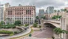
Limits
Officially, the central area is bounded by districts of Municipality Cathedral. However, the social perception of what is called "center of São Paulo" varies and may include other areas of city. Until the creation of the administrative office of the Cathedral, the notion of "center" was equivalent to the region of the former administration regional office, who also included the districts of Brás and Pari, currently covered by a Municipality of Mooca. The concept of a central area of São Paulo, however, is wider depending on the study is done about the region and may include items such as financial centers Paulista Avenue and Berrini.
| Districts | Population | HDI |
|---|---|---|
| Santa Cecília | 71,179 | 0.930 |
| Bela Vista | 63,190 | 0.940 |
| Liberdade | 61,875 | 0.936 |
| Consolação | 54,522 | 0.950 |
| República | 47,718 | 0.901 |
| Cambuci | 28,717 | 0.903 |
| Bom Retiro | 26,598 | 0.864 |
| Sé | 20,115 | 0.858 |
Social Characteristics
According to the 2000 census, the total population of the area is 374,002 inhabitants, including the neighborhoods and districts of Sé itself, Bela Vista, Bom Retiro, Cambuci, Consolação, Aclimação, Brás, Liberdade, República and Santa Cecília. It is the least populated administrative region in the city, albeit one with a wider range of public facilities and jobs. The average income in the area is R$ 2335.54, and each year the central area of São Paulo has a rate negative of population growth that reaches 5% per year, according to IBGE and SEADE statistics.[1][2]
This factor contributed to what has been called degradation the region, as some experts in urban studies, with the removal of the São Paulo elite of the central areas, occurs along the removal of public stewardship, leading to a sense of abandonment. Despite showing an average income higher than that of other regions of the city, it has many homeless individuals and pockets of poverty, such as the region known as Cracolândia (lit. "Crackland"), which has recently been undergoing a controversial process of revitalization by the city government, accused of promoting "social hygiene" through gentrification.
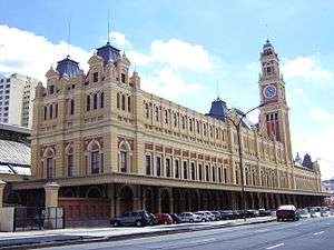
The Centro region is the most well-served by public transportation, with four of the five Metrô subway lines operating in the area, along with several CPTM commuter rail lines. It is also home to some of the major institutions of higher education in the city, as Mackenzie University, The Armando Alvares Penteado Foundation (FAAP) and units of the University of São Paulo (USP), like Law School, The University Center on Maria Antonia Street, and the headquarters of the USP Post-Graduate School of Architecture and Urban Affairs.
Key points

Viaducts
- Chá Viaduct
- Santa Ifigênia Viaduct
- Anhangabaú Square
Avenue and Streets
- Prestes Maia Avenue
- Tiradentes Avenue
- Brigadeiro Luís Antônio Avenue
- Liberdade Avenue
- Estado Avenue
- São João Avenue
- Ipiranga Avenue
- Rio Branco Avenue
- 23 de Maio Avenue
- 9 de Julho Avenue
- Angélica Avenue
- Paulista Avenue
- Conselheiro Furtado Street
- 15 de Novembro Street
- Rua 25 de Março
- Porto Geral Alley
- Consolação Street
- Augusta Street
- Maria Antonia Street
- Dona Veridiana Street
- Higienópolis Avenue
- Carmo Street
- Vergueiro Street
Squares
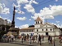
- Praça da Sé
- Praça da República
- Praça Doutor João Mendes
- Praça Ramos de Azevedo
- Pátio do Colégio
- Largo do Arouche
- Largo São Bento
- Largo do Paiçandu
- Largo de São Francisco
- Largo da Misericórdia
Metro and commuter railway stations
- Metro Stations
- Line 1 (Blue)
- Line 2 (Green)
- Line 3 (Red)
- Line 4 (Yellow)
- CPTM commuter railway stations
- Line 7 (Ruby), Line 10 (Turquoise) and Line 11 (Coral)
- Line 8 (Diamond)
Major Shopping Centers
- Shopping Light
- Shopping Frei Caneca
- Shopping Paulista
- Shopping Pátio Higienópolis
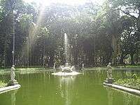
Major Parks
- Jardim da Luz
- Parque da Aclimação
- Parque Dom Pedro II
Colleges and universities
- Escola de Administração de Empresas de São Paulo – Fundação Getúlio Vargas (EAESP/FGV)
- Universidade Presbiteriana Mackenzie
- Faculdade de Direito da Universidade de São Paulo (FDUSP) – USP
- Faculdade de Ciências Médicas da Santa Casa de São Paulo (FCMSCSP)
- Centro de Ciências Exatas e Tecnologia – Pontifícia Universidade Católica de São Paulo – (CCET/PUC-SP)
- Fundação Armando Alvares Penteado (FAAP)
- Escola da Cidade (AEAUSP)
- Liceu de Artes e Ofícios de São Paulo (LAO-SP)
- Faculdade de Tecnologia de São Paulo (FATEC-SP)
- Conservatório Dramático e Musical de São Paulo (CDMSP)
- Universidade Livre de Música – Centro de Estudos Musicais Tom Jobim
Hospitals
- Hospital Samaritano
- Hospital Santa Catarina
- Irmandade da Santa Casa de Misericórdia de São Paulo (ISCMSP)
- Hospital Nove de Julho
- Hospital Sírio-Libanês
- Hospital Alemão Oswaldo Cruz
- Beneficência Portuguesa de São Paulo
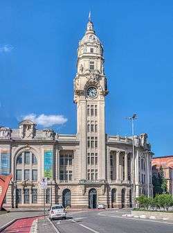
Culture and Leisure
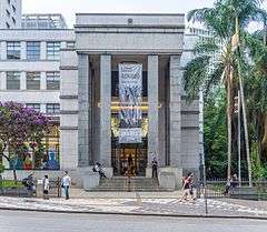
- Mário de Andrade Library
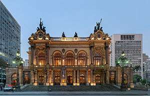
- Theatro Municipal
- São Paulo Museum of Art (MASP)
- Museum of the Portuguese Language
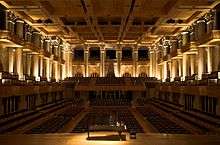
- Sala São Paulo
- Pinacoteca do Estado
- Museu de Arte Saca
- Sociedade Brasileira de Cultura Japonesa
Rivers
- [[Tamanduateí River]River]]
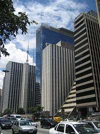
Buildings
.JPG)
Major buildings in the central zone of São Paulo:
| Rank | Name | Height ft (m) |
Floors | Year |
|---|---|---|---|---|
| 1 | Mirante do Vale | 558/170 | 51 | 1960 |
| 2 | Edifício Itália | 556/168 | 45 | 1965 |
| 3 | Altino Arantes Building | 528/161 | 40 | 1947 |
| 4 | Banco do Brasil Building | 474/143 | 24 | 1955 |
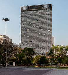
| 5 | Edifício Copan | 460/140 | 45 | 1953 |
| 6 | Barão de Iguape Building | 445/133 | 37 | 1959 |
| 7 | Ipiranga 165 | 440/130 | 36 | 1968 |
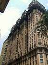
| 8 | Martinelli Building | 440/130 | 30 | 1929 |
| 9 | Grande São Paulo Building | 438/129 | 40 | 1971 |
| 10 | Mercantil Finasa | 438/129 | 35 | 1973 |
| 11 | Andraus Building | 390/115 | 32 | 1962 |
| 12 | Conde de Prates Building | 385/112 | 33 | 1955 |
| 13 | CBI Esplanada | 380/110 | 30 | 1948 |
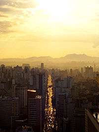
Sightseeing
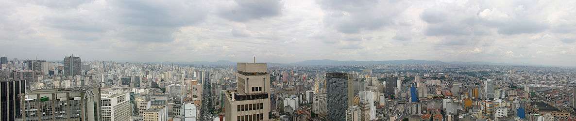
Torre Banespa ("Banespa Tower"), situated on the highest point of the Altino Arantes Building and Edifício Itália are the main sightseeing places in the region and São Paulo as a whole, providing a privileged views of the city with a range of up to 40 kilometers, making it possible to see other city landmarks such as the Mercado Municipal, the São Paulo Cathedral, Edifício Copan and even Serra da Cantareira at distance. Mirante do Vale Building, completed in 1960, although not well known as a sightseeing place due to its location at the bottom of a valley, is still the tallest building in Brazil.
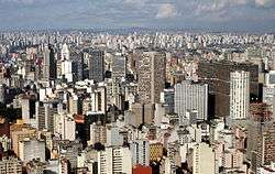
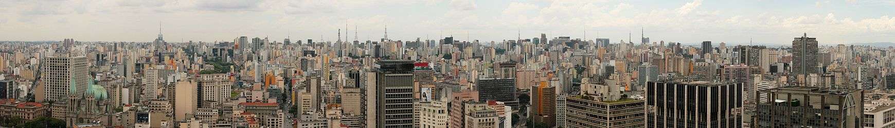
Panorama
.jpg)
See also
| Wikimedia Commons has media related to Central Zone São Paulo. |
References
- ↑ Outskirts of São Paulo grows more than the center Archived August 31, 2011, at the Wayback Machine. Retrieved on January 24, 2008
- ↑ São Paulo has drop in population growth Retrieved on January 24, 2008
External links
- Subprefeitura Sé
- Mirante do Vale
- Visitation on the building, the site of Santander Banespa Bank
- Information about the bank and the Altino Arantes Building
- About the Building Banespa in Sampacentro Site
- Articles and information on the Edifício Itália site in Sampacentro Site
Coordinates: 23°32′42″S 46°38′18″W / 23.54500°S 46.63833°W