Central Hulu Sungai Regency
| Central Hulu Sungai Regency Kabupaten Hulu Sungai Tengah | ||
|---|---|---|
| Regency | ||
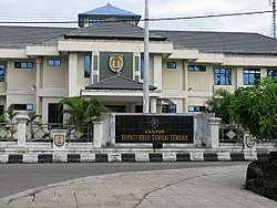 Central Hulu Sungai Regency government office | ||
| ||
| Motto(s): Murakata | ||
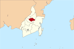 Location within South Kalimantan | ||
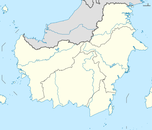 Central Hulu Sungai Regency Location in Kalimantan and Indonesia  Central Hulu Sungai Regency Central Hulu Sungai Regency (Indonesia) | ||
| Coordinates: 2°35′S 115°23′E / 2.583°S 115.383°ECoordinates: 2°35′S 115°23′E / 2.583°S 115.383°E | ||
| Country | Indonesia | |
| Province | South Kalimantan | |
| Capital | Barabai | |
| Established | 24 December 1959 | |
| Government | ||
| • Regent | H.A. Chairansyah | |
| • Vice Regent | vacant | |
| Area | ||
| • Total | 1,472.1 km2 (568.4 sq mi) | |
| Population (2014) | ||
| • Total | 262,746 | |
| • Density | 180/km2 (460/sq mi) | |
| Time zone | UTC+8 (ICST) | |
| Area code | (+62) 517 | |
| Website | hulusungaitengahkab.go.id | |

Central Hulu Sungai Regency is one of the nine regencies in the Indonesian province of South Kalimantan. The area is 1,472 km2 and the population at the 2010 Census was 243,460;[1] the latest official estimate (as at January 2014) is 262,746. The capital is Barabai.
Administrative districts
Central Hulu Sungai Regency is divided into eleven districts (kecamatan), listed below:
- Haruyan
- Batu Benawa
- Hantakan
- Batang Alai Selatan (South Batang Alai)
- Batang Alai Timur (East Batang Alai)
- Barabai
- Labuan Amas Selatan (South Labuan Amas)
- Labuan Amas Utara (North Labuan Amas)
- Pandawan
- Batang Alai Utara (North Batang Alai)
- Limpasu
Climate
Climate in Central Hulu Sungai Regency is Tropical wet and dry climate, such as in Labuan Amas Utara (North Labuan Amas).
References
- ↑ Biro Pusat Statistik, Jakarta, 2011.
External links
| Wikimedia Commons has media related to Central Hulu Sungai Regency. |
Regencies and cities of South Kalimantan | ||
|---|---|---|
Capital: Banjarmasin | ||
| Regencies | ||
| Cities | ||
| Authority control |
|---|
This article is issued from
Wikipedia.
The text is licensed under Creative Commons - Attribution - Sharealike.
Additional terms may apply for the media files.