Centerville, North Carolina
| Centerville, North Carolina | |
|---|---|
| Census-designated place | |
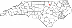 Location of Centerville, North Carolina | |
| Coordinates: 36°11′6″N 78°6′41″W / 36.18500°N 78.11139°WCoordinates: 36°11′6″N 78°6′41″W / 36.18500°N 78.11139°W | |
| Country | United States |
| State | North Carolina |
| County | Franklin |
| Established | 1882 |
| Incorporated | May 25, 1965[1] |
| Dissolved | July 22, 2017[2] |
| Named for | Central location of area between Louisburg, Warrenton and Littleton. |
| Area | |
| • Total | 0.3 sq mi (0.7 km2) |
| • Land | 0.3 sq mi (0.7 km2) |
| • Water | 0.0 sq mi (0.0 km2) |
| Elevation | 340 ft (100 m) |
| Population (2010) | |
| • Total | 89 |
| • Estimate (2016)[3] | 92 |
| • Density | 300/sq mi (130/km2) |
| Time zone | UTC-5 (Eastern (EST)) |
| • Summer (DST) | UTC-4 (EDT) |
| Area code(s) | 919 and 984 |
| FIPS code | 37-11560[4] |
| GNIS feature ID | 0982946[5] |
Centerville is a census-designated place (CDP) in the rural northeastern corner of Franklin County, North Carolina, United States. The population was 89 at the 2010 census, a loss of 10 persons from the previous count of 99 at the 2000 census.[6] It was an incorporated town from 1965 to 2017.[2]
There is no post office in Centerville, and thus no zip code; it simply uses that of Louisburg, which is located 12 miles (19 km) west. Centerville is centered on "the crossroads", which is the intersection of NC-561 and NC-58, and consists of two small old-fashioned country stores, one each on two of that intersection's four corners. Two sell gasoline (Arnold's and The Country Store), and one of those also sells diesel and kerosene (The Country Store). All two sell basic general store items, such as toilet paper, soap, household cleaning products, canned and boxed food, etc., as well as common convenience store items such as sodas, snack foods, cigarettes, beer, etc.
There's also a Dollar General, a muffler shop and a medical clinic.
Centerville has its own church (Centerville Baptist Church, a member of the Southern Baptist Convention), and volunteer fire department. There is no police department, so Centerville—like the surrounding unincorporated area—is patrolled by the Franklin County Sheriff's Office.
As is common in the rural stretches of eastern North Carolina, many of the houses in and around Centerville are quite old and in poor states of repair, and agriculture is the main use of land. Tobacco, soybeans, corn, and hay are the main crops.
Centerville includes many antique buildings from its heyday, including the now-defunct Serepta Church, a former Methodist church located at the intersection of NC-561 and Centerville-Laurel Mill Road.
Perry School and Vine Hill are listed on the National Register of Historic Places.[7][8]
History
Centerville was established around 1882 and named for its central location between the towns of Louisburg, Warrenton and Littleton.[9] It was incorporated in 1965, four years after the dissolution of the nearby town of Wood in 1961.[10][11]
Geography
Centerville is located at 36°11′6″N 78°6′41″W / 36.18500°N 78.11139°W (36.184980, −78.111252).[12]
According to the United States Census Bureau, the city has a total area of 0.3 square miles (0.78 km2), all of it land.
Demographics
| Historical population | |||
|---|---|---|---|
| Census | Pop. | %± | |
| 1970 | 123 | — | |
| 1980 | 135 | 9.8% | |
| 1990 | 115 | −14.8% | |
| 2000 | 99 | −13.9% | |
| 2010 | 89 | −10.1% | |
| Est. 2016 | 92 | [3] | 3.4% |
| U.S. Decennial Census[13] | |||
As of the census[4] of 2010, there were 89 people residing in what was then a town. The racial makeup of the town was 93% White (83 persons), 3.5% Black (3 persons), and 3.5% other (3 persons).
Dissolution
On February 22, 2017, a bill was filed in the North Carolina General Assembly towards needed legislative approval for dissolution of the Town of Centerville back into Franklin County. The Centerville Town Council voted unanimously in their January meeting to dissolve the town charter due to lack of growth and financial issues for continuing on as a municipality.[11] When the bill is passed, the town will have 30 days to pay off its bills and liquidate its assets. Under the legislation, any remaining money would be given to Centerville Fire Department.[11] Senate Bill 122, regarding the dissolution of the Town of Centerville, was ratified by the North Carolina General Assembly on June 22, 2017.[14][2] The town officially dissolved on July 22, 2017.[2]
References
- ↑ North Carolina General Assembly, House Bill 878, Incorporation of the Town of Centerville, 1965 Session, Retrieved Apr. 11, 2017.
- 1 2 3 4 Senate Bill 122, North Carolina General Assembly, Retrieved Jul. 6, 2017.
- 1 2 "Population and Housing Unit Estimates". Retrieved June 9, 2017.
- 1 2 "American FactFinder". United States Census Bureau. Archived from the original on 2013-09-11. Retrieved 2008-01-31.
- ↑ "US Board on Geographic Names". United States Geological Survey. 2007-10-25. Retrieved 2008-01-31.
- ↑ http://factfinder2.census.gov/faces/tableservices/jsf/pages/productview.xhtml?pid=DEC_10_PL_P1&prodType=table
- ↑ National Park Service (2010-07-09). "National Register Information System". National Register of Historic Places. National Park Service.
- ↑ "National Register of Historic Places Listings". Weekly List of Actions Taken on Properties: 1/03/11 through 1/07/11. National Park Service. 2011-01-14.
- ↑ William S. Powell, The North Carolina Gazetteer: A Dictionary of Tar Heel Places, 1968, The University of North Carolina Press at Chapel Hill, ISBN 0-8078-1247-1, Library of Congress Catalog Card #28-25916, page 98. Retrieved Jan. 15, 2015.
- ↑ Franklin County, North Carolina Communities, Retrieved Jan. 15, 2015.
- 1 2 3 WRAL Channel 5, Franklin County town dissolves charter, melts into county by Bryan Mims, February 23, 2017, Retrieved Apr. 11, 2017.
- ↑ "US Gazetteer files: 2010, 2000, and 1990". United States Census Bureau. 2011-02-12. Retrieved 2011-04-23.
- ↑ "Census of Population and Housing". Census.gov. Archived from the original on May 12, 2015. Retrieved June 4, 2015.
- ↑ North Carolina General Assembly, Senate Bill 122, List of Chamber Actions, Retrieved Apr. 12, 2017.
- William S. Powell, The North Carolina Gazetteer: A Dictionary of Tar Heel Places, 1968, The University of North Carolina Press at Chapel Hill, ISBN 0-8078-1247-1, Library of Congress Catalog Card #28-25916, page 98. Retrieved Jan. 15, 2015.
Municipalities and communities of Franklin County, North Carolina, United States | ||
|---|---|---|
| Towns |  | |
| CDP | ||
| Unincorporated communities | ||
| Footnotes | ‡This populated place also has portions in an adjacent county or counties | |