Celles, Cantal
| Celles | |
|---|---|
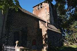 The templar preceptory of Celles | |
 Celles Location within Auvergne-Rhône-Alpes region  Celles | |
| Coordinates: 45°06′57″N 2°57′17″E / 45.1158°N 2.9547°ECoordinates: 45°06′57″N 2°57′17″E / 45.1158°N 2.9547°E | |
| Country | France |
| Region | Auvergne-Rhône-Alpes |
| Department | Cantal |
| Arrondissement | Saint-Flour |
| Canton | Murat |
| Area1 | 18.35 km2 (7.08 sq mi) |
| Population (2008)2 | 235 |
| • Density | 13/km2 (33/sq mi) |
| Time zone | UTC+1 (CET) |
| • Summer (DST) | UTC+2 (CEST) |
| INSEE/Postal code | 15031 /15170 |
| Elevation |
800–1,075 m (2,625–3,527 ft) (avg. 880 m or 2,890 ft) |
|
1 French Land Register data, which excludes lakes, ponds, glaciers > 1 km2 (0.386 sq mi or 247 acres) and river estuaries. 2 Population without double counting: residents of multiple communes (e.g., students and military personnel) only counted once. | |
Celles is a former commune in the Cantal department in south-central France. On 1 December 2016, it was merged into the new commune Neussargues en Pinatelle.[1][2]
Population
| Historical population | ||
|---|---|---|
| Year | Pop. | ±% |
| 1962 | 240 | — |
| 1968 | 281 | +17.1% |
| 1975 | 257 | −8.5% |
| 1982 | 229 | −10.9% |
| 1990 | 221 | −3.5% |
| 1999 | 239 | +8.1% |
| 2008 | 235 | −1.7% |
See also
References
- ↑ Arrêté préfectoral 21 September 2016 (in French)
- ↑ Arrêté préfectoral, correcting the creation date
| Wikimedia Commons has media related to Celles (Cantal). |
This article is issued from
Wikipedia.
The text is licensed under Creative Commons - Attribution - Sharealike.
Additional terms may apply for the media files.