Cayo Agua Island
| Native name: Isla Cayo Agua | |
|---|---|
 Bocas del Toro Archipelago | |
 Cayo Agua Island | |
| Geography | |
| Coordinates | 9°8′N 82°2′W / 9.133°N 82.033°WCoordinates: 9°8′N 82°2′W / 9.133°N 82.033°W |
| Archipelago | Bocas del Toro Archipelago |
| Area | 16 km2 (6.2 sq mi) |
| Highest elevation | 0 m (0 ft) |
| Administration | |
| Province | Bocas del Toro |
| District | Bocas del Toro |
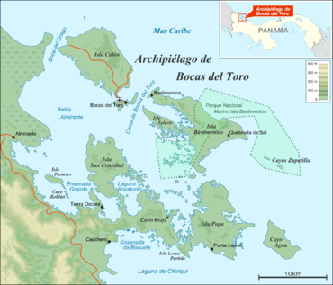
Cayo Agua (Water Cay) is the eastern and southernmost island in the Bocas del Toro Archipelago, Panama, separating Chiriquí Lagoon in the south from the Caribbean Sea in the north. It has a surface area of 16 km2.[1]
See also
References
- ↑ St. Louis, Regis & Scott Doggett (2004), Lonely Planet Panama, Lonely Planet Publications, p. 227, ISBN 1-74104-133-3
| Islands | 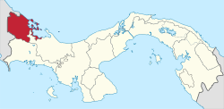 | |
|---|---|---|
| Protected areas | ||
| Settlements |
| |
This article is issued from
Wikipedia.
The text is licensed under Creative Commons - Attribution - Sharealike.
Additional terms may apply for the media files.