Castallack
| Castallack | |
|---|---|
 Castallack | |
 Castallack Castallack shown within Cornwall | |
| OS grid reference | SW451253 |
| Civil parish | |
| Unitary authority | |
| Ceremonial county | |
| Region | |
| Country | England |
| Sovereign state | United Kingdom |
| Post town | PENZANCE |
| Postcode district | TR19 |
| Dialling code | 01736 |
| Police | Devon and Cornwall |
| Fire | Cornwall |
| Ambulance | South Western |
| EU Parliament | South West England |
| UK Parliament | |
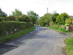
Castallack is a hamlet near Lamorna in west Cornwall, England, UK.[1] According to the Post Office the population of the hamlet at the 2011 census is the civil parish of Paul.
Castallack lies within the Cornwall Area of Outstanding Natural Beauty (AONB). Almost a third of Cornwall has AONB designation, with the same status and protection as a National Park.
Castallack Roundago (grid reference SW44822540) is a good example of an Romano-British round despite it having been partly destroyed in the 19th century.[2]
References
- ↑ Ordnance Survey: Landranger map sheet 203 Land's End & Isles of Scilly (Map). Ordnance Survey. 2009. ISBN 978-0-319-23289-7.
- ↑ Anon (2006). Kirkham, Graham; Herring, Peter, eds. "Castallack Roundago". Cornish Archaeology / Hendhyscans Kernow. Cornwall Archaeological Society. 41–42 (2002–3): 186. ISSN 0070-024X.
Cornwall Portal | |
| Unitary authorities | |
| Major settlements |
|
| Rivers | |
| Topics | |
This article is issued from
Wikipedia.
The text is licensed under Creative Commons - Attribution - Sharealike.
Additional terms may apply for the media files.