Carp River (Algoma District)
| Carp River | |
| River | |
| Country | Canada |
|---|---|
| Province | Ontario |
| Region | Northeastern Ontario |
| District | Algoma |
| Part | Unorganized, North |
| Part of | Great Lakes Basin |
| Tributaries | |
| - left | East Carp River |
| Source | Unnamed lake |
| - elevation | 545 m (1,788 ft) |
| - coordinates | 47°03′26″N 84°32′54″W / 47.05722°N 84.54833°W |
| Mouth | Batchawana Bay on Lake Superior |
| - elevation | 180 m (591 ft) |
| - coordinates | 46°56′42″N 84°34′48″W / 46.94500°N 84.58000°WCoordinates: 46°56′42″N 84°34′48″W / 46.94500°N 84.58000°W |
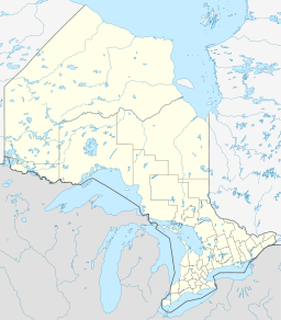 Location of the mouth of the Carp River in Ontario | |
The Carp River is a river in the Unorganized North Part of Algoma District in Northeastern Ontario, Canada.[1] The river is in the Great Lakes Basin and is a tributary of Lake Superior.
Course
The river begins at an unnamed lake in geographic Nicolet Township[2] and heads west, then turns south, enters geographic Palmer Township,[3] flows through the Cedar Lakes, and takes in the left tributary East Carp River. It continues south, passes into geographic Fisher Township,[4] takes in the left tributary Carp Creek arriving from Carp Lake, passes under Ontario Highway 17, and reaches Batchawana Bay on Lake Superior.
Recreation
The mouth of the Carp River is at the west end of Batchawana Bay Provincial Park.
Tributaries
- Carp Creek (left)
- East Carp River (left)
References
- ↑ "Carp River". Geographical Names Data Base. Natural Resources Canada. Retrieved 2012-08-24.
- ↑ "Nicolet" (PDF). Geology Ontario - Historic Claim Maps. Ontario Ministry of Northern Development, Mines and Forestry. Archived from the original (PDF) on 2016-03-04. Retrieved 2012-08-24.
- ↑ "Palmer" (PDF). Geology Ontario - Historic Claim Maps. Ontario Ministry of Northern Development, Mines and Forestry. Archived from the original (PDF) on 2016-03-04. Retrieved 2012-08-24.
- ↑ "Fisher" (PDF). Geology Ontario - Historic Claim Maps. Ontario Ministry of Northern Development, Mines and Forestry. Retrieved 2012-08-24.
Other map sources:
- Map 12 (PDF) (Map). 1 : 1,600,000. Official road map of Ontario. Ministry of Transportation of Ontario. 2010-01-01. Retrieved 2012-08-24.
- Restructured municipalities - Ontario map #4 (Map). Restructuring Maps of Ontario. Ontario Ministry of Municipal Affairs and Housing. 2006. Retrieved 2012-08-24.
This article is issued from
Wikipedia.
The text is licensed under Creative Commons - Attribution - Sharealike.
Additional terms may apply for the media files.