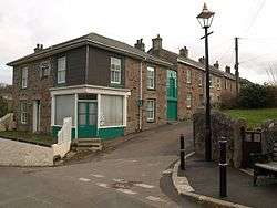
Carn Brea Village
| Carn Brea | |
|---|---|
| village | |
 | |
| Coordinates: 50°13′34″N 5°14′28″W / 50.226°N 5.241°WCoordinates: 50°13′34″N 5°14′28″W / 50.226°N 5.241°W | |
| Country | England |
| County | Cornwall |
| Civil parish | Carn Brea |
| Postcode | TR16 |
Carn Brea Village is a village in the civil parish of Carn Brea (where the 2011 census population is included), Cornwall, England, UK. It is south of the railway line to Penzance while Tolskithy is to the north.[1][2]
References
- ↑ Ordnance Survey: Landranger map sheet 203 Land's End & Isles of Scilly (Map). Ordnance Survey. 2009. ISBN 978-0-319-23289-7.
- ↑ Carn Brea Village; Explore Britain
Cornwall Portal | |
| Unitary authorities | |
| Major settlements |
|
| Rivers | |
| Topics | |
This article is issued from
Wikipedia.
The text is licensed under Creative Commons - Attribution - Sharealike.
Additional terms may apply for the media files.