Carlton, Washington
| Carlton, Washington | |
|---|---|
| Unincorporated community | |
 Carlton, Washington | |
| Coordinates: 48°14′54″N 120°06′58″W / 48.24833°N 120.11611°WCoordinates: 48°14′54″N 120°06′58″W / 48.24833°N 120.11611°W | |
| Country | United States |
| State | Washington |
| County | Okanogan |
| Elevation | 1,414 ft (431 m) |
| Time zone | UTC-8 (Pacific (PST)) |
| • Summer (DST) | UTC-7 (PDT) |
| ZIP code | 98814 |
| Area code(s) | 509 |
| GNIS feature ID | 1517403[1] |
Carlton is an unincorporated community in Okanogan County, Washington, United States. Carlton is located on the Methow River and Washington State Route 153, 8 miles (13 km) south of Twisp. Carlton has a post office with ZIP code 98814.[2]
See also
References
- ↑ U.S. Geological Survey Geographic Names Information System: Carlton, Washington
- ↑ ZIP Code Lookup Archived September 12, 2012, at the Wayback Machine.
Municipalities and communities of Okanogan County, Washington, United States | ||
|---|---|---|
| Cities | 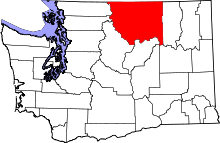 | |
| Towns | ||
| CDPs | ||
| Unincorporated communities | ||
| Indian reservation | ||
| Ghost towns | ||
| Footnotes | ‡This populated place also has portions in an adjacent county or counties | |
This article is issued from
Wikipedia.
The text is licensed under Creative Commons - Attribution - Sharealike.
Additional terms may apply for the media files.