Carclaze
Coordinates: 50°21′13″N 4°46′51″W / 50.3535°N 4.7808°W
Carclaze
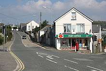
Carclaze is a suburb of the town of St Austell in mid Cornwall, England, United Kingdom.[1] The suburb forms part of the civil parish of Treverbyn. It gives its name to the china clay works to the north.
References
External links
| Wikisource has original text related to this article: |
Cornwall Portal | |
| Unitary authorities | |
| Major settlements |
|
| Rivers | |
| Topics | |
This article is issued from
Wikipedia.
The text is licensed under Creative Commons - Attribution - Sharealike.
Additional terms may apply for the media files.