Capivari de Baixo
| Capivari de Baixo, Santa Catarina | ||
|---|---|---|
| ||
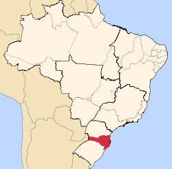
 Location in Santa Catarina Brazil | ||
 Capivari de Baixo, Santa Catarina Location in Santa Catarina Brazil | ||
| Coordinates: 28°28′00″S 49°00′25″W / 28.46667°S 49.00694°WCoordinates: 28°28′00″S 49°00′25″W / 28.46667°S 49.00694°W | ||
| Country |
| |
| Region | South | |
| State |
| |
| City Emancipation | March 30, 1992 | |
| Government | ||
| • Mayor | Nivaldo Souza (Partido Socialista Brasileiro) | |
| Area | ||
| • Total | 53.165 km2 (20.527 sq mi) | |
| Elevation | 100 m (300 ft) | |
| Population (2016) | ||
| • Total | 23,982 | |
| Time zone | UTC-03:00 (BRT) | |
| • Summer (DST) | UTC-02:00 (BRST) | |
| Website | Prefeitura Municipal de Capivari de Baixo | |

Capivari de Baixo is a Brazilian municipality located in the southern region of Santa Catarina.[1] In 2010, it had a population estimated at 21,674 inhabitants.[2] As of 2016, the population was estimated to be at 23,982.[2] From 1991 to 2000, the demographic growth has been of 1,51% yearly, while the national average was of 1,63%.[3] From 2000 to 2010, the demographic growth was of 1,56% yearly, while the national average was of 1,17%.[3] Capivari de Baixo has the largest coal-fired thermoelectric power plant of Latin America, Complexo Termoelétrico Jorge Lacerda.[4]
References
- ↑ "Archived copy". Archived from the original on 2014-04-14. Retrieved 2013-02-24.
- 1 2 "IBGE | Cidades | Santa Catarina | Capivari de Baixo". www.cidades.ibge.gov.br. Retrieved 2017-01-11.
- 1 2 "Atlas do Desenvolvimento Humano no Brasil". 2013. Retrieved January 10, 2016.
- ↑ SUL, DIARIO DO. "Cinco décadas de existência do Complexo Jorge Lacerda". diariodosul.com.br. Retrieved 2017-01-11.
Capital: Florianópolis | |||||||||
| Grande Florianópolis |
|  | |||||||
| Norte Catarinense |
| ||||||||
| Oeste Catarinense | |||||||||
| Serrana |
| ||||||||
| Sul Catarinense |
| ||||||||
| Vale do Itajai |
| ||||||||
This article is issued from
Wikipedia.
The text is licensed under Creative Commons - Attribution - Sharealike.
Additional terms may apply for the media files.