Capira
| Capira | |
|---|---|
| Town and corregimiento | |
 Capira | |
| Coordinates: 8°45′0″N 79°52′12″W / 8.75000°N 79.87000°WCoordinates: 8°45′0″N 79°52′12″W / 8.75000°N 79.87000°W | |
| Country |
|
| Province | Panamá Oeste |
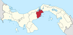
| District | Capira |
| Area[1] | |
| • Land | 45.6 km2 (17.6 sq mi) |
| Population (2010)[1] | |
| • Total | 5,181 |
| • Density | 113.5/km2 (294/sq mi) |
| Population density calculated based on land area. | |
| Time zone | UTC−5 (EST) |
Capira is a town and corregimiento in Capira District, Panamá Oeste Province, Panama with a population of 5,181 as of 2010.[1] It is the seat of Capira District.[1] Its population as of 1990 was 3,606; its population as of 2000 was 4,553.[1]
References
- 1 2 3 4 5 "Cuadro 11 (Superficie, población y densidad de población en la República...)" [Table 11 (Area, population, and population density in the Republic...)] {{webarchive |url=https://web.archive.org/web/20160304030354/http://www.contraloria.gob.pa/inec/archivos/P3601Cuadro11.xls |date=March 4, 2016 }} (.xls). In "Resultados Finales Básicos" [Basic Final Results] (in Spanish). National Institute of Statistics and Census of Panama. Archived from the original on July 10, 2015. Retrieved May 26, 2015.
This article is issued from
Wikipedia.
The text is licensed under Creative Commons - Attribution - Sharealike.
Additional terms may apply for the media files.