Capellanía (wetland)
| Capellanía Wetland Humedal de Capellanía | |
|---|---|
 Capellanía Wetland | |
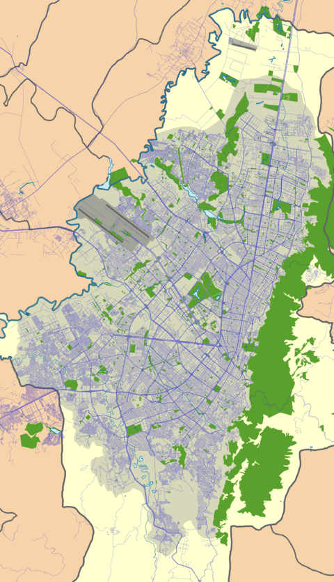 Location in Bogotá | |
| Location |
Fontibón, Bogotá |
| Coordinates | 4°40′30″N 74°7′50″W / 4.67500°N 74.13056°WCoordinates: 4°40′30″N 74°7′50″W / 4.67500°N 74.13056°W |
| Area | 27.03 ha (66.8 acres) |
| Elevation | 2,542 m (8,340 ft) |
| Administrator | EAAB - ESP |
| Website | Humedal de Capellanía |
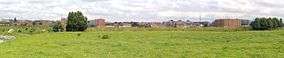
Capellanía (Spanish: Humedal de Capellanía) is a wetland situated in the locality of Fontibón as one of the Wetlands of Bogotá, Colombia. It forms part of the Fucha River basin on the Bogotá savanna. Since 1995, it has been split into two due to the construction of the Avenida La Esperanza. This has caused rapid deterioration and the wetland is likely to disappear because of the industries that surround it, the current transportation projects of the area, and future developments approved by the district. The wetland covers 27 hectares (67 acres).[1]
Flora and fauna
Due to the industrial activities around the wetland, it hardly hosts fauna.[2]
Flora
Flora registered in the wetland are among others kikuyu grass (Pennisetum clandestinum), southern bulrush (Scirpus californicus) and larger bur-marigold (Bidens laevis).[2]
See also
References
Bibliography
- Moreno, Vanesa; Juan Francisco García, and Juan Carlos Villalba. s.a. Descripción general de los humedales de Bogotá D.C., 1–28. Sociedad Geográfica de Colombia. Accessed 2017-03-03.
External links
- (in Spanish) Fundación Humedales de Bogotá
- (in Spanish) Conozca los 15 humedales de Bogotá - El Tiempo
 | Administrative subdivision in 20 localities |  | |
|---|---|---|---|
| Metropolitan Area | |||
| Geography | |||
| |||
| |||