Canworthy Water
Coordinates: 50°41′50″N 4°30′59″W / 50.69721°N 4.51632°W
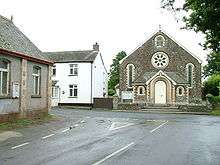
Canworthy Water village centre
Canworthy Water (Cornish: Boskarn) is a settlement in northeast Cornwall, England, United Kingdom. It is situated beside the River Ottery at OS grid ref SX224918 approximately seven miles (11 km) northeast of Camelford.[1]
Canworthy Water is mainly in the civil parish of Warbstow (Detached), with parts north of the River Ottery in Jacobstow civil parish.
| Wikimedia Commons has media related to Canworthy Water. |
References
Cornwall Portal | |
| Unitary authorities | |
| Major settlements |
|
| Rivers | |
| Topics | |
This article is issued from
Wikipedia.
The text is licensed under Creative Commons - Attribution - Sharealike.
Additional terms may apply for the media files.