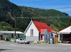
Canvastown
| Canvastown | |
|---|---|
 | |
 Canvastown | |
| Coordinates: 41°17′26″S 173°40′13″E / 41.29056°S 173.67028°ECoordinates: 41°17′26″S 173°40′13″E / 41.29056°S 173.67028°E | |
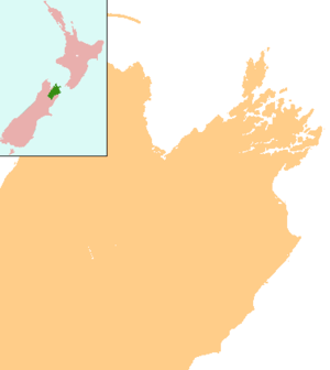
| Country | New Zealand |
| Region | Marlborough |
Canvastown is a locality at the point where the Wakamarina River joins the Pelorus River, in Marlborough, New Zealand. State Highway 6 runs through the area. Rai Valley is 17 km to the northwest. Havelock is 10 km to the east.[1][2]
History
The town was founded in 1864, after gold was discovered in the Wakamarina Valley. Up to 6000 miners came to make their fortunes. Where there had previously been a Māori Pā, streets of tents sprang up providing accommodation, restaurants and taverns to a population of about 3000 people. About 25,000 ounces (710,000 g) of gold was recovered in 1864.[3] The surface gold was worked out within two years and most of the miners moved to new gold discoveries on the West Coast.[4][5] Steam dredges continued to work the river into the 20th century.[6]
Education
Canvastown School is a coeducational full primary (years 1-8) school with a decile rating of 5 and a roll of 29.[7] The school was built in 1877[8] and celebrated its 125th Jubilee in 2002.[9]
Culture
Te Hora Marae is located in Canvastown. It is the marae (meeting ground) of Ngāti Kuia and includes Te Hora wharenui (meeting house).[10][11]
See also
| Wikimedia Commons has media related to Canvastown. |
Notes
- ↑ Peter Dowling (editor) (2004). Reed New Zealand Atlas. Reed Books. pp. map 60. ISBN 0-7900-0952-8.
- ↑ Roger Smith, GeographX (2005). The Geographic Atlas of New Zealand. Robbie Burton. pp. map 138. ISBN 1-877333-20-4.
- ↑ "Gold Discoveries - Wakamarina and the West Coast". Encyclopedia of New Zealand (1966).
- ↑ "Gold and gold mining - Other goldfields". Te Ara: The Encyclopedia of New Zealand.
- ↑ A. D. McIntosh, ed. (1940). Marlborough - A Provincial History. p. 241.
- ↑ Marlborough Historical Society (2005). Click - A Captured Moment - Marlborough's Early Heritage. Blenheim: Marlborough Historical Society. p. 200. ISBN 0-473-10475-X.
- ↑ "Te Kete Ipurangi - Canvastown School". Ministry of Education.
- ↑ "Canvastown School (X1719)". National Register of Archives and Manuscripts. Archived from the original on 2008-10-17. Retrieved 2008-05-18.
- ↑ "Jubilees & reunions: Canvastown School" (– Scholar search). Education Gazette New Zealand. 81 (5). 25 March 2002.
- ↑ "Te Kāhui Māngai directory". tkm.govt.nz. Te Puni Kōkiri.
- ↑ "Māori Maps". maorimaps.com. Te Potiki National Trust.