Canley Vale railway station
Canley Vale | |||||||||||||||
|---|---|---|---|---|---|---|---|---|---|---|---|---|---|---|---|
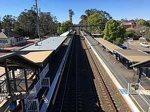 Northbound View in September 2018 | |||||||||||||||
| Location |
Railway Parade, Canley Vale Australia | ||||||||||||||
| Coordinates | 33°53′13″S 150°56′37″E / 33.886889°S 150.943652°ECoordinates: 33°53′13″S 150°56′37″E / 33.886889°S 150.943652°E | ||||||||||||||
| Elevation | 14m | ||||||||||||||
| Owned by | RailCorp | ||||||||||||||
| Operated by | Sydney Trains | ||||||||||||||
| Line(s) | Main South | ||||||||||||||
| Distance | 30.98 kilometres from Central | ||||||||||||||
| Platforms | 2 side | ||||||||||||||
| Tracks | 2 | ||||||||||||||
| Connections |
| ||||||||||||||
| Construction | |||||||||||||||
| Structure type | Ground | ||||||||||||||
| Disabled access | Yes, to platform 1 only | ||||||||||||||
| Other information | |||||||||||||||
| Status | Staffed | ||||||||||||||
| Station code | CVE | ||||||||||||||
| Website | Transport for NSW | ||||||||||||||
| History | |||||||||||||||
| Opened | 15 April 1878 | ||||||||||||||
| Electrified | Yes | ||||||||||||||
| Traffic | |||||||||||||||
| Passengers (2013) | 2,620 (daily)[1] (Sydney Trains, NSW TrainLink) | ||||||||||||||
| Rank | 94 | ||||||||||||||
| Services | |||||||||||||||
| |||||||||||||||
Canley Vale railway station is located on the Main South line, serving the Sydney suburb of Canley Vale. It is served by Sydney Trains T2 Inner West & Leppington Line and T5 Cumberland line services.
History
Canley Vale station opened in April 1878.[2]
Platforms & services
| Platform | Line | Stopping pattern | Notes |
| 1 | services to Central & the City Circle | ||
|---|---|---|---|
| services to Quakers Hill , Schofields and Richmond | |||
| 2 | services to Leppington | ||
| services to Leppington |
Transport links
Transit Systems Sydney operate one route via Canley Vale station:
- 817: Cabramatta station and Fairfield station[3]
Canley Vale station is served by one NightRide route:
- N50: Liverpool station to City (Town Hall)[4]
References
- ↑ Bureau of Transport Statistics. "Train Statistics 2014" (PDF). Transport NSW. Retrieved 12 July 2018.
- ↑ Canley Vale Station NSWrail.net
- ↑ "Transit Systems route 817". Transport for NSW.
- ↑ "N50 Nightride". Transport for NSW.
External links

- Canley Vale station details Transport for New South Wales
This article is issued from
Wikipedia.
The text is licensed under Creative Commons - Attribution - Sharealike.
Additional terms may apply for the media files.