Canal Streetcar Line
| Canal-Cemeteries branch Canal-City Park/Museum branch | |||||||||||||||||||||||||||||||||||||||||||||||||||||||||||||||||||||||||||||||||||||||||||||||||||||||||||||||||||||||||||||||||||||||||||||||||||||||||||||||||||||||||||||||||||||||||||||||||||||||||||||||||||||||||||||||||||||||||||||||||||||||||||||||||||||||||||||||||||||||||||||||||||||||||||||||||||||||||||||||||||||||||||||||||||||||||||||||||||||||||||||||||
|---|---|---|---|---|---|---|---|---|---|---|---|---|---|---|---|---|---|---|---|---|---|---|---|---|---|---|---|---|---|---|---|---|---|---|---|---|---|---|---|---|---|---|---|---|---|---|---|---|---|---|---|---|---|---|---|---|---|---|---|---|---|---|---|---|---|---|---|---|---|---|---|---|---|---|---|---|---|---|---|---|---|---|---|---|---|---|---|---|---|---|---|---|---|---|---|---|---|---|---|---|---|---|---|---|---|---|---|---|---|---|---|---|---|---|---|---|---|---|---|---|---|---|---|---|---|---|---|---|---|---|---|---|---|---|---|---|---|---|---|---|---|---|---|---|---|---|---|---|---|---|---|---|---|---|---|---|---|---|---|---|---|---|---|---|---|---|---|---|---|---|---|---|---|---|---|---|---|---|---|---|---|---|---|---|---|---|---|---|---|---|---|---|---|---|---|---|---|---|---|---|---|---|---|---|---|---|---|---|---|---|---|---|---|---|---|---|---|---|---|---|---|---|---|---|---|---|---|---|---|---|---|---|---|---|---|---|---|---|---|---|---|---|---|---|---|---|---|---|---|---|---|---|---|---|---|---|---|---|---|---|---|---|---|---|---|---|---|---|---|---|---|---|---|---|---|---|---|---|---|---|---|---|---|---|---|---|---|---|---|---|---|---|---|---|---|---|---|---|---|---|---|---|---|---|---|---|---|---|---|---|---|---|---|---|---|---|---|---|---|---|---|---|---|---|---|---|---|---|---|---|---|---|---|---|---|---|---|---|---|---|---|---|---|---|---|---|---|---|---|---|---|---|---|---|---|---|---|---|---|---|---|---|---|---|---|---|---|---|---|
 Canal Streetcar on Canal Street at Bourbon Street | |||||||||||||||||||||||||||||||||||||||||||||||||||||||||||||||||||||||||||||||||||||||||||||||||||||||||||||||||||||||||||||||||||||||||||||||||||||||||||||||||||||||||||||||||||||||||||||||||||||||||||||||||||||||||||||||||||||||||||||||||||||||||||||||||||||||||||||||||||||||||||||||||||||||||||||||||||||||||||||||||||||||||||||||||||||||||||||||||||||||||||||||||
| Overview | |||||||||||||||||||||||||||||||||||||||||||||||||||||||||||||||||||||||||||||||||||||||||||||||||||||||||||||||||||||||||||||||||||||||||||||||||||||||||||||||||||||||||||||||||||||||||||||||||||||||||||||||||||||||||||||||||||||||||||||||||||||||||||||||||||||||||||||||||||||||||||||||||||||||||||||||||||||||||||||||||||||||||||||||||||||||||||||||||||||||||||||||||
| Type | Heritage streetcar | ||||||||||||||||||||||||||||||||||||||||||||||||||||||||||||||||||||||||||||||||||||||||||||||||||||||||||||||||||||||||||||||||||||||||||||||||||||||||||||||||||||||||||||||||||||||||||||||||||||||||||||||||||||||||||||||||||||||||||||||||||||||||||||||||||||||||||||||||||||||||||||||||||||||||||||||||||||||||||||||||||||||||||||||||||||||||||||||||||||||||||||||||
| System | New Orleans Regional Transit Authority | ||||||||||||||||||||||||||||||||||||||||||||||||||||||||||||||||||||||||||||||||||||||||||||||||||||||||||||||||||||||||||||||||||||||||||||||||||||||||||||||||||||||||||||||||||||||||||||||||||||||||||||||||||||||||||||||||||||||||||||||||||||||||||||||||||||||||||||||||||||||||||||||||||||||||||||||||||||||||||||||||||||||||||||||||||||||||||||||||||||||||||||||||
| Status | Operational | ||||||||||||||||||||||||||||||||||||||||||||||||||||||||||||||||||||||||||||||||||||||||||||||||||||||||||||||||||||||||||||||||||||||||||||||||||||||||||||||||||||||||||||||||||||||||||||||||||||||||||||||||||||||||||||||||||||||||||||||||||||||||||||||||||||||||||||||||||||||||||||||||||||||||||||||||||||||||||||||||||||||||||||||||||||||||||||||||||||||||||||||||
| Locale | New Orleans, Louisiana | ||||||||||||||||||||||||||||||||||||||||||||||||||||||||||||||||||||||||||||||||||||||||||||||||||||||||||||||||||||||||||||||||||||||||||||||||||||||||||||||||||||||||||||||||||||||||||||||||||||||||||||||||||||||||||||||||||||||||||||||||||||||||||||||||||||||||||||||||||||||||||||||||||||||||||||||||||||||||||||||||||||||||||||||||||||||||||||||||||||||||||||||||
| Termini |
French Market (Riverfront and Esplanade) Cemeteries or City Park | ||||||||||||||||||||||||||||||||||||||||||||||||||||||||||||||||||||||||||||||||||||||||||||||||||||||||||||||||||||||||||||||||||||||||||||||||||||||||||||||||||||||||||||||||||||||||||||||||||||||||||||||||||||||||||||||||||||||||||||||||||||||||||||||||||||||||||||||||||||||||||||||||||||||||||||||||||||||||||||||||||||||||||||||||||||||||||||||||||||||||||||||||
| Services | Routes 47 and 48 | ||||||||||||||||||||||||||||||||||||||||||||||||||||||||||||||||||||||||||||||||||||||||||||||||||||||||||||||||||||||||||||||||||||||||||||||||||||||||||||||||||||||||||||||||||||||||||||||||||||||||||||||||||||||||||||||||||||||||||||||||||||||||||||||||||||||||||||||||||||||||||||||||||||||||||||||||||||||||||||||||||||||||||||||||||||||||||||||||||||||||||||||||
| Operation | |||||||||||||||||||||||||||||||||||||||||||||||||||||||||||||||||||||||||||||||||||||||||||||||||||||||||||||||||||||||||||||||||||||||||||||||||||||||||||||||||||||||||||||||||||||||||||||||||||||||||||||||||||||||||||||||||||||||||||||||||||||||||||||||||||||||||||||||||||||||||||||||||||||||||||||||||||||||||||||||||||||||||||||||||||||||||||||||||||||||||||||||||
| Opened |
1861 (first incarnation) April 18, 2004 (current incarnation) | ||||||||||||||||||||||||||||||||||||||||||||||||||||||||||||||||||||||||||||||||||||||||||||||||||||||||||||||||||||||||||||||||||||||||||||||||||||||||||||||||||||||||||||||||||||||||||||||||||||||||||||||||||||||||||||||||||||||||||||||||||||||||||||||||||||||||||||||||||||||||||||||||||||||||||||||||||||||||||||||||||||||||||||||||||||||||||||||||||||||||||||||||
| Closed | 1964 (first incarnation) | ||||||||||||||||||||||||||||||||||||||||||||||||||||||||||||||||||||||||||||||||||||||||||||||||||||||||||||||||||||||||||||||||||||||||||||||||||||||||||||||||||||||||||||||||||||||||||||||||||||||||||||||||||||||||||||||||||||||||||||||||||||||||||||||||||||||||||||||||||||||||||||||||||||||||||||||||||||||||||||||||||||||||||||||||||||||||||||||||||||||||||||||||
| Owner | New Orleans Regional Transit Authority | ||||||||||||||||||||||||||||||||||||||||||||||||||||||||||||||||||||||||||||||||||||||||||||||||||||||||||||||||||||||||||||||||||||||||||||||||||||||||||||||||||||||||||||||||||||||||||||||||||||||||||||||||||||||||||||||||||||||||||||||||||||||||||||||||||||||||||||||||||||||||||||||||||||||||||||||||||||||||||||||||||||||||||||||||||||||||||||||||||||||||||||||||
| Operator(s) | New Orleans Regional Transit Authority | ||||||||||||||||||||||||||||||||||||||||||||||||||||||||||||||||||||||||||||||||||||||||||||||||||||||||||||||||||||||||||||||||||||||||||||||||||||||||||||||||||||||||||||||||||||||||||||||||||||||||||||||||||||||||||||||||||||||||||||||||||||||||||||||||||||||||||||||||||||||||||||||||||||||||||||||||||||||||||||||||||||||||||||||||||||||||||||||||||||||||||||||||
| Character | Runs in neutral ground (central median) along Canal Street, in traffic lanes next to the neutral ground on N. Carrollton Avenue | ||||||||||||||||||||||||||||||||||||||||||||||||||||||||||||||||||||||||||||||||||||||||||||||||||||||||||||||||||||||||||||||||||||||||||||||||||||||||||||||||||||||||||||||||||||||||||||||||||||||||||||||||||||||||||||||||||||||||||||||||||||||||||||||||||||||||||||||||||||||||||||||||||||||||||||||||||||||||||||||||||||||||||||||||||||||||||||||||||||||||||||||||
| Technical | |||||||||||||||||||||||||||||||||||||||||||||||||||||||||||||||||||||||||||||||||||||||||||||||||||||||||||||||||||||||||||||||||||||||||||||||||||||||||||||||||||||||||||||||||||||||||||||||||||||||||||||||||||||||||||||||||||||||||||||||||||||||||||||||||||||||||||||||||||||||||||||||||||||||||||||||||||||||||||||||||||||||||||||||||||||||||||||||||||||||||||||||||
| Line length | 5.5 mi (8.9 km) (total) | ||||||||||||||||||||||||||||||||||||||||||||||||||||||||||||||||||||||||||||||||||||||||||||||||||||||||||||||||||||||||||||||||||||||||||||||||||||||||||||||||||||||||||||||||||||||||||||||||||||||||||||||||||||||||||||||||||||||||||||||||||||||||||||||||||||||||||||||||||||||||||||||||||||||||||||||||||||||||||||||||||||||||||||||||||||||||||||||||||||||||||||||||
| Track gauge | 5 ft 2 1⁄2 in (1,588 mm) | ||||||||||||||||||||||||||||||||||||||||||||||||||||||||||||||||||||||||||||||||||||||||||||||||||||||||||||||||||||||||||||||||||||||||||||||||||||||||||||||||||||||||||||||||||||||||||||||||||||||||||||||||||||||||||||||||||||||||||||||||||||||||||||||||||||||||||||||||||||||||||||||||||||||||||||||||||||||||||||||||||||||||||||||||||||||||||||||||||||||||||||||||
| Electrification | 600 V DC Trolley wire | ||||||||||||||||||||||||||||||||||||||||||||||||||||||||||||||||||||||||||||||||||||||||||||||||||||||||||||||||||||||||||||||||||||||||||||||||||||||||||||||||||||||||||||||||||||||||||||||||||||||||||||||||||||||||||||||||||||||||||||||||||||||||||||||||||||||||||||||||||||||||||||||||||||||||||||||||||||||||||||||||||||||||||||||||||||||||||||||||||||||||||||||||
| |||||||||||||||||||||||||||||||||||||||||||||||||||||||||||||||||||||||||||||||||||||||||||||||||||||||||||||||||||||||||||||||||||||||||||||||||||||||||||||||||||||||||||||||||||||||||||||||||||||||||||||||||||||||||||||||||||||||||||||||||||||||||||||||||||||||||||||||||||||||||||||||||||||||||||||||||||||||||||||||||||||||||||||||||||||||||||||||||||||||||||||||||
The Canal Streetcar line is a historic streetcar line in New Orleans, Louisiana. It is operated by the New Orleans Regional Transit Authority (RTA). It originally operated from 1861 to 1964. It was redesigned and rebuilt between 2000 and 2004, and operation was reinstated in 2004 after a 40-year hiatus. Primarily running along its namesake street, Canal Street, it consists of two branches named for their outer terminals,[1] totaling about 5 1⁄2 miles (8.9 km) in length:[2] "Canal - Cemeteries" (officially designated as Route 47) and "Canal - City Park/Museum" (officially designated as Route 48). Each branch is denoted with the red and light green colors respectively on most RTA publications.
Before the return of the line, the Canal Street corridor was served from 1964 to 2004 by several RTA bus lines utilizing the neutral ground in the Central Business District where the tracks now run.
Route description
The trunk of the Canal Streetcar line travels a direct route along Canal Street from where it begins at Convention Center Boulevard (in front of Harrah's Casino) to Carrollton Avenue where the two branches split. Tracks continue toward the River to the tracks utilized by the Riverfront line. Effective Sunday September 30, 2018, both branches of the Canal line are extended on the Riverfront tracks between Canal Street and the French Market terminal at Esplanade.[3] Leaving the downtown area, the line mostly traverses several neighborhoods in the Mid-City portion of the city and consists of 3 miles (4.8 km) inland.
Branches
The "Cemeteries" branch continues on Canal Street past Carrollton Avenue to its terminus at Metairie Road (which continues as City Park Avenue), surrounded by several cemeteries. For much of its history, this area constituted the northern (lakeside) boundary of the city, which explains the density of cemeteries, Catholic, Protestant, and Jewish, in this area. Beginning July 31, 2017, and completed on December 4, a new loop terminal was built north of City Park Avenue on Canal Boulevard, providing passengers with better access to transfer between the streetcars and connecting bus lines. Following a month of testing and training, the new loop went into service January 7, 2017. [4][5]
The "City Park/Museum" branch (or sometimes just "City Park") turns northward from Canal onto North Carrollton Avenue, where it runs in the inside lanes of the street rather than in the neutral ground. It is reduced to a single track at the intersection of City Park/Moss Avenues and returns to the neutral ground before it ends at Beauregard Circle, at Esplanade Avenue and Bayou St. John, near the entrance of the New Orleans Museum of Art in City Park. It is within easy walking distance of the New Orleans Fairgrounds, site of the yearly Jazz and Heritage Festival.
The Canal Cemeteries and City Park branches were originally designated as Routes 42 and 45, respectively, until January 2009, when the route numbers were changed to 47 and 48.
History
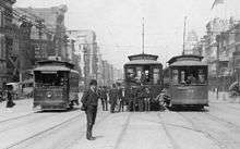
The Canal Street Line traces its origins to the old New Orleans City RR Co., founded to provide horse-drawn streetcar service throughout the city. This system's first lines opened in June 1861, running on Esplanade, Magazine, Prytania, and Canal Streets. The original car barn for the Canal Line, which served it until the end in 1964, was established at White Street. The line ran on its namesake street from St. Charles Street to the car barn; it was extended in August all the way to the end of the street at the Cemeteries.[6]
The City RR came under the control of the New Orleans Traction Co. in 1892 as the system was prepared for electrification. A large order for new electric streetcars was placed with the Brill Co. of Philadelphia. The Canal Line was the first New Orleans Traction line to be electrified, beginning electric service on July 28, 1894. It was followed very quickly by Esplanade and the rest of the company's horsecar lines. The line was extended slightly in the central business district to terminate at the foot of Canal Street, not far from the Mississippi River.[7]
In 1901, the streetcar company slightly extended the Canal and Esplanade Lines so that their outer ends met at City Park Ave., and connected them together in a Belt Line. Canal cars left the central business district on Canal Street, operated to City Park Ave., turned down that street to Esplanade Ave., and returned on Esplanade to Rampart and thus back to Canal Street. Cars marked Esplanade left the central business district via Rampart Street down to Esplanade, then operated out Esplanade to City Park Ave. to Canal, and returned on Canal Street. This Belt Line arrangement lasted until December 27, 1934, when Esplanade Ave. was converted to buses, and Canal resumed running only on Canal Street, end-to-end.[6]
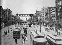
From 1934 to 1950, there were two lines running on Canal Street. Cars marked West End operated from the foot of Canal to the outer end of the street at the cemeteries, then turned left onto City Park Avenue (Metairie Road) to the New Basin Canal, and then out the east bank of that canal to the West End amusement area at Lake Pontchartrain. Cars marked Cemeteries followed the same route, but turned back at the cemeteries immediately after turning off of Metairie Road. West End made only limited stops along Canal Street from Claiborne Ave. to City Park Ave. The West End line was converted to buses in 1950, after which the surviving Cemeteries cars were once again signed Canal. In 1951, the outer terminus of the Canal Line was moved to the end of Canal Street, and tracks on City Park Ave. (Metairie Road) were removed.[8]
In 1964, the streetcar company (known since 1922 as New Orleans Public Service Incorporated, or NOPSI) proposed to convert the Canal line to buses. The line was to be combined with the West End and Canal Boulevard bus lines, so that patrons could have a one-seat ride all the way from the central business district to Lake Pontchartrain. There was tremendous controversy over the proposal from the protests of preservationists. While the St. Charles Streetcar line was spared, the Canal line was not. The last day was May 30, 1964, with the final run (NOPSI car 972, carrying banners which read "See Me On St. Charles") leaving Canal Line tracks at about 5:00 a.m. on May 31. All the streetcars, except for 35 reserved for the St. Charles Line, were scrapped or donated to museums across the country, and all track and overhead wire were removed.[9]

By the 1990s, interest in streetcars was rekindled, not only in New Orleans, but in many cities around the country. Plans for the restoration of the Canal Line were announced in 2000, and tracks were rebuilt from the foot of Canal Street out to the cemeteries. A branch line was created on North Carrollton Avenue, which had never before had streetcar service. Finally, the Canal streetcar line reopened April 18, 2004, almost 40 years after its close. It replaced multiple stop service on Canal in the Mid-City mostly except for a limited stop express line which ran all the way to the lake, which was eliminated suddenly due to Hurricane Katrina.
In 2005, Hurricane Katrina damaged the red streetcars of the Canal and Riverfront lines which were stored at the car barn behind the RTA headquarters. As streetcar service was restored, it was forced to utilize the green cars borrowed from the St. Charles line while the red cars were rebuilt.
Operation
The Canal Streetcar trunk operates frequent service daily, from every six to seven minutes daily to every ten minutes at night. The Canal-Cemeteries branch operates 24 hours a day, seven days a week, averaging every ten minutes (7-13 minutes literally on scheduled trips) during the day and at night and every 30 minutes late at night. The Canal-City Park/Museum branch has a shorter operation schedule, seven days a week from approximately 6 a.m. to 12:15 a.m., with 20 minute headways throughout service times. After 11 p.m., several City Park branch trips do not operate all the way to the central business district; instead they operate from the Museum of Art terminal to the intersection of Canal and White Street (at the car barn).[10]
List of streetcar stops
From Harrah's Casino to Mid-City
| Stop | Neighborhood(s) | Other streetcar lines | Notes |
|---|---|---|---|
| Canal Streetcar line trunk by way of Canal Street | |||
| Harrah's Casino | Downtown, Central Business District | Inbound terminus of Canal Streetcar. Within walking distance of Riverfront Line (at foot of Canal Street), Algiers Point-Canal Street Ferry and Gretna Ferry. Inbound stop location is at Convention Center Boulevard; the outbound stop is half a block west. Serves Audubon Aquarium of the Americas, Harrah's Casino, IMAX Theater, Woldenberg Park, World Trade Center. | |
| Peters Street | Downtown, Central Business District, French Quarter | Serves Audubon Insectarium, Harrah's Casino and The Shops at Canal Place. | |
| Magazine/Decatur Streets | Downtown, Central Business District, French Quarter | ||
| Camp/Chartres Streets | Downtown, Central Business District, French Quarter | ||
| St. Charles Avenue/Royal Street | Downtown, Central Business District, French Quarter | ||
| Carondelet/Bourbon Streets | Downtown, Central Business District, French Quarter | Transfer connection to St. Charles Streetcar Line. | |
| Baronne/Dauphine Streets | Downtown, Central Business District, French Quarter | ||
| Rampart Street | Downtown, Central Business District, French Quarter | Major transfer point for Rampart-St. Claude Streetcar Line and many RTA buses serving downtown. | |
| Elk Place/Basin Street | Downtown, Biomedical District | ||
| Claiborne Avenue | Downtown, Biomedical District, Tulane/Gravier | Crosses under Pontchartrain Expressway (Interstate 10). | |
| Prieur Street | Tulane/Gravier | ||
| Galvez Street | Tulane/Gravier | ||
| Tonti Street | Tulane/Gravier | ||
| Dorgenois Street | Tulane/Gravier | ||
| Broad Street | Mid-City, Tulane/Gravier | ||
| White Street | Mid-City | Late-night inbound terminus of Canal-City Park/Museum branch. Serves RTA headquarters and tracks diverge to the A. Phillip Randolph car barn. | |
| Salcedo Street | Mid-City | ||
| Lopez Street | Mid-City | ||
| Jefferson Davis Parkway | Mid-City | ||
| Clark Street | Mid-City | ||
| Telemachus Street | Mid-City | ||
| Scott Street | Mid-City | ||
| Carrollton Avenue | Mid-City | Last outbound stop on both Cemeteries and City Park branches before tracks diverge. | |
| Canal Streetcar line "Cemeteries" branch by way of Canal Street | |||
| Hennessey Street | Mid-City | ||
| Murat Street | Mid-City | ||
| St. Patrick Street | Mid-City | ||
| Anthony Street | Mid-City | ||
| Cemeteries | Mid-City | Outbound terminus. Intersection of Canal Street/Canal Blvd. and Metairie Road/City Park Avenue. | |
| Canal Streetcar line "City Park/Museum" branch by way of North Carrollton Avenue | |||
| Bienville Avenue | Mid-City | ||
| St. Louis Street | Mid-City | ||
| Orleans Avenue | City Park neighborhood | ||
| Dumaine Street | City Park | ||
| City Park Avenue | City Park | ||
| City Park and Museum of Art | City Park | Outbound terminus. Serves New Orleans City Park, Museum of Art. Intersection of North Carrollton Avenue (continues as Wisner Boulevard) and Esplanade Avenue. | |
Footnotes
- ↑ Branley, Edward J. (2004). New Orleans: The Canal Streetcar Line. Charleston, SC: Arcadia Publishing. p. 112. ISBN 978-0738516059.
- ↑ "Streetcars in New Orleans". NewOrleansOnline.com. The Official Tourism Site of the City of New Orleans. 2013. Retrieved 16 July 2013.
- ↑ Evans, Beau. "Streetcars to run all night along Canal Street, Riverfront". Nola.com - The Times Picayune. Retrieved October 1, 2018.
- ↑ "Cemeteries Transit Center Project". New Orleans RTA. Retrieved 7 October 2017.
- ↑ "Canal streetcar to cross over City Park Avenue starting Sunday". New Orleans RTA. Retrieved January 8, 2018.
- 1 2 Hennick & Charlton (1975), p. 75.
- ↑ Hennick & Charlton (1975), p. 24.
- ↑ Hennick & Charlton (1975), p. 100-102.
- ↑ Hennick & Charlton (1975), p. 42-46.
- ↑ "New Orleans RTA". Retrieved May 23, 2018.
References
- Hennick, Louis C.; Charlton, Elbridge Harper (1975). The Streetcars of New Orleans. Jackson Square Press. ISBN 978-1-5655-4568-7. OCLC 49910971.
External links
Route map: