Callicoon, New York
| Callicoon | |
|---|---|
| Town | |
 County Route 149 as it passes through the snowy landscape of the Town of Callicoon. | |
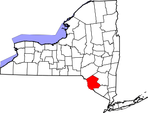
_highlighted.svg.png) Location of Callicoon in Sullivan County, New York | |
| Coordinates: 41°50′11″N 74°55′00″W / 41.83639°N 74.91667°WCoordinates: 41°50′11″N 74°55′00″W / 41.83639°N 74.91667°W | |
| Country | United States |
| State | New York |
| County | Sullivan |
| Area[1] | |
| • Total | 48.95 sq mi (126.77 km2) |
| • Land | 48.59 sq mi (125.85 km2) |
| • Water | 0.35 sq mi (0.92 km2) |
| Population (2010) | |
| • Total | 3,057 |
| • Estimate (2016)[2] | 2,920 |
| • Density | 60.09/sq mi (23.20/km2) |
| FIPS code | 36-105-11759 |
Callicoon is a town in Sullivan County, New York, USA. The population was 3,057 at the 2010 census.[3] The town is in the northwestern part of the county.
History
The town was formed in 1842 from the town of Liberty. The original spelling of the name was "Collikoon." This name is said to signify "turkey" in both Dutch and Choctaw. (The Dutch for turkey is "kalkoen," while the closest Native American word is the Choctaw word for turkey, "cholokloha.").[4][5]
Part of the town was given over to form the town of Fremont in 1851.
Geography
Callicoon Creek, which flows through the town, was once called "Beaverkill Creek."
According to the United States Census Bureau, the town has a total area of 49.0 square miles (126.9 km²), of which, 48.7 square miles (126.0 km²) of it is land and 0.3 square miles (0.9 km²) of it (0.69%) is water.
Demographics
| Historical population | |||
|---|---|---|---|
| Census | Pop. | %± | |
| 1830 | 438 | — | |
| 1840 | 622 | 42.0% | |
| 1850 | 1,671 | 168.6% | |
| 1860 | 3,174 | 89.9% | |
| 1870 | 2,763 | −12.9% | |
| 1880 | 2,180 | −21.1% | |
| 1890 | 2,083 | −4.4% | |
| 1900 | 2,054 | −1.4% | |
| 1910 | 2,059 | 0.2% | |
| 1920 | 1,739 | −15.5% | |
| 1930 | 1,996 | 14.8% | |
| 1940 | 2,092 | 4.8% | |
| 1950 | 2,134 | 2.0% | |
| 1960 | 2,176 | 2.0% | |
| 1970 | 2,398 | 10.2% | |
| 1980 | 2,998 | 25.0% | |
| 1990 | 3,024 | 0.9% | |
| 2000 | 3,052 | 0.9% | |
| 2010 | 3,057 | 0.2% | |
| Est. 2016 | 2,920 | [2] | −4.5% |
| U.S. Decennial Census[6] | |||
As of the census[3] of 2010, there were 3,057 people, 1,288 households, and 822 families residing in the town. The population density was 62.7 people per square mile (24.2/km²). There were 90 housing units at an average density of 36.9 per square mile (14.3/km²). The racial makeup of the town was 95.81% White, 0.75% Black or African American, 0.20% Native American, 0.69% Asian, 1.15% from other races, and 1.41% from two or more races. Hispanic or Latino of any race were 4.55% of the population.
There were 1,288 households out of which 24.8% had children under the age of 18 living with them, 49.3% were married couples living together, 10.0% had a female householder with no husband present, and 36.2% were non-families. 29.3% of all households were made up of individuals and 13.7% had someone living alone who was 65 years of age or older. The average household size was 2.30 and the average family size was 2.82.
In the town, the population was spread out with 23.1% under the age of 18, 6.5% from 18 to 24, 25.1% from 25 to 44, 27.3% from 45 to 64, and 18.1% who were 65 years of age or older. The median age was 42 years. For every 100 females, there were 94.5 males. For every 100 females age 18 and over, there were 92.3 males.
The median income for a household in the town was $38,811, and the median income for a family was $46,645. Males had a median income of $34,524 versus $24,185 for females. The per capita income for the town was $19,272. About 6.8% of families and 10.5% of the population were below the poverty line, including 11.3% of those under age 18 and 6.1% of those age 65 or over.
Communities and locations in Callicoon
- Callicoon Center – A hamlet in the north part of the town at the junction of Routes 122 and 125. This community was originally called Thurmansville. The Hessinger Store was listed on the National Register of Historic Places in 2000.[7]
- Jeffersonville – A village.
- North Branch – A hamlet on the north branch of the Callicoon Creek and Route 122.
- Youngsville – A hamlet in the eastern part of the town.
Although it bears the same name, the census-designated place and hamlet of Callicoon is not in this town but rather in the neighboring town of Delaware, New York.
References
- ↑ "2016 U.S. Gazetteer Files". United States Census Bureau. Retrieved Jul 5, 2017.
- 1 2 "Population and Housing Unit Estimates". Retrieved June 9, 2017.
- 1 2 "American FactFinder". United States Census Bureau. Retrieved 2008-01-31.
- ↑ French, J.H., Gazetteer of the State of New York (1860), p. 644, reprinted by Genealogical Publishing Co. 1998. ISBN 978-0806314563
- ↑ LINGUIST List 7.174, Feb 4 1996
- ↑ "Census of Population and Housing". Census.gov. Archived from the original on May 12, 2015. Retrieved June 4, 2015.
- ↑ National Park Service (2009-03-13). "National Register Information System". National Register of Historic Places. National Park Service.
