California Township, Starke County, Indiana
| California Township | |
|---|---|
| Township | |
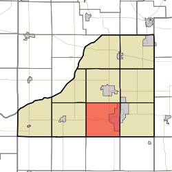 Location in Starke County | |
| Coordinates: 41°13′02″N 86°38′44″W / 41.21722°N 86.64556°WCoordinates: 41°13′02″N 86°38′44″W / 41.21722°N 86.64556°W | |
| Country |
|
| State |
|
| County | Starke |
| Government | |
| • Type | Indiana township |
| Area | |
| • Total | 36.27 sq mi (93.9 km2) |
| • Land | 34.66 sq mi (89.8 km2) |
| • Water | 1.61 sq mi (4.2 km2) 4.44% |
| Elevation[1] | 715 ft (218 m) |
| Population (2010) | |
| • Total | 2,011 |
| • Density | 58/sq mi (22/km2) |
| Time zone | UTC-6 (Central (CST)) |
| • Summer (DST) | UTC-5 (CDT) |
| ZIP codes | 46366, 46534, 46960, 46996 |
| Area code(s) | 574 |
| GNIS feature ID | 453153 |
California Township is one of nine townships in Starke County, in the U.S. state of Indiana.[2] As of the 2010 census, its population was 2,011 and it contained 1,383 housing units.[3]
Geography
According to the 2010 census, the township has a total area of 36.27 square miles (93.9 km2), of which 34.66 square miles (89.8 km2) (or 95.56%) is land and 1.61 square miles (4.2 km2) (or 4.44%) is water.[3]
Cities, towns, villages
- Bass Lake (southwest half)
Unincorporated towns
- Aldine at 41°12′03″N 86°40′28″W / 41.200874°N 86.674458°W
- Bass Station at 41°11′07″N 86°36′08″W / 41.185319°N 86.602234°W
(This list is based on USGS data and may include former settlements.)
Adjacent townships
- Center Township (north)
- Washington Township (northeast)
- North Bend Township (east)
- Tippecanoe Township, Pulaski County (southeast)
- Franklin Township, Pulaski County (south)
- Rich Grove Township, Pulaski County (southwest)
- Wayne Township (west)
- Jackson Township (northwest)
Major highways
Airports and landing strips
- Wheeler Airport
Lakes
- Round Lake
School districts
- Knox Community School Corporation
- North Judson-San Pierre School Corporation
Political districts
- Indiana's 2nd congressional district
- State House District 17
- State Senate District 5
References
- United States Census Bureau 2008 TIGER/Line Shapefiles
- United States Board on Geographic Names (GNIS)
- IndianaMap
- ↑ "US Board on Geographic Names". United States Geological Survey. October 25, 2007. Retrieved 2017-05-09.
- ↑ "California Township". Geographic Names Information System. United States Geological Survey. Retrieved 2009-07-05.
- 1 2 "Population, Housing Units, Area, and Density: 2010 - County -- County Subdivision and Place -- 2010 Census Summary File 1". United States Census. Retrieved 2013-05-10.
External links
Places adjacent to California Township, Starke County, Indiana | |
|---|---|
Municipalities and communities of Starke County, Indiana, United States | ||
|---|---|---|
| City | ||
| Towns | ||
| Townships | ||
| CDPs | ||
| Other unincorporated communities | ||
| Footnotes | ‡This populated place also has portions in an adjacent county or counties | |
This article is issued from
Wikipedia.
The text is licensed under Creative Commons - Attribution - Sharealike.
Additional terms may apply for the media files.