California State Route 261
| ||||
|---|---|---|---|---|
| Eastern Toll Road | ||||
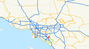 SR 261 highlighted in red | ||||
| Route information | ||||
| Defined by Streets and Highways Code § 561 | ||||
| Maintained by Caltrans and TCA | ||||
| Length | 6.12 mi (9.85 km) | |||
| Existed | 1987 – present | |||
| Major junctions | ||||
| South end | Walnut Avenue in Irvine, California | |||
| North end |
| |||
| Location | ||||
| Counties | Orange | |||
| Highway system | ||||
| ||||

State Route 261 (SR 261) is a tollway in the U.S. state of California that is part of the Eastern Transportation Corridor system. It connects State Route 241 with Interstate 5. However, Route 261 does not directly connect with I-5; surface streets must be used to make the connection; continuing south on Route 261 leads directly into a high-speed controlled-access portion of Jamboree Road.
Route description
The southern end of SR 261 is at an interchange with Jamboree Road near Walnut Avenue. SR 261 passes under I-5 but does not have an interchange with it. The freeway continues next to The Market Place, a mall in Irvine, before going through a toll plaza after the Irvine Boulevard interchange. Following this is the Portola Parkway exit, after which SR 261 briefly enters the city of Orange and has an interchange with Santiago Canyon Road (CR S18). In the middle of this interchange, SR 261 merges with SR 241; the latter continues north towards SR 91.[1]
SR 261 is part of the California Freeway and Expressway System,[2] and is part of the National Highway System,[3] a network of highways that are considered essential to the country's economy, defense, and mobility by the Federal Highway Administration.[4]
History
The California State Legislature added SR 231 to the state highway system in 1988; it was a route from I-5 around the Tustin–Irvine boundary to SR 91.[5] In 1991, the Legislature renumbered part of SR 231 to be SR 261.[6] Five years later, SR 231 was renumbered to SR 241, and the southern terminus with I-5 was changed to become Walnut Avenue.[7]
Tolls
SR 261 employs a barrier toll system, where drivers are charged flat-rate tolls based on what particular toll booths they pass through. There is one mainline toll plaza and toll booths at selected on- and off-ramps. The mainline toll plaza uses a congestion pricing scheme based on the time of day, while patrons who use an exit along the toll road are charged a prorated toll. The toll road is equipped with the FasTrak electronic toll collection system. Patrons paying by cash are charged a more expensive rate.[8]
Since May 13, 2014, the road has been using an all-electronic, open road tolling system; cash is no longer being accepted.[9] Drivers may pay using the FasTrak electronic toll collection system, license plate tolling (under Transportation Corridor Agencies's brand name "ExpressAccount"), or via a one time payment online. Those using Fastrak are charged a lower toll than those using the other two methods. Drivers must pay within 5 days after their trip on the toll road or they will be assessed a toll violation.[10]
The following table lists the tolls at each of the tolled exits for passenger cars and other two-axle vehicles (as of July 1, 2015). Vehicles with more than two axles pay a higher toll at the Irvine Ranch Toll Plaza.[8]
| Toll Booth | FasTrak | Toll-by-plate ExpressAccount | One-time payment |
|---|---|---|---|
| Irvine Blvd | Northbound Entrance: $1.46 Northbound Exit and Southbound Entrance: $0.94 |
Northbound Entrance: $2.46 Northbound Exit and Southbound Entrance: $1.94 |
Northbound Entrance: $2.46 Northbound Exit and Southbound Entrance: $1.94 |
| IRVINE RANCH TOLL PLAZA Price assumes 2-axle automobile. |
Peak: $1.88 Pre/Post Peak: $1.88 Off-Peak: $1.46 Weekends: $1.46 |
Peak: $2.88 Pre/Post Peak: $2.88 Off-Peak: $2.46 Weekends: $2.46 |
All times: $2.88 |
| Portola Pkwy Southbound Exit and Entrance, and Northbound Entrance | $1.46 | $2.46 | $2.46 |
Exit list
Except where prefixed with a letter, postmiles were measured on the road as it was when the route was established, based on the alignment that existed at the time, and do not necessarily reflect current mileage. R reflects a realignment in the route since then, M indicates a second realignment, L refers an overlap due to a correction or change, and T indicates postmiles classified as temporary (for a full list of prefixes, see the list of postmile definitions).[11] Segments that remain unconstructed or have been relinquished to local control may be omitted. The entire route is in Orange County.
| Location | Postmile [11][12][13] | Exit [14] | Destinations | Notes | |
|---|---|---|---|---|---|
| Irvine | 0.00 | Jamboree Road | Continuation beyond Walnut Avenue | ||
| 0.00 | 1 | Walnut Avenue, Edinger Avenue | No exit number northbound; south end of SR 261 | ||
| 0.24 | Northbound exit and southbound entrance | ||||
| 1.64 | 2 | Irvine Boulevard | |||
| Irvine Ranch toll plaza | |||||
| 2.85 | 3 | Portola Parkway | |||
| Orange | 6.04 | 6A | Northbound exit and southbound entrance | ||
| 6.21 | 6B | Northbound exit and southbound entrance; north end of 261; SR 241 south exit 32 | |||
| 1.000 mi = 1.609 km; 1.000 km = 0.621 mi | |||||
See also

References
- ↑ Orange County Road Atlas (Map). Thomas Brothers. 2008.
- ↑ California State Legislature. "Section 250–257". Streets and Highways Code. Sacramento: California State Legislature. Retrieved June 9, 2017.
- ↑ Federal Highway Administration (March 25, 2015). National Highway System: Los Angeles, CA (PDF) (Map). Scale not given. Washington, DC: Federal Highway Administration. Retrieved September 3, 2017.
- ↑ Natzke, Stefan; Neathery, Mike & Adderly, Kevin (June 20, 2012). "What is the National Highway System?". National Highway System. Washington, DC: Federal Highway Administration. Retrieved July 1, 2012.
- ↑ California State Assembly. "An act to add Sections 188.4 and 531 to the Streets and Highways Code, relating to transportation". 1987–1988 Session of the Legislature. Statutes of California. State of California. Ch. 1364.
- ↑ California State Assembly. "An act...relating to highways". 1991–1992 Session of the Legislature. Statutes of California. State of California. Ch. 775.
- ↑ California State Assembly. "An act to amend Section 564 of the Code of Civil Procedure, to amend Section 19993.7 of, and to add Section 65088.5 to, the Government Code, and to amend Sections 11474, 44013.5, and 44521 of, and to repeal Sections 39047.4..." 1995–1996 Session of the Legislature. Statutes of California. State of California. Ch. 1154.
- 1 2 "The Toll Roads Rate Card" (PDF). July 1, 2015. Archived from the original (PDF) on March 31, 2012. Retrieved July 9, 2015.
- ↑ "All Electronic Tolling". Transportation Corridor Agencies. Archived from the original on October 16, 2012. Retrieved October 12, 2013.
- ↑ "The Toll Roads Overview". Transportation Corridor Agencies. Retrieved December 29, 2013.
- 1 2 California Department of Transportation. "State Truck Route List". Sacramento: California Department of Transportation. Archived from the original (XLS file) on June 30, 2015. Retrieved June 30, 2015.
- ↑ California Department of Transportation (July 2007). "Log of Bridges on State Highways". Sacramento: California Department of Transportation.
- ↑ California Department of Transportation, All Traffic Volumes on CSHS, 2005 and 2006
- ↑ California Department of Transportation, California Numbered Exit Uniform System, SR-261 Northbound and SR-261 Southbound, accessed February 2008
External links
Route map:
| Wikimedia Commons has media related to California State Route 261. |