Caledonia, Missouri
| Caledonia, Missouri | |
|---|---|
| Village | |
| Nickname(s): Caley | |
 Location of Caledonia, Missouri | |
| Coordinates: 37°45′48″N 90°46′20″W / 37.76333°N 90.77222°WCoordinates: 37°45′48″N 90°46′20″W / 37.76333°N 90.77222°W | |
| Country | United States |
| State | Missouri |
| County | Washington |
| Area[1] | |
| • Total | 0.16 sq mi (0.41 km2) |
| • Land | 0.16 sq mi (0.41 km2) |
| • Water | 0 sq mi (0 km2) |
| Elevation | 915 ft (279 m) |
| Population (2010)[2] | |
| • Total | 130 |
| • Estimate (2016)[3] | 130 |
| • Density | 810/sq mi (320/km2) |
| Time zone | UTC-6 (Central (CST)) |
| • Summer (DST) | UTC-5 (CDT) |
| ZIP code | 63631 |
| Area code(s) | 573 |
| FIPS code | 29-10432[4] |
| GNIS feature ID | 0749157[5] |
Caledonia is a village in Washington County, Missouri, United States. The population was 130 at the 2010 census. Caledonia is 4 miles east of Belgrade, Missouri.
History
Caledonia was laid out in 1819.[6] The village is named after the Roman Empire's Latin name for Scotland.[7] A post office has been in operation at Caledonia since 1819.[8]
The Caledonia Historic District, Land Archeological Site, Lost Creek Pictograph Archeological Site, and Harrison Queen House are listed on the National Register of Historic Places.[9]
Geography
Caledonia is located at 37°45′48″N 90°46′20″W / 37.76333°N 90.77222°W (37.763368, -90.772212).[10]
According to the United States Census Bureau, the village has a total area of 0.16 square miles (0.41 km2), all of it land.[1]
Demographics
| Historical population | |||
|---|---|---|---|
| Census | Pop. | %± | |
| 1880 | 236 | — | |
| 1900 | 166 | — | |
| 1910 | 128 | −22.9% | |
| 1920 | 133 | 3.9% | |
| 1930 | 143 | 7.5% | |
| 1940 | 139 | −2.8% | |
| 1950 | 143 | 2.9% | |
| 1960 | 119 | −16.8% | |
| 1970 | 113 | −5.0% | |
| 1980 | 162 | 43.4% | |
| 1990 | 142 | −12.3% | |
| 2000 | 158 | 11.3% | |
| 2010 | 130 | −17.7% | |
| Est. 2016 | 130 | [3] | 0.0% |
| U.S. Decennial Census[11] | |||
2010 census
As of the census[2] of 2010, there were 130 people, 58 households, and 39 families residing in the village. The population density was 812.5 inhabitants per square mile (313.7/km2). There were 76 housing units at an average density of 475.0 per square mile (183.4/km2). The racial makeup of the village was 100.0% White. Hispanic or Latino of any race were 0.8% of the population.
There were 58 households of which 25.9% had children under the age of 18 living with them, 55.2% were married couples living together, 3.4% had a female householder with no husband present, 8.6% had a male householder with no wife present, and 32.8% were non-families. 31.0% of all households were made up of individuals and 17.2% had someone living alone who was 65 years of age or older. The average household size was 2.24 and the average family size was 2.72.
The median age in the village was 46 years. 17.7% of residents were under the age of 18; 6.1% were between the ages of 18 and 24; 24.6% were from 25 to 44; 30% were from 45 to 64; and 21.5% were 65 years of age or older. The gender makeup of the village was 53.1% male and 46.9% female.
2000 census
As of the census[4] of 2000, there were 158 people, 66 households, and 40 families residing in the village. The population density was 1,133.9 people per square mile (435.7/km²). There were 79 housing units at an average density of 567.0 per square mile (217.9/km²). The racial makeup of the village was 100.00% White.
There were 66 households out of which 31.8% had children under the age of 18 living with them, 50.0% were married couples living together, 12.1% had a female householder with no husband present, and 37.9% were non-families. 30.3% of all households were made up of individuals and 16.7% had someone living alone who was 65 years of age or older. The average household size was 2.39 and the average family size was 3.00.
In the village, the population was spread out with 25.3% under the age of 18, 13.9% from 18 to 24, 27.2% from 25 to 44, 20.3% from 45 to 64, and 13.3% who were 65 years of age or older. The median age was 29 years. For every 100 females, there were 100.0 males. For every 100 females age 18 and over, there were 87.3 males.
The median income for a household in the village was $24,833, and the median income for a family was $28,125. Males had a median income of $20,179 versus $15,625 for females. The per capita income for the village was $10,685. About 19.1% of families and 29.3% of the population were below the poverty line, including 40.0% of those under the age of eighteen and 6.7% of those sixty five or over.
School Teams
Valley R-VI is the local school. There are three schools: An elementary school, an intermediate school, and the high school/junior high, which are in the same building in Caledonia next to the intermediate school. The elementary and intermediate buildings resemble dome like structures. The reason for the unconventional structures are because of severe weather. “They are tornado proof – hurricane proof – fire proof and so our kids are very safe,“ says Valley superintendent . Cited: http://www.monolithic.org/in-the-media/kmov-of-st-louis-news-article-features-valley-r-6-school-district-s-domes
Nearest Airport
Washington County Airport, Airport Road, Mineral Point, Missouri 63660
References
- 1 2 "US Gazetteer files 2010". United States Census Bureau. Archived from the original on 2012-07-14. Retrieved 2012-07-08.
- 1 2 "American FactFinder". United States Census Bureau. Retrieved 2012-07-08.
- 1 2 "Population and Housing Unit Estimates". Retrieved June 9, 2017.
- 1 2 "American FactFinder". United States Census Bureau. Archived from the original on 2013-09-11. Retrieved 2008-01-31.
- ↑ "US Board on Geographic Names". United States Geological Survey. 2007-10-25. Retrieved 2008-01-31.
- ↑ "Washington County Place Names, 1928–1945". The State Historical Society of Missouri. Archived from the original on June 24, 2016. Retrieved December 30, 2016.
- ↑ Eaton, David Wolfe (1918). How Missouri Counties, Towns and Streams Were Named. The State Historical Society of Missouri. p. 370.
- ↑ "Post Offices". Jim Forte Postal History. Retrieved 30 December 2016.
- ↑ National Park Service (2010-07-09). "National Register Information System". National Register of Historic Places. National Park Service.
- ↑ "US Gazetteer files: 2010, 2000, and 1990". United States Census Bureau. 2011-02-12. Retrieved 2011-04-23.
- ↑ "Census of Population and Housing". Census.gov. Archived from the original on May 12, 2015. Retrieved June 4, 2015.
Municipalities and communities of Washington County, Missouri, United States | ||
|---|---|---|
| Cities | 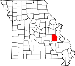 | |
| Villages | ||
| Townships | ||
| Unincorporated communities |
| |
| Ghost towns | ||
| Footnotes | ‡This populated place also has portions in an adjacent county or counties | |