Cadet, Missouri
| Cadet, Missouri | |
|---|---|
| Unincorporated community | |
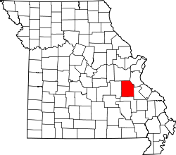 Location of Cadet, Missouri | |
| Country | United States |
| State | Missouri |
| County | Washington |
| Elevation[1] | 801 ft (244 m) |
| Time zone | UTC-6 (Central (CST)) |
| • Summer (DST) | UTC-5 (CDT) |
| ZIP code | 63630 |
| Area code(s) | 573 |
Cadet is an unincorporated community in Union Township in eastern Washington County, Missouri, United States.[1] Cadet is located on Missouri Route 47 between Old Mines to the west and Bonne Terre to the southeast.[2] The village is about 6 miles (10 km) northeast of Potosi.[3]
History
Cadet had its start when the railroad was extended to that point.[4] A post office called Cadet has been in operation since 1859.[5] It is unknown why the name "Cadet" was applied to this community.[4]
References
- 1 2 GNIS data for Cadet, Missouri
- ↑ Missouri Atlas & Gazetteer, DeLorme, 1998, First edition, p. 48 ISBN 0-89933-224-2
- ↑ "Cadet - Washington County Missouri".
- 1 2 "Washington County Place Names, 1928–1945". The State Historical Society of Missouri. Archived from the original on June 24, 2016. Retrieved December 30, 2016.
- ↑ "Post Offices". Jim Forte Postal History. Retrieved 30 December 2016.
Municipalities and communities of Washington County, Missouri, United States | ||
|---|---|---|
| Cities | | |
| Villages | ||
| Townships | ||
| Unincorporated communities |
| |
| Ghost towns | ||
| Footnotes | ‡This populated place also has portions in an adjacent county or counties | |
Coordinates: 37°59′15″N 90°41′18″W / 37.98750°N 90.68833°W
This article is issued from
Wikipedia.
The text is licensed under Creative Commons - Attribution - Sharealike.
Additional terms may apply for the media files.