Bushbuckridge
| Bushbuckridge Bosbokrand Mapulaneng | |
|---|---|
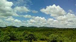 Mountains in BushBuckridge during day time. | |
 Bushbuckridge  Bushbuckridge Bushbuckridge (South Africa)  Bushbuckridge Bushbuckridge (Africa) | |
| Coordinates: 24°50′17″S 31°04′23″E / 24.83806°S 31.07306°ECoordinates: 24°50′17″S 31°04′23″E / 24.83806°S 31.07306°E | |
| Country | South Africa |
| Province | Mpumalanga |
| District | Ehlanzeni |
| Municipality | Bushbuckridge |
| Established | 1884 |
| Area[1] | |
| • Total | 1.80 km2 (0.69 sq mi) |
| Population (2011)[1] | |
| • Total | 2,109 |
| • Density | 1,200/km2 (3,000/sq mi) |
| Racial makeup (2011)[1] | |
| • Black African | 96.9% |
| • Coloured | 0.2% |
| • Indian/Asian | 1.8% |
| • Other | 1.0% |
| First languages (2011)[1] | |
| • Northern Sotho | 32.4% |
| • Tsonga | 22.4% |
| • Sotho | 19.4% |
| • Swazi | 9.0% |
| • Other | 16.7% |
| Time zone | UTC+2 (SAST) |
| Postal code (street) | 1280 |
| PO box | 1280 |
| Area code | 013 |
Bushbuckridge (Afrikaans: Bosbokrand) is the main town in Bushbuckridge Local Municipality, Ehlanzeni District, Mpumalanga, South Africa.[1] The name Bushbuck Ridge was given because of the large herds of bushbuck found here in the 1880s, and the prominent WNW-ESE ridge in the southeastern part of the municipality.[2] The town of Bushbuckridge grew around a trading store that opened in 1884.
The suburbs and rural areas to the south of Bushbuckridge constitute a "sub place", called Bushbuckridge NU with a 2011 population of 1070, covering 1,587.56 square kilometres (613 sq mi).[3]
Notes and references
- 1 2 3 4 5 "Main Place Bushbuckridge". Census 2011.
- ↑ South African Languages - Place names
- ↑ "Bushbuckridge NU Sub Place from Census 2011". Adrian Frith. Archived from the original on 20 August 2015.
Municipalities and communities of Ehlanzeni District Municipality, Mpumalanga | ||
|---|---|---|
District seat: Mbombela | ||
| Mbombela | .svg.png) | |
| Nkomazi | ||
| Thaba Chweu | ||
| Umjindi | ||
| Bushbuckridge | ||
This article is issued from
Wikipedia.
The text is licensed under Creative Commons - Attribution - Sharealike.
Additional terms may apply for the media files.