Burrows, Indiana
| Burrows | |
|---|---|
| Unincorporated community | |
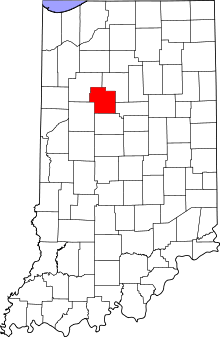 Carroll County's location in Indiana | |
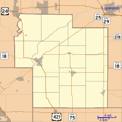 Burrows Location in Carroll County | |
| Coordinates: 40°40′36″N 86°30′27″W / 40.67667°N 86.50750°WCoordinates: 40°40′36″N 86°30′27″W / 40.67667°N 86.50750°W | |
| Country | United States |
| State | Indiana |
| County | Carroll |
| Township | Liberty |
| Elevation | 699 ft (213 m) |
| Time zone | UTC-5 (EST) |
| • Summer (DST) | UTC-4 (EST) |
| ZIP code | 46916 |
| Area code(s) | 574 |
| FIPS code | 18-09460[1] |
| GNIS feature ID | 431874[2] |
Burrows is an unincorporated community in Liberty Township, Carroll County, Indiana, United States. It is part of the Lafayette, Indiana Metropolitan Statistical Area.
History
The Burrows post office was originally called Cornucopia.[3] The post office opened at Burrows (Cornucopia) in 1853.[4]
Geography
Burrows is located at 40°40′36″N 86°30′27″W / 40.67667°N 86.50750°W. Indiana State Road 25 and the Norfolk Southern Railway both pass northeast through town.
References
- ↑ "American FactFinder". United States Census Bureau. Archived from the original on 2013-09-11. Retrieved 2008-01-31.
- ↑ "Burrows, Indiana". Geographic Names Information System. United States Geological Survey. Retrieved 2009-10-10.
- ↑ Baker, Ronald L. (October 1995). From Needmore to Prosperity: Hoosier Place Names in Folklore and History. Indiana University Press. p. 83. ISBN 978-0-253-32866-3.
A post office called Cornucopia was established here...
- ↑ "Carroll County". Jim Forte Postal History. Retrieved 28 August 2014.
Municipalities and communities of Carroll County, Indiana, United States | ||
|---|---|---|
| City | ||
| Towns | ||
| Townships | ||
| Unincorporated communities |
| |
This article is issued from
Wikipedia.
The text is licensed under Creative Commons - Attribution - Sharealike.
Additional terms may apply for the media files.