Burnie Airport
| Burnie Airport Wynyard Airport | |||||||||||||||
|---|---|---|---|---|---|---|---|---|---|---|---|---|---|---|---|
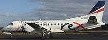 A Regional Express Saab 340 aircraft at Burnie Airport | |||||||||||||||
| Summary | |||||||||||||||
| Airport type | Public | ||||||||||||||
| Owner/Operator | Burnie Airport Corporation | ||||||||||||||
| Serves | Burnie, Tasmania | ||||||||||||||
| Location | Wynyard, Tasmania | ||||||||||||||
| Opened | February 26, 1934[1] | ||||||||||||||
| Elevation AMSL | 62 ft / 19 m | ||||||||||||||
| Coordinates | 40°59′56″S 145°43′52″E / 40.99889°S 145.73111°ECoordinates: 40°59′56″S 145°43′52″E / 40.99889°S 145.73111°E | ||||||||||||||
| Website | www.burnieairport.com.au | ||||||||||||||
| Map | |||||||||||||||
 YWYY Location in Tasmania | |||||||||||||||
| Runways | |||||||||||||||
| |||||||||||||||
| Statistics (2016/17[2]) | |||||||||||||||
| |||||||||||||||
Burnie Airport (IATA: BWT, ICAO: YWYY), also called Burnie Wynyard Airport or Wynyard Airport, is a regional airport located adjacent to the town of Wynyard, about 17 kilometres (11 mi) west from Burnie, Tasmania, Australia. Formally named the Wynyard Aerodrome, the first official opening occurred on February 26, 1934. The Burnie Airport is majority owned by the Burnie City Council.
Airlines and destinations
Regional Express Airlines operates services to and from Melbourne about 4 times per day using Saab 340 turboprop aircraft. Sharp Airlines offers flights to King Island and Launceston twice per day using a 19-seat Metro 23 (SA-227) turboprop aircraft.
| Airlines | Destinations |
|---|---|
| Regional Express Airlines | Melbourne |
| Sharp Airlines | Launceston, King Island |
History
The first aerodrome at Wynyard was built by volunteers on an old racecourse. However, within a year of completion in 1932, the aerodrome was found to be too small for larger passenger and mail aircraft. A larger aerodrome was developed on the southern outskirts of the town and was officially opened on the 26 February 1934.[1][4] A further opening ceremony on 1 January 1935 was attended by the Prime Minister of the time, Joseph Lyons.[5]
In the mid-1970s, Federal policy was adopted that would eventually see the ownership and maintenance of all airports outside of capital cities transferred from the Commonwealth to the respective local authorities.[1][6] Under the new scheme, the future of the Wynyard Aerodrome was cast into doubt after Federal funding was secured for upgrading the Devonport Airport in August 1980; few if any areas of regional Australia had two major commuter and cargo airports only 60 km apart, which was the situation for Burnie/Wynyard and Devonport. After much political controversy, it wasn't until March 1985 that AU$5.2 million of funding was allocated by the State and Federal governments to upgrade the Wynyard aerodrome.[1]
The upgraded aerodrome was officially opened on 15 February 1987, incorporating a sealed runway 1650 m long. Ownership had been transferred from the Commonwealth to the Burnie Port Authority and the Wynyard Aerodrome was renamed to Burnie Airport.[1][7]
The Burnie Airport Corporation Unit Trust acquired the Burnie Airport from the Burnie Port Corporation in 2001. The Trust is 51% owned by the Burnie City Council and 49% owned by a private sector partner, the Australian Airports Association.[8]
At-grade railway crossing
Until early 2000, Burnie airport had the distinction of having a railway line cross the northern end of runway 05/23,[9] complete with flashing red signals, but without boom gates. Lights would begin flashing approximately 5 minutes before the train was expected to cross the runway, and aircraft were prohibited to land during this time. Since then, the runway has been shortened to no-longer cross the railway line, but the old runway segment is still visible from aerial photography.
The railway line has not been in operation since 2003.[10]
Notable accidents and incidents
- On 13 April 1975, after taking off from Burnie Airport, a parachutist was drowned in a dam following a free fall descent 18.5 kilometres (11.5 mi) south of Wynyard. For reasons which have not been determined, the parachutist did not or was unable to control his descent so as to avoid landing in the dam which was some 500 metres (1,600 ft) from the designated drop zone.[11]
- On 12 January 1997, a Piper Aircraft Corp PA-28R-180 suffered engine power loss during the initial climb shortly after takeoff. Attempts to recover the engine were unsuccessful and due to the low altitude, the aircraft was stalled into the water at the mouth of the Inglis River about 2 kilometres (1.2 mi) from the aerodrome. The pilot and two passengers suffered minor injuries as a result of the crash. The subsequent ATSB investigation was hindered by the badly damaged aircraft, but it was suspected that the air duct hose had collapsed resulting in reduced air supply to the engine. It was determined that the type of hose was not designated by the manufacturer to be installed in the air inlet system.[12]
Statistics
Burnie Airport was ranked 55th in Australia for the total number of revenue passengers served in the financial year 2016-2017.[2]
| Financial Year Ending |
Revenue passengers total | Aircraft movements total | |||||||
|---|---|---|---|---|---|---|---|---|---|
| 1986* | 140,255 | 9,654 | |||||||
| 1991* | 77,540 | 8,102 | |||||||
| 1996* | 112,499 | 8,936 | |||||||
| 2001* | 92,237 | 6,524 | |||||||
| 2006* | 93,381 | 7,129 | |||||||
| 2007 | 87,529 | 6,384 | |||||||
| 2008 | 95,275 | 6,835 | |||||||
| 2009 | 86,916 | 6,419 | |||||||
| 2010 | 79,340 | 4,553 | |||||||
| 2011 | 70,402 | 3,050 | |||||||
| 2012 | 69,078 | 4,026 | |||||||
| 2013 | 67,088 | 3,987 | |||||||
| 2014 | 66,771 | 3,926 | |||||||
| 2015 | 62,240 | 3,888 | |||||||
| 2016 | 62,020 | 3,929 | |||||||
| 2017 | 59,861 | 3,929 | |||||||
|
*Showing annual statistics every 5 years (then yearly afterwards) | |||||||||
See also
References
- 1 2 3 4 5 Pink, Kerry (2000). Campsite to City - A History of Burnie. Burnie: Burnie City Council. p. 115. ISBN 0 646 40532 2.
- 1 2 3 4 "Airport Traffic Data 1985–86 to 2016–17". bitre.gov.au. Australian Government Department of Infrastructure and Regional Development. Retrieved 3 October 2017.
- ↑ YWYY – Wynyard (PDF). AIP En Route Supplement from Airservices Australia, effective 01 March 2018, Aeronautical Chart
- ↑ "Successful Air Pageant at Wynyard". The Advocate. Burnie, Tasmania. 27 February 1934. Retrieved 30 March 2017.
- ↑ "Wynyard - Opening of Aerodrome". The Advocate. Burnie, Tasmania. 31 December 1934. Retrieved 31 December 2016.
- ↑ "Management of Aerodromes under the Local Ownership Plan" (PDF). profemery.info. S J Emery. 17 August 1987. Retrieved 30 March 2017.
- ↑ Rimon, Wendy. "Air Transport". The Companion to Tasmanian History. University of Tasmania. Retrieved 31 December 2016.
- ↑ Burnie City Council Annual Report 2015 - 2016 (PDF) (Report). Burnie City Council. p. 56. Retrieved 31 December 2016.
- ↑ http://www.airwaysmuseum.com/WYY%20rail%20crossing%201.htm
- ↑ "Archived copy". Archived from the original on 13 May 2014. Retrieved 2014-05-13.
- ↑ "Cessna U206F, VH-PGJ, near Wynyard Tasmania, 13 April 1975". atsb.gov.au. Australian Transport Safety Bureau. 21 October 1975. Retrieved 31 December 2016.
- ↑ "Ditching involving a Piper Aircraft Corp PA-28R-180, VH-BOP, 2km NW Wynyard, Aerodrome, TAS on 27 January 1997". atsb.gov.au. Australian Transport Safety Bureau. 27 January 1997. Retrieved 31 December 2016.