Buritis, Rondônia
| Buritis | ||
|---|---|---|
| Municipality | ||
| ||
 Location in Rondônia state | ||
 Buritis Location in Brazil | ||
| Coordinates: 10°12′43″S 63°49′44″W / 10.21194°S 63.82889°WCoordinates: 10°12′43″S 63°49′44″W / 10.21194°S 63.82889°W | ||
| Country |
| |
| Region | North Region | |
| State | Rondônia | |
| Area | ||
| • Total | 3,266 km2 (1,261 sq mi) | |
| Population (2015) | ||
| • Total | 37,838 | |
| • Density | 12/km2 (30/sq mi) | |
| Time zone | BRT-1 (UTC-4) | |

Buritis is a municipality located in the Brazilian state of Rondônia. Its population was 37,838 (2015) and its area is 3,266 km².[1] The city consists largely of unpaved, dirt packed roads. There is one large grocery store of the Goncalves chain. Buritis has one stoplight. Surrounding and outlying farmers rely on Buritis to supply goods and replenish supplies. The city has a democratic government with a mayor and eight sitting Council members for each of the eight sectors. The climate is tropical/equatorial with few variations in temperature and climate from month to month.[2][3]
References
Capital: Porto Velho | ||
| Alvorada d'Oeste | 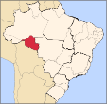 | |
| Ariquemes | ||
| Cacoal | ||
| Colorado do Oeste | ||
| Guajara-Mirim | ||
| Ji-Parana | ||
| Porto Velho | ||
| Vilhena | ||
This article is issued from
Wikipedia.
The text is licensed under Creative Commons - Attribution - Sharealike.
Additional terms may apply for the media files.