Bundesstraße 16
| |||||||||||||||||||||||||||||||||||||||||||||||||||||||||||||||||||||||||||||||||||||||||||||||||||||||||||||||||||||||||||||||||||||||
|---|---|---|---|---|---|---|---|---|---|---|---|---|---|---|---|---|---|---|---|---|---|---|---|---|---|---|---|---|---|---|---|---|---|---|---|---|---|---|---|---|---|---|---|---|---|---|---|---|---|---|---|---|---|---|---|---|---|---|---|---|---|---|---|---|---|---|---|---|---|---|---|---|---|---|---|---|---|---|---|---|---|---|---|---|---|---|---|---|---|---|---|---|---|---|---|---|---|---|---|---|---|---|---|---|---|---|---|---|---|---|---|---|---|---|---|---|---|---|---|---|---|---|---|---|---|---|---|---|---|---|---|---|---|---|---|
| Bundesstraße 16 | |||||||||||||||||||||||||||||||||||||||||||||||||||||||||||||||||||||||||||||||||||||||||||||||||||||||||||||||||||||||||||||||||||||||
 | |||||||||||||||||||||||||||||||||||||||||||||||||||||||||||||||||||||||||||||||||||||||||||||||||||||||||||||||||||||||||||||||||||||||
| Route information | |||||||||||||||||||||||||||||||||||||||||||||||||||||||||||||||||||||||||||||||||||||||||||||||||||||||||||||||||||||||||||||||||||||||
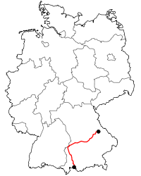
| Length | 340 km (210 mi) | ||||||||||||||||||||||||||||||||||||||||||||||||||||||||||||||||||||||||||||||||||||||||||||||||||||||||||||||||||||||||||||||||||||||
| Major junctions | |||||||||||||||||||||||||||||||||||||||||||||||||||||||||||||||||||||||||||||||||||||||||||||||||||||||||||||||||||||||||||||||||||||||
| Northeast end | Bavarian Forest | ||||||||||||||||||||||||||||||||||||||||||||||||||||||||||||||||||||||||||||||||||||||||||||||||||||||||||||||||||||||||||||||||||||||
| |||||||||||||||||||||||||||||||||||||||||||||||||||||||||||||||||||||||||||||||||||||||||||||||||||||||||||||||||||||||||||||||||||||||
| Southwest end | Füssen | ||||||||||||||||||||||||||||||||||||||||||||||||||||||||||||||||||||||||||||||||||||||||||||||||||||||||||||||||||||||||||||||||||||||
| Location | |||||||||||||||||||||||||||||||||||||||||||||||||||||||||||||||||||||||||||||||||||||||||||||||||||||||||||||||||||||||||||||||||||||||
| States | Bavaria | ||||||||||||||||||||||||||||||||||||||||||||||||||||||||||||||||||||||||||||||||||||||||||||||||||||||||||||||||||||||||||||||||||||||
| Highway system | |||||||||||||||||||||||||||||||||||||||||||||||||||||||||||||||||||||||||||||||||||||||||||||||||||||||||||||||||||||||||||||||||||||||

The Bundesstraße 16 or B 16 is one of the German federal highways crossing southern Bavaria from east to south. It runs from the Bavarian Forest to Regensburg and then along the river Danube to Günzburg. From Roding to Regensburg the highway is developed without any junctions and is in parts signed as B 16n. From Günzburg to Füssen the B 16 runs from north to south.
towns that are passed by the B 16
Roding - Nittenau - Regensburg - Kelheim - Abensberg - Neustadt an der Donau - Vohburg - Ingolstadt - Neuburg a.d.Donau - Rain - Donauwörth - Höchstädt - Dillingen a.d.Donau - Lauingen - Gundelfingen - Günzburg - Ichenhausen - Krumbach (Schwaben) - Mindelheim - Kaufbeuren - Marktoberdorf - Füssen
B 16 (new)
Since a few years there are attempts to develop this Bundesstraße without any junctions and crossings of towns and villages. Therefore, many drivings were built. Today there are main through-roads only between Lauingen and Donauwörth. Several drivings are in planning:
- Dillingen an der Donau: the plan is ready since 2009/0717; start of construction in the year 2010; completion in the year 2012;
- Höchstädt an der Donau: in planning; start of construction not before the year 2012;
- Tapfheim: preparatory planning
References
This article incorporates text translated from the article Bundesstraße 16 from the German Wikipedia, retrieved on 2 August 2009
| Wikimedia Commons has media related to Bundesstraße 16. |
| Authority control |
|---|