Bundesstraße 465
| |
|---|---|
| Bundesstraße 465 | |
 | |
| Route information | |
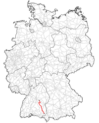
| Length | 110 km (70 mi) |
| Major junctions | |
| North end | Kirchheim unter Teck |
| South end | Leutkirch im Allgäu |
| Location | |
| States | Baden-Württemberg |
| Highway system | |

The Bundesstraße 465 (abbreviation: B 465) leads from Kirchheim (Teck) to Leutkirch Allgäu.
History
Today's Bundesstraße 465 is formed from three former Württemberg state roads:
- The northern stretch to Römerstein was part of Württemberg state road no. 45, led from Plochingen over Kirchheim (Teck) and Blaubeuren to Ulm.
- The middle stretch from Bad Urach was part of Württemberg state road 43 , and led from Stuttgart over Urach, Münsingen and Ehingen to Biberach an der Riss. This road was according to the Description of the Oberamt Ehingen created in 1810.
- The southern part led as Württemberg state road 54. from the railway station in Unteressendorf to Bad Wurzach and Leutkirch im Allgäu and finally to Isny.
The Bundesstraße 465 was established in the early 1960 years.
The Bundesstraße 465 passes the following municipalities
.jpg)
Rock fixing between Lenningen and Römerstein (2007)
This article is issued from
Wikipedia.
The text is licensed under Creative Commons - Attribution - Sharealike.
Additional terms may apply for the media files.