Bukomansimbi
| Bukomansimbi | |
|---|---|
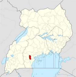
 Bukomansimbi Map of Uganda showing the location of Bukomansimbi. | |
| Coordinates: 00°10′00″S 31°37′07″E / 0.16667°S 31.61861°E | |
| Country |
|
| Region | Central Uganda |
| District | Bukomansimbi District |
| Elevation | 1,200 m (3,900 ft) |
| Population (2012 Estimate) | |
| • Total | 9,900 |
| Time zone | UTC+3 (EAT) |
Bukomansimbi is a town in the Central Region of Uganda. It is the chief municipal, administrative, and commercial center of Bukomansimbi District and the site of the district headquarters.
Location
Bukomansimbi is on the main highway between Masaka and Sembabule. It is approximately 26 kilometres (16 mi), by road, northwest of Masaka, the largest city in the sub-region.[1] The coordinates of the town are 0°10'00.0"S, 31°37'07.0"E (Latitude:-0.166667; Longitude:31.618600).[2]
Population
As of May 2014, local sources estimated the population of the town as "less than 10,000".[3]
Points of interest
The following additional points of interest lie within the town limits or close to its borders:[3]
- offices of Bukomansimbi Town Council
- Bukomansimbi central market
- Kitanda Health Center III, a health facility administered by the Uganda Ministry of Health
- Masaka-Sembabule road, passing through the western neighborhoods of the town
- Kitoma Light Junior School
- Kabigi Taqwa Islamic School
- Makoomi Yesu Akwagala School
- St. Josephat Meeru Primary School
- Kyakamunya Muslim Primary School
- St. Lawrence School
- St. Kizito School
- Mbaale Ibn Masood School
- Lwamayonza School
- Kakindu Muslim School
- Mukoza Muslim School
- Madera Junior School
- Kidsgear Primary School
- Hoys College
See also
References
- ↑ "Road Distance Between Masaka And Bukomansimbi With Map". Globefeed.com. Retrieved 10 May 2014.
- ↑ Google (21 July 2015). "Location of Bukomansimbi At Google Maps" (Map). Google Maps. Google. Retrieved 21 July 2015.
- 1 2 Watuwa Timbiti, Disms Buregyeya (24 September 2013). "Environment: Bukomansimbi's nightmares". New Vision. Retrieved 21 July 2015.
Capital: Bukomansimbi | ||
| Towns and villages |
|  |
| Economy |
| |
| Health |
| |
| Transport | ||
| Notable people |
| |
This article is issued from
Wikipedia.
The text is licensed under Creative Commons - Attribution - Sharealike.
Additional terms may apply for the media files.