Budj Bim
| Budj Bim | |
|---|---|
| Mount Eccles | |
| Highest point | |
| Elevation | 178 m (584 ft) |
| Coordinates | 38°04′S 141°55′E / 38.067°S 141.917°ECoordinates: 38°04′S 141°55′E / 38.067°S 141.917°E |
| Geography | |
| Location | Victoria, Australia |
| Climbing | |
| Easiest route | Lava Canal track |

Budj Bim or Mount Eccles is an extinct volcano near Macarthur in southwestern Victoria, Australia. Budj Bim is also the Gunditjmara name, meaning High Head. The roughly conical shaped peak rises 178 metres (584 ft).[1] The peak is a scoria hill that was thrown up beside a group of three overlapping volcanic craters that now contain Lake Surprise. A line of smaller craters and scoria cones runs to the southeast. Lava flows extend to form a shield volcano and are fed by several lava channels, or "lava canals" as they are known locally.
Formation
Initial estimates of the age of the eruption were all "minimum ages" from swamps that formed some time after the eruption and ranged from 6000 to 27,000 years,[2] but the latest evidence suggests that the eruption was at least 30,000 years ago (using dated sediments in the floor of the Lake Surprise crater[2]) and could have been as old as 40,000 for the Tyrendarra lava flow.[2]
The eruptions produced the Tyrendarra lava flow which flowed in a generally southerly direction into the ocean at Tyrendarra, 50 kilometres (31 mi).[3][4] The flow disrupted the earlier drainage system; to the east the Fitzroy River now flows cleanly between the rocks of the lava flow and the Mount Clay escarpment; to the west its tributary Darlot Creek flows through a more complex landscape of swamps, wetlands and adjacent low-lying land prone to flooding.
The eruptions altered the drainage in the area producing wetlands of the Budj Bim National Heritage Landscape.[3] The name Budj Bim has been given to two areas on the Australian National Heritage List, proclaimed in 2004,[3] the Budj Bim National Heritage Landscape - Tyrendarra Area and the Budj Bim National Heritage Landscape - Mount Eccles Lake Condah Area.
Importance
The Budj Bim areas have been included on the Heritage List because of their importance in the history of the Gunditjmara.
From some thousands of years before European settlement, the Gunditjmara developed a system of aquaculture which channelled the water of the Darlot Creek into adjacent lowlying areas trapping eels and fish in a series of weirs. This provided a year-round supply of eels which were harvested with woven traps and often smoked in hollows of the Manna Gum (Eucalyptus viminalis), and permitted a forager society to develop into a settled society constructing permanent stone dwellings.
After the European settlement began from the late 1830s, the rocks and uneven land of the lava flow permitted attacks on settlers and the means to escape from reprisal as the terrain was unsuited to horses. Attempts to pacify the Gunditjmara led to the Eumeralla Wars which did not conclude until the 1860s.
The Lake Condah Mission, established in 1868, is important to the history of the Gunditjmara, under the various policies of State authorities.
Naming Mount Eccles
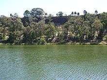
.jpg)
The mountain was named Mount Eeles in 1836 by Major Thomas Mitchell after William Eeles of the 95th Regiment of Foot who fought with Mitchell in the Peninsular War. A draftsman's error meant that the name was rendered Eccles from 1845.[5]
The Mount Eccles Lake Condah Area
This area includes the Mount Eccles National Park and the Condah Mission Station at Lake Condah on Darlot Creek to the west 38°03′44″S 141°50′00″E / 38.06222°S 141.83333°E, with the addition of recently purchased properties linking the two and in the east towards Lake Gorrie.
Mount Eccles National Park at Lake Surprise encompasses 61.2 square kilometres (24 sq mi) and includes many interesting geologic features such as lava flows, lava caves, scoria cones and crater lakes. The park has a campground and the base of the vents supports Lake Surprise, which is generally closed for swimming due to blue-green algae issues. The dreaming of local Koori nations incorporates tales of volcanic eruptions from the past. Mount Napier is located 25 kilometres (16 mi) northeast of Budj Bim.
Condah Mission Station
The Condah Mission Station was established in 1868 after agitation from displaced Gunditjmara to be permitted to live near the places from which they had been removed. In 1885 the permanent mission church was built from local stone.
In 1886 the Half-Caste Act, or an Act to amend an Act entitled "An Act to Provide for the Protection and Management of the Aboriginal Natives of Victoria" was passed which provided for the removal of all people other than fullblood Aboriginals from reserves. The Aborigines Act of 1910 rescinded that decision, and many aboriginals returned.
In 1950 it was decided that the Mission would close and the church and other facilities were destroyed to facilitate this:
Condah Mission Station Church, 1885. Destroyed 1950. Stones used to enlarge Church of England Hamilton and to pave cowyards.[6]
In 1959 the reserve was revoked and all remaining people were evicted.
Following the Aboriginal Land (Lake Condah and Framlingham Forest) Act 1987, the 53 hectare former reserve was vested to the Kerrup Jmara Elders Corporation.
The Kerrup Jmara Elders Corporation entered liquidation during the 1990s.
The reserve was eventually vested to the Gunditj Mirring Traditional Owners Aboriginal Corporation (Registered Native Title Corporate) in 2008 by the Commonwealth Minister for Indigenous Affairs, Hon. Jenny Macklin.
The Tyrendarra Area
This area (38°12′S 141°46′E / 38.200°S 141.767°E) comprises the Peters site between the Fitzroy River and Darlot Creek purchased by the Gunditj Mirring Traditional Owners Aboriginal Corporation in May 2010 (after some years' leasehold) and the Kurtonitj wetlands to the north acquired by the Corporation in September 2009.[7]
Much of the area was part of the Mount Clay squatting run (established in 1841) and the later property Keeleeng; the landscape and vegetation was seldom disturbed leaving the tumuli, stone huts and the infrastructure of the aquaculture. To the south of the Australian National Heritage List area (on both sides of the Princes Highway the landscape has been compromised by the removal of stone for fencing and, more recently, the crushing of stone to provide material for road building. As a result, most rock features have disappeared.
See also
References
- ↑ Eussen, Dick (March 2011), "Northern Extravaganza", On the Road, p. 64
- 1 2 3 Grimes, Ken (2013). "The Ages of Our Volcanoes" (PDF). Retrieved 2014-08-05.
- 1 2 3 "Place ID 105678". Australian Heritage Database. Department of the Environment. Retrieved 2010-05-28.
- ↑ Parks Victoria (November 2012), Budj Bim - Mt Eccles National Park Visitor Guide (PDF), retrieved 2013-03-03
- ↑ Learmonth, Noel F. (1970). Four Towns and a Survey. Hawthorn Press: Melbourne
- ↑ Learmonth, Noel F., ''Four Towns and a Survey., Hawthorn Press: Melbourne, 1970 ISBN 0725600128
- ↑ Indigenous Land Corporation, Land Purchased VIC, archived from the original on 25 October 2009, retrieved 28 May 2010