Bunyola
| Bunyola | ||
|---|---|---|
| Municipality and town | ||
 | ||
| ||
 Municipal location | ||
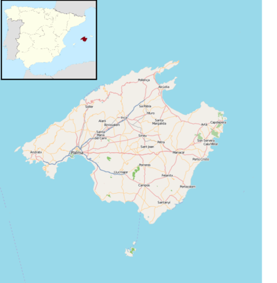 Bunyola Location of the town in Majorca 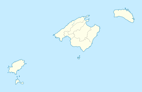 Bunyola Bunyola (Balearic Islands)  Bunyola Bunyola (Spain) | ||
| Coordinates: 39°41′48″N 2°41′59″E / 39.69667°N 2.69972°E | ||
| Country |
| |
| Autonomous Community | Balearic Islands | |
| Province | Balearic Islands | |
| Island | Majorca | |
| Comarca | Serra de Tramuntana | |
| Government | ||
| • Mayor (2015-) | Andreu Bujosa Bestard | |
| Area | ||
| • Total | 32.7 sq mi (84.7 km2) | |
| Elevation | 787,5 ft (240 m) | |
| Population (1 January 2017) | ||
| • Total | 6,636 | |
| • Density | 184.3/sq mi (71.15/km2) | |
| Time zone | UTC+1 (CET) | |
| • Summer (DST) | UTC+2 (CEST) | |
| Website | http://www.ajbunyola.net/ | |
Bunyola is a municipality of the island of Mallorca, Spain, located in the spurs of the Serra de Tramuntana, at a distance of 9 miles (14 km) from Palma. The municipality has an area of 32.67 square miles (84.6 km2) and a population of 6,636 inhabitants,INE Instituto Nacional Estadística and the Ferrocarril de Sóller passes through it on the way to Palma. (INE 2018).
The municipality of Bunyola is located in the Comarca of Serra de Tramuntana, the Tramuntana Range was awarded World Heritage Status by UNESCO as an area of great physical and cultural significance. Bunyola borders with other municipalities of Palma de Mallorca, Marratxí, Santa Maria del Camí, Alaró, Escorca, Sóller, Deià and Valldemossa.
Palmayola, Sa Font Seca y Orient are located within the municipality boundaries.
Celebration day of the patron saint, San Mateo, is on the 21st of September.
References
Coordinates: 39°41′48″N 2°41′59″E / 39.69667°N 2.69972°E
| Authority control |
|---|