Broughton Village
| Broughton Village New South Wales | |||||||||||||||
|---|---|---|---|---|---|---|---|---|---|---|---|---|---|---|---|
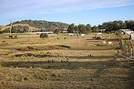 Princes Highway at Broughton Village | |||||||||||||||
|
Broughton Village Location in New South Wales | |||||||||||||||
| Coordinates | 34°44′47″S 150°45′08″E / 34.74639°S 150.75222°ECoordinates: 34°44′47″S 150°45′08″E / 34.74639°S 150.75222°E | ||||||||||||||
| Population | 86 (2016 census)[1] | ||||||||||||||
| Postcode(s) | 2534 | ||||||||||||||
| Location | |||||||||||||||
| LGA(s) | |||||||||||||||
| Region | Illawarra | ||||||||||||||
| County | Camden | ||||||||||||||
| Parish | Broughton | ||||||||||||||
| State electorate(s) | Kiama | ||||||||||||||
| Federal Division(s) | Gilmore | ||||||||||||||
| |||||||||||||||
Broughton Village is a locality on the border of the Kiama and Shoalhaven local government areas in New South Wales, Australia.[2][3] It lies on the Princes Highway about 18 southwest of Kiama and 39 km north of Nowra and on Broughton creek. At the 2016 census, it had a population of 86.[1] Broughton Village is to not to be confused with Broughton, a locality that lies to its immediate southwest or Broughton Vale, which lies to its immediate northwest.
References
| Wikimedia Commons has media related to Broughton Village, New South Wales. |
- 1 2 Australian Bureau of Statistics (27 June 2017). "Broughton Village". 2016 Census QuickStats. Retrieved 7 August 2017.

- ↑ "Broughton Village". Geographical Names Register (GNR) of NSW. Geographical Names Board of New South Wales. Retrieved 7 August 2017.
- ↑ "Broughton Village". OpenStreetMap. Retrieved 9 August 2017.
| Nowra suburbs |
|
|---|---|
| Suburbs near Jervis Bay | |
| North of Shoalhaven River |
|
| South of Shoalhaven River |
|
| Sussex Inlet |
|
| Ulladulla |
|
| Far South |
|
Main Article: Local government areas of New South Wales | |
This article is issued from
Wikipedia.
The text is licensed under Creative Commons - Attribution - Sharealike.
Additional terms may apply for the media files.