Broomhill, Manitoba
| Broomhill | |
|---|---|
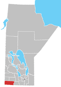
 Broomhill Location of Broomhill in Manitoba | |
| Coordinates: 49°23′35″N 101°5′15″W / 49.39306°N 101.08750°WCoordinates: 49°23′35″N 101°5′15″W / 49.39306°N 101.08750°W | |
| Country |
|
| Province |
|
| Region | Westman Region |
| Census Division | No. 5 |
| Government | |
| • Governing Body | Rural Municipality of Albert Council |
| • MP | Larry Maguire |
| • MLA | Vacant |
| Time zone | UTC−6 (CST) |
| • Summer (DST) | UTC−5 (CDT) |
| Area code(s) | 204 |
| NTS Map | 062F06 |
| GNBC Code | GADSV |
Broomhill is a community in the Rural Municipality of Albert, Manitoba, Canada. The community is located on Highway 345 between the communities of Tilston and Bede, approximately 124 km south-west of Brandon, Manitoba only 25 km north-west of the Town of Melita. The town was named for the adundance of Broom plants that were seen growing on the sandhills in the area. This area is commonly known for its rare mix of grasslands and wildlife.[1]
Infrastructure
Broomhill was served by the Canadian Pacific Railway on its Alida subdivision until a storm in the spring of 1976 washed out the bridge over the Souris River near Lauder Manitoba. The bridge was never repaired and the line was salvaged beginning in 1978., as well Manitoba Highway 345.
See also
References
- ↑ "Watchable Wildlife Manitoba" May 14, 2012
Places adjacent to Broomhill, Manitoba | |
|---|---|
Division No. 5, Manitoba (Southwest Manitoba) | ||||
|---|---|---|---|---|
| Towns |
|  | ||
| Villages |
| |||
| Rural municipalities |
| |||
| Unincorporated communities | ||||
This article is issued from
Wikipedia.
The text is licensed under Creative Commons - Attribution - Sharealike.
Additional terms may apply for the media files.