Brochant (Paris Métro)
Brochant | |||||||||||
|---|---|---|---|---|---|---|---|---|---|---|---|
| Paris Métro station | |||||||||||
 | |||||||||||
| Location |
17th arrondissement of Paris Île-de-France | ||||||||||
| Coordinates | 48°53′27″N 2°19′11″E / 48.89083°N 2.31972°ECoordinates: 48°53′27″N 2°19′11″E / 48.89083°N 2.31972°E | ||||||||||
| Owned by | RATP Group | ||||||||||
| Operated by | RATP Group | ||||||||||
| Line(s) |
| ||||||||||
| Platforms | 2 | ||||||||||
| Tracks | 2 | ||||||||||
| Other information | |||||||||||
| Station code | 30-08 | ||||||||||
| Fare zone | 1 | ||||||||||
| History | |||||||||||
| Opened | 20 January 1921 | ||||||||||
| Services | |||||||||||
| |||||||||||
| Location | |||||||||||
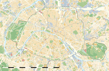 Brochant Location within Paris | |||||||||||
Brochant is a station on the north-western branch of Line 13 of the Métro in the 17th arrondissement. The station is situated under the Avenue de Clichy at Rue Brochant, from which the station derives its name.
The station opened 20 January 1912 with the opening of the second branch of line B of the Nord-Sud company from La Fourche to Porte de Clichy. On 27 March 1931 line B became line 13 of the Métro. The street is named after André-Jean-François-Marie Brochant de Villiers, a French mineralogist and geologist who was responsible for the preparation of geological map of France.
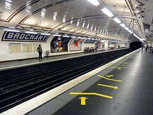
Station layout
| Street Level |
| Mezzanine |
| B2 | Side platform, doors will open on the right | |
| Northbound | ← | |
| Southbound | | |
| Side platform, doors will open on the right | ||
Gallery
 Street-level entrance at Brochant.
See also
| Wikimedia Commons has media related to Brochant (Paris Metro). |
References
- Roland, Gérard (2003). Stations de métro. D’Abbesses à Wagram. Éditions Bonneton.
| Stations |
| ||||||
|---|---|---|---|---|---|---|---|
This article is issued from
Wikipedia.
The text is licensed under Creative Commons - Attribution - Sharealike.
Additional terms may apply for the media files.