Road signs in the United Kingdom
Road signs used in the United Kingdom conform broadly to European norms, though a number of signs are unique and direction signs omit European route numbers.
There is a vast range of signs in use on British roads, from directional sign posts, to signs warning of possible hazards ahead, and regulatory signs instructing motorists to perform certain actions.
History
.jpg)
Modern British road signage can be traced to the development of the "ordinary" bicycle and the establishment of clubs to further the interests of its riders, notably the Cyclists' Touring Club (CTC), the National Cyclists' Union (NCU) and the Scottish Cyclists' Union (SCU). By the early 1880s all three organisations were erecting their own cast-iron "danger boards". Importantly, these signs warned of hazards, rather than just stating distances and/or giving direction to places, acknowledging the fact that cyclists, like modern motorists, were unlikely to be familiar with the roads they were travelling along and were travelling too fast to take avoiding action without prior warning. In addition, it was the cycling lobby that successfully pressured government in 1888 into vesting ownership of and responsibility for roads with county councils in previously established highway districts (HDs) that would be funded from taxation rather than tolls. The HDs were active in the erection of semi-standardised directional signs and mileposts in the latter years of the 19th century.
The rise of motoring after 1896 saw the pattern repeated. The larger motoring clubs, notably The Automobile Association (AA) and the Royal Scottish Automobile Club (RSAC) erected their own, idiosyncratic warning boards and direction signs on a wide scale. In addition, under the Motor Car Act 1903, four national signs were created, supposed to be set at least 8 ft (2.4 m) from the ground and 50 yards (46 m) from the reference point. These signs were interesting in being based on shape, rather than text or image; a white ring (speed limited as marked on a small information plate below it); a white (sometimes red) diamond (a "motor notice" such as a weight restriction, given on a plate below); a red disc (a prohibition); and a red open triangle (a hazard or warning). These latter two could be given detail by the attachment of an information plate below, but often it was left to the motorist to guess what the sign was referring to and local variations as to the definition of what was a prohibition or just a "notice", for instance, were common. In spite of this confusing beginning, this format of sign was to develop into the British road sign that was standard from 1934 until 1964. Before this time, until 1933, when regulations for traffic signs were published under powers created by the Road Traffic Act 1930, "national" road signage specifications were only advisory.[1]
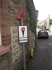
Following a review of 'national' signage in 1921 a limited number of warning and hazard information plates were enhanced by the use of symbols, rather than text only. Such symbols had been developed in continental Europe as early as 1909, but had been dismissed by the UK, which favoured the use of text. The symbols were simple silhouettes, easy to 'read' at a distance. Some were peculiarly British: 'SCHOOL' (and later 'CHILDREN') depicted by the flaming torch of knowledge. The government was to make increasing efforts to standardise road signs in the Road Traffic Act 1930 (RTA) and regulations of 1933, being finally consolidated with the publication of the 1934 Road Traffic Acts and Regulations handbook. These saw the end of the very individual black and yellow vitreous enamel AA signs (although the AA was still allowed to erect temporary direction signs, and still does). While the RSAC had ceased erecting signs, the Royal Automobile Club (RAC) had begun to do so to RTA specifications (save for the inclusion of the RAC badge) and was very active in this respect in the late-1930s.
The national British signs were now a red disc (prohibition), a red open triangle (warning/hazard), a red ring (an order), and a red open triangle in a ring for the new (1933) warning with order 'SLOW - MAJOR ROAD AHEAD' and 'HALT AT MAJOR ROAD AHEAD' plates (the predecessors of 'GIVE WAY' and 'STOP' respectively). All signs were to carry information plates mounted below them, the warnings or hazards being illustrated with a wide range of prescribed symbols, but with a text panel below, being only text where no symbol existed. Lettering and symbols were black on a white ground except for orders (like 'TURN LEFT') which were white on blue. New to the UK were the first combination sign, which incorporated information on the sign itself, the 30 miles per hour speed restriction (introduced in 1934), with '30' in black letters on a white disc (the information) surrounded by a red ring (the order sign). It was accompanied by its 'derestriction' a white disc with a diagonal black band bisecting it. Neither of these signs required separate information plates. The 1934 RTA&R also clarified direction and distance signage which also remained in that form until 1964. All signs were mounted on posts painted in black and white stripes, and their reverse sides were finished black, green, or more rarely (usually after repainting) white. The 'HALT' plate was unique in being T-shaped; orders were mainly landscape and warnings always portrait. Sizes were strictly prescribed, the warning plate being 21 by 12 inches (53 cm × 30 cm) with the surmounting triangle 18 inches (46 cm) equal.
In preparation for invasion during World War II, all navigational signposts and railway station signs were removed, to confuse potential enemy ground movements.
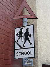
The national signs were subject to minor modification, mainly in the early post-World War II years. For instance, 'SCHOOL' became a schoolboy and girl marching off a kerb, 'CHILDREN' a boy and girl playing handball on a kerb's edge. A train 'CROSSING NO GATES' was given a more toy-like locomotive. Meanwhile, the triangle was inverted for 'HALT' and 'SLOW', while 'NO ENTRY' became a combination sign - a red disc bisected by a horizontal white rectangle bearing the lettering. Orders were now black on white, save for 'NO WAITING', which was black on yellow in a red ring. Some of these changes were part of an attempt to reflect European standards.
Early road signs were usually cast iron, but this was increasingly displaced by cast aluminium in the 1930s. Cast signs were designed to be maintained by being repainted with the raised lettering and symbol easily picked out by an untrained hand. This sort of sign was sometimes given an element of night use by the inclusion of glass reflectors. An alternative to casting and painting was vitreous enamelled sheet iron or steel. In the 1950s cast signs were quickly displaced by sheet metal (usually aluminium) coated with adhesive plastics; these could be made reflective, famously by Scotchlite. Such signs had become almost universal by the reforms of the early 1960s.
The major reform of UK road signage to better reflect European practice happened in two stages. The first was associated with the first motorway construction project and the development of a signage system for it by the Anderson Committee of 1957. Although it was additional to the existing signage, it set a number of benchmarks that were developed under the Worboys Committee of 1963 that was largely responsible for the road signage system effected from 1964, which is still current. Until Worboys, the most notable differences between European signs and those in the UK was their reliance on symbols without text wherever possible, thereby increasing the internationalism of their 'language', together with their combined nature, for instance the warning signs having the symbol inside the triangle instead of on a separate information plate. The Worboys Committee recommended that such practices were adopted in the UK and the 'New Traffic Signs' of 1964 were part of the most comprehensive reformation of the UK streetscape that the country has experienced. Unlike previous government efforts to regulate signage, which tended to be cumulative, Worboys argued a modernist position of starting from zero, with all previous signs being deemed obsolete, illegal even, therefore subject to total and systematic replacement. As a result, local authorities were charged with massive resignage programmes. Order and Prohibition signs were almost all replaced within a couple of years, with the warning and direction signs taking somewhat longer. Few pre-1964 warning signs survived more than about ten years, and, while direction signs were similarly replaced, more have survived as they were not deemed as essential as the others in regulatory terms.
The system currently in use was mainly developed in the late 1950s and the early 1960s, with additional colour-coding introduced in the mid-1980s. There were three major steps in the development of the system.
- The Anderson Committee established the motorway signing system.
- The Worboys Committee reformed signing for existing all-purpose roads.
- The Guildford Rules introduced features to indicate different categories of route.
Anderson Committee
In 1957, a government committee was formed to design signs for the new motorway network. A system was needed that could be easily read at high speed. Colin Anderson, chairman of P&O, was appointed chairman; T. G. Usborne, of the Ministry of Transport had charge of proceedings. Two graphic designers were commissioned to design the system of signage: Jock Kinneir and his assistant (and later business partner) Margaret Calvert. The new signs were first used on the Preston bypass in 1958.[3]
Worboys Committee
The UK government formed another committee in 1963 to review signage on all British roads. It was chaired by Sir Walter Worboys of Imperial Chemical Industries. The result was a document that defined traffic signing in Britain: Traffic Signs Regulations and General Directions (TSRGD). It was first introduced on 1 January 1965 but has been updated many times since. It is comparable with the Manual on Uniform Traffic Control Devices in the United States. The TSRGD is a Statutory Instrument that prescribes the sign faces and permitted variants that may be used on UK roads. The TSRGD is supported by the Traffic Signs Manual (TSM), which consists of 8 separately-published chapters which provides "the codes to be followed in the use, siting, and illumination of signs both on all-purpose roads and motorways. It also covers temporary signs for use in connection with road works, in emergency by the police, and temporary route signing by motoring organisations and highway authorities."
Guildford Rules
As part of an effort to eliminate sign clutter in the mid-1980s, a colour-coding system was developed to indicate information pertaining to different categories of route on a single sign. The system became known as Guildford Rules, after the town of Guildford, where experimental versions of this signing system were tested.
Design
Road signs in the United Kingdom are governed by an extremely complex and detailed set of guidelines. The basic units of measurement used by sign designers are the 'x-height' (the height of the lower case letter 'x') and the 'stroke width' (sw) (4 sw = 1 x-height). The sizes of borders, symbols and arrows and the spacing and layout of the sign face are expressed in sw, so that all the elements remain in proportion. The x-height of a sign is dictated mainly by the speed of traffic approaching it, hence 300 mm x-heights are common on motorways, whereas parking signs are mostly at 15 mm or 20 mm x-height.[4]
Traffic signs are generally designed using specialist computer software. The two most popular systems are SignPlot from Buchanan Computing, and KeySign[5] (previously AutoSign) from Key Traffic Systems, originally developed in the 1980s by Pete Harman and Geoff Walker whilst working for Humberside County Council.
Shape
Almost all signs have rounded corners. This is partly for aesthetic reasons. It is also safer for anyone coming into contact with a sign, and it makes the sign more durable, as rain is less likely to corrode the corners.
.svg.png)
.svg.png)
.svg.png)
.svg.png)
Units of measurement
The United Kingdom is the only European country to use mostly imperial units rather than SI units on road signs for distance measurements and speed limits, and one of few countries in the world (the United States, Liberia and Burma being the others) to do so.[6][7] Vehicle weight limits are signed only in metric (TSRGD 1981), and metric units may be used in addition to imperial ones for height, width and length restrictions.
From March 2015, all new height and width restrictions are to have dual metric-imperial units.[8] This is because of the disproportionate number of bridge strikes involving foreign lorries (between 10 and 12% in 2008). Originally, the government planned to make dual units mandatory on new height warning and restriction signs on 9 April 2010.[9][10] but it was not included in the 2011 amendment to the TSRGD. In November 2014 it was announced that all new height and width restriction signs installed from March 2015 would have dual metric-imperial units.[11]
Colours
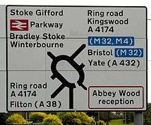
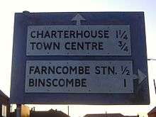
Three colour combinations are used on Worboys direction signs depending upon the category of the route. All roads are categorised as either motorways (white on blue), primary routes (white on dark green with yellow route numbers), or non-primary routes (black on white).[12][13]
TSRGD 1994 also prescribed a system of white-on-brown direction signs for tourist and recreational attractions. TSRGD 2002[14] updated this and introduced a system of black-on-yellow signs for roadworks. TSRGD 2016 is the current version in force.
On Advance Direction Signs, as introduced under the Guildford Rules, the background colour indicates the category of route on which it is located.[13] On all directional signs, destination names are placed on the colour appropriate to the category of route used from that junction.[13] A panel of one colour on a different colour of background therefore indicates a change of route status.[13] A smaller area of colour, called a patch, surrounds a bracketed route number (but not its associated destination) to indicate a higher status route that is joined some distance away.[13] A patch may only be coloured blue or green.[13]
Signs indicating a temporary change, such as roadworks or route diversions, are denoted with a yellow background. Usually these signs use a simple black on yellow colour code, more complex signage use the conventional signs superimposed onto a yellow background.
In some areas, such as the Dartmoor National Park, additional signs and colours are used to distinguish road conditions. In addition to the national colour schemes, the park also uses white signs with a light blue border and text to denote routes suitable for medium-sized vehicles and white signs with a brown border and text for routes suitable for cars and small vehicles only. The park also uses fingerpost signs for routes suitable for local traffic only. These routes are publicised in park leaflets and other media.[15]
For ease of reference, the main colour-coding rules may be summarised as below:
| Sign background | Border | Lettering | Usage | Ruleset |
|---|---|---|---|---|
| Blue | White | White | Motorway | Anderson |
| Brown | White | White | Recreational attractions | |
| Green | White | White (with yellow route numbers) | Primary route | Worboys |
| White | Black | Black | Non-primary route | Worboys |
| White | Blue | Black | Local destinations | Discontinued in favour of black border co-use |
| White | Red | Black | Ministry of Defence sites | |
| Yellow | Black | Black | Roadworks | Guildford |
The colour-coding for panels on signs may be summarised as below:
| Panel background | Border | Lettering | Usage | Ruleset |
|---|---|---|---|---|
| Blue | White | White | Motorway | Guildford |
| Brown | White | White | Recreational attractions | Guildford |
| Green | White | White | Primary routes | Guildford |
| Red | White | White | Hospital | Guildford |
| White | Red | Black | Ministry of Defence sites | Guildford |
Typefaces
Two typefaces are specified for British road signs: Transport and Motorway.
Transport is a mixed-case font and is used for all text on fixed permanent signs except route numbers on motorway signs.[4] It is used in two weights: Transport Medium (for light text on dark backgrounds) and Transport Heavy (for dark text on light backgrounds).[4]
Motorway has a limited character set consisting of just numbers and a few letters and symbols needed to show route numbers; it has elongated characters and is designed to add emphasis to route numbers on motorways.[4] Motorway is used to sign all route numbers on motorways themselves, and may also be used on non-motorway roads to sign directions in which motorway regulations apply immediately (such as motorway slip roads). Motorway Permanent is light characters on a dark background; Motorway Temporary is dark on light.
Transport Medium and Motorway Permanent were developed for the Anderson Committee and appeared on the first motorway signs. The other two typefaces are similar but have additional stroke width in the letters to compensate for light backgrounds. These typefaces are the only ones permitted on road signs in the UK. Although signs containing other typefaces do appear occasionally in some places, they are explicitly forbidden in government guidelines, and are technically illegal.
Language
Bilingual signs are used in Wales. Welsh highway authorities, until 2016, could choose whether the signs in their area were "English-priority" or "Welsh-priority", and the language having priority in each highway authority's area appeared first on signs. Most of south Wales used English-priority while western, mid, and most of northern Wales were Welsh-priority. New regulations that came into force in 2016 mandate all signs to be in Welsh first, with the existing "English-priority" signage being replaced only when they otherwise would.[16] Bilingual signs were permitted by special authorisation after 1965 and in 1972 the Bowen Committee recommended that they should be provided systematically throughout Wales.
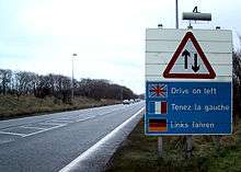
A small number of multilingual signs exist in the UK on major roads that leave major ports (such as Dover). They detail in English, French, German, and, occasionally Swedish, standard speed limits and reminders to drive on the left. Multilingual 'no stopping' signs exist in several locations on the M25.
In the Scottish Highlands and Islands, many road signs have Scottish Gaelic in green, in addition to English in black. This is part of the Gaelic language revival encouraged by many, including the Scottish Government and Bòrd na Gàidhlig.
Retroreflection
Road signs in the UK must be retroreflective in order for drivers to read them at night.[17] There are three commonly used grades of materials used:
- Class 1 (engineering grade) is a low performance glass bead product, it was the first reflective material used on the UK network and invented by 3M. Today in the UK it is used only for street nameplates and parking signs.
- Class 2 (high intensity) is generally a microprismatic product which uses truncated cube corners to return light to the driver. It is commonly used for directional signs or less important regulatory signs. There are also high intensity glass bead products that meet this class.
- Class 3 (diamond grade) is a high end microprismatic product for important signs, those on high speed roads and in areas of ambient lighting where a driver may be distracted by the light clutter. Class 3 can be divided into two divisions; 3A for long distance and 3B for short distance. Currently the only product that performs to these levels is DG3.
Categorisation
Road signs in the United Kingdom are categorised as:
- Bus and cycle signs
- Direction and tourist signs
- Information signs
- Level crossing signs
- Low bridge signs
- Motorway signs
- On street parking
- Pedestrian, cycle, equestrian
- Pedestrian zone signs
- Regulatory signs
- Road works and temporary
- Signs for cyclists and pedestrians
- Speed limit signs
- Tidal flow lane control
- Traffic calming
- Tram signs
- Warning signs
Warning signs
The importance of a warning sign is emphasised by the red border drawn around it and the triangular shape. Some warning sings do not have a red border like sharp deviation. Priority through the junction is indicated by the broader line. Examples below exclude low bridges, railway and tramway level crossings, bus and pedal cycle facilities, traffic calming and road works.
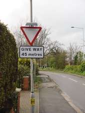
 STOP or GIVE WAY line
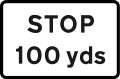 Plate use with "STOP" triangle to give distance to STOP line
 Plate used with "GIVE WAY" sign to give distance to GIVE WAY line
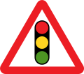 Traffic signals ahead
 Plate used with "traffic signals" for traffic signals that operate only at certain times
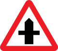 Crossroads
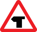 T-junction
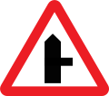 Side road
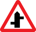 Staggered junction
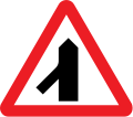 Traffic merges from the left
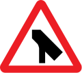 Traffic merges onto main carriageway
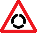 Roundabout
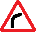 Bend to right (left if symbol reversed)
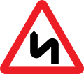 Double bend first to the left (right if symbol reversed)
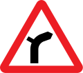 Junction on a bend (symbols may be reversed)
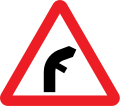 Junction on a bend (symbols may be reversed)
 Plate used with "roundabout" or "bend" signs
 Sharp deviation of route to the left (right if chevrons reversed)
 Plate used with warning signs where a reduction in speed is necessary
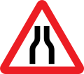 Road narrows on both sides
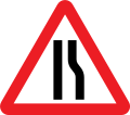 Road narrows on right (left if symbol reversed)
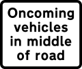
 Single file traffic in each direction
 Road wide enough for only one line of vehicles
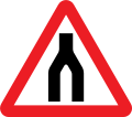 End of dual carriageway
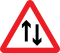 Two-way traffic
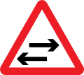 Two-way traffic on route crossing ahead
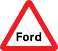 Worded warning "Ford" may be varied to "Flood", "Gate", "Gates" or "No smoking"
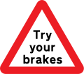 Try brakes after crossing a ford or before descending a steep hill
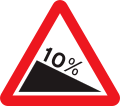 Steep hill downwards (10% is equivalent to 1:10)
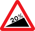 Steep hill upwards (20% is equivalent to 1:5)
 Plates used with "steep hill" signs
 Plates used with "steep hill" signs
 Plates used with "steep hill" signs
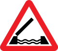 Opening of swing bridge
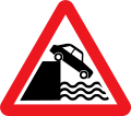 Quayside or river bank
 Water course alongside road
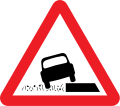 Soft verges
 Plate used with "soft verges" for distance shown
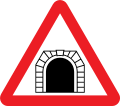 Tunnel
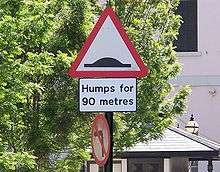
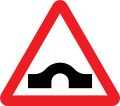 Hump bridge
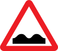 Uneven road
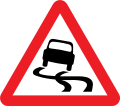 Slippery road
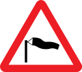 Side winds
 Distance to hazard
 Distance and direction to hazard
 Distance over which hazard extends
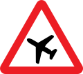 Low-flying aircraft or sudden aircraft noise
 Gliders likely
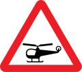 Low-flying helicopters or sudden helicopter noise
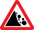 Risk of falling or fallen rocks
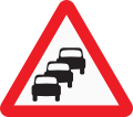 Traffic queues ahead
 Traffic queues likely ahead
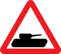 Slow-moving military vehicles likely to be in or crossing the road
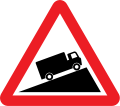 Slow-moving vehicles ahead
 Plate for "slow-moving vehicles" to show distance over which slow lorries extends
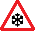 Ice or Snowdrifts
 Plate used with "ice". may be varied to "snowdrifts"
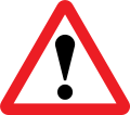 Other danger ahead. This sign must be accompanied by an information plate specifying the nature of the danger.
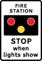 Fire station ahead, STOP when lights show. "FIRE" may be varied to "AMBULANCE"
 Plate indicates nature of hazard
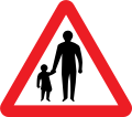 Pedestrians ahead
 Pedestrians in road for distance shown
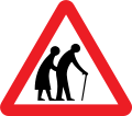 Frail pedestrians likely to cross
 Disabled pedestrians. "Disabled" may be varied to "Blind"
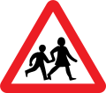 Children going to or from school
 Plate used with "school" sign
 Alternative plates used with "school" sign
 Alternative plates used with "school" sign
 Alternative plates used with "school" sign
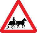 Horse-drawn vehicles likely to be in the road
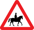 Accompanied horses or ponies likely to be in or crossing the road
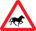 Wild horses or ponies
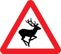 Wild animals
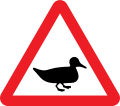 Wild fowl
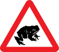 Migratory toad crossing
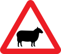 Sheep
Sheep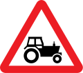 Agricultural vehicles
 Agricultural vehicles
 Area infected by animal disease
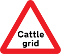 Cattle grid
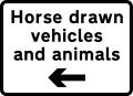 Plate used with "cattle grid" for indication of bypass for horse-drawn vehicles and animals
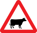 Cattle
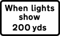 Plate used with "cattle" to indicate supervised cattle crossing ahead
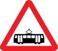 Trams likely to be crossing ahead
Regulatory signs
Signs in circular red borders are prohibitive, whether or not they also have a diagonal red line. Circular blue signs mainly give a positive (mandatory) instruction. Such circular signs may be accompanied by, or place on, a rectangular plate (information) that provides details of the prohibition or instruction; for example, waiting and loading plates and zone entry signs.
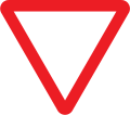
'Stop' signs (octagonal) and 'give way' signs (inverted triangle) are the two notable exceptions, the distinctive shapes being recognisable even if the face is obscured by dirt or snow.
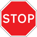 Stop before crossing the traverse line on the road and ensure the way is clear before entering a major road
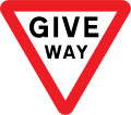 Give way to traffic on the major road (English Language Only)
.svg.png) Give way to traffic on the major road (English and Wales Language)
Give way to traffic on the major road (English and Wales Language)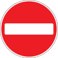 No Entry for vehicular traffic
 All vehicles prohibited except non-mechanically propelled vehicles being pushed by pedestrians.
 Plate used on "vehicles prohibited" All vehicles prohibited
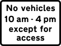 Plate for "vehicles prohibited", during the time indicated except for access
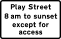 Plate for "vehicles prohibited", all vehicles prohibited from 'Play Street' during the period indicated except for access
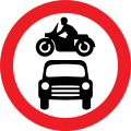 Motor vehicles prohibited
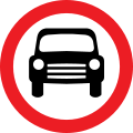 Motor vehicles except solo motor cycles prohibited
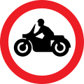 Solo motor cycles prohibited
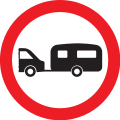 Towed caravans prohibited
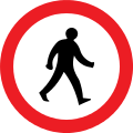 Pedestrians prohibited
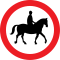 Ridden or accompanied horses prohibited
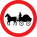 Horse-drawn vehicles prohibited
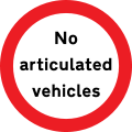 Articulated vehicles prohibited
.svg.png) Goods vehicles exceeding a gross weight of 7.5 t prohibited
Goods vehicles exceeding a gross weight of 7.5 t prohibited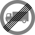 End of prohibition of goods vehicles exceeding the maximum gross weight indicated in a previous sign
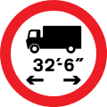 Vehicles exceeding length indicated prohibited
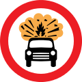 Vehicles carrying explosives prohibited
 Plate used on "vehicles carrying explosives"
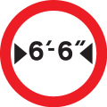 Vehicles exceeding width indicated prohibited (imperial only)
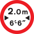 Vehicles exceeding width indicated prohibited (imperial and metric)
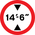 Vehicles exceeding height indicated prohibited (imperial only)
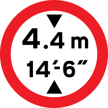 Vehicles exceeding height indicated prohibited (imperial and metric)
.svg.png) Vehicles exceeding a gross weight of 33 t prohibited from crossing the bridge or structure
Vehicles exceeding a gross weight of 33 t prohibited from crossing the bridge or structure Plate for any regulation sign except for access to premises or land adjacent to the road, where there is no other route. Other exemptions may be shown
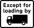 Except for loading and unloading by goods vehicles
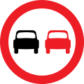 No overtaking
 Priority must be given to vehicles from the opposite direction
 Plate for "Oncoming vehicles"
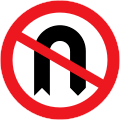 No U-turns for vehicular traffic
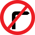 No right turn for vehicular traffic
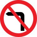 No left turn for vehicular traffic
 Stop before crossing, children crossing ahead
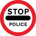 Stop before crossing, Police ahead
 Vehicular traffic must turn left (right if symbol reversed)
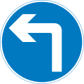 Vehicular traffic must turn ahead in the direction indicated by the arrow
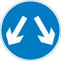 Vehicular traffic may reach the same destination by passing either side of the sign
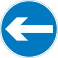
 Vehicular traffic passing the sign must keep to the left of the sign (right if symbol reversed)
 Dual carriageway Plate
 One-way plate
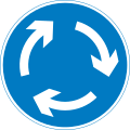 Mini-roundabout (give way to traffic from the immediate right)
 No Waiting or No Parking
 No Stopping
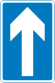 One-way traffic
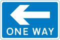 One-way traffic
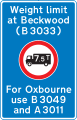 Location of weight restriction ahead with indication of an alternative route (may show a different restriction)
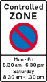 No parking zone
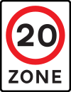 Speed limit zone in Miles per hour (mph)
 Advisory speed limit in Miles per hour (mph)
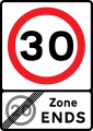 End of speed limit zone in Miles per hour (mph)
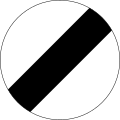 End of maximum speed limit in Miles per hour (mph)
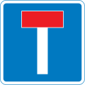 No through road
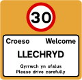 Built-up Area Begins in Miles per hour (mph)
 National speed limits
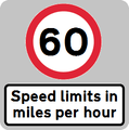 National speed limits (Northern Ireland Only)
Speed Limit Signs
The United Kingdom national speed limit for cars and motorcycles in areas of street lighting (excluding Motorways) is 30 miles per hour. Other limits may apply if they are specifically signed
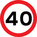 Maximum speed limit of 40 miles per hour
- Entrance to a 20 miles per hour speed limit zone
 End of controlled or voucher parking zone
- End of 20 miles per hour zone and start of 30 miles per hour zone
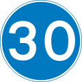 Minimum speed limit of 30 miles per hour
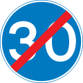 End of 30 miles per hour minimum speed limit
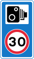 Speed camera ahead and reminder of 30 miles per hour speed limit
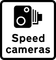 Area in which cameras are used to enforce the speed limit regulations
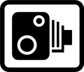 Speed Camera
.svg.png) Average speed check
Average speed check
Low Bridge Signs
Bridges with a clearance of less than 16.6 feet (5.1 m) are normally signed. Units are traditionally in feet and inches, but any new or replacement sign must contain metric measurements. Both regulatory roundels and warning triangles can be used, depending on the type of bridge however bridges particularly at risk from strikes may have a variable message sign that is activated by high vehicles passing through an infra-red beam. When the sign is activated, four amber lamps flash, the top pair alternating with the bottom pair
- Vehicles exceeding width indicated are prohibited
- Vehicles exceeding length indicated are prohibited
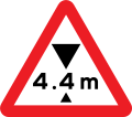 Maximum headroom of 4.4 m at hazard ahead
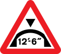 Maximum headroom of 12'-6" at arch bridge ahead
- Maximum height
Level crossing Signs
Some level crossings in the United Kingdom do not have gates or barriers. These crossings will have several signs posted on approach and at the crossing.
 Level crossing with gate or barrier ahead
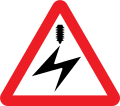 Electrified overhead cable ahead
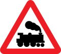 Railway level crossing without gate or barrier ahead
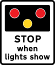 Warning of light signals at a level crossing without a gate or barrier ahead (the sign may also be used at a lifting bridge or airfield)
 Load gauge to afford audible warning of the maximum safe height of vehicles about to pass under electrified
 Open level crossing
 More than one train crossing
Bus and cycle signs
Some roads and pavements are shared with cyclists and buses. The word "local" on the bus symbol means the only buses that may use the lane are those running a local service. Where the word "local" is not shown, the lane may be used by any vehicle designed to carry more than 8 passengers, excluding the driver, and local buses. Solo motorcycles may use the lane where the motorcycle symbol is shown on the signs. Other vehicles may enter and stop in a bus lane to load and unload unless signs alongside the lane indicate otherwise.
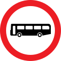 Buses prohibited
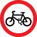 Riding of pedal cycles prohibited
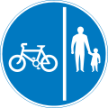 Route comprising a separated track and path for cycles and pedestrian
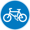 Route for use by pedal cycles only
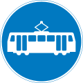 Route for use by tramcars only
 Route for use by buses and tramcars only
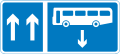 Contra-flow bus lane
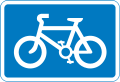 Route recommended for pedal cycles on the main carriageway of a road
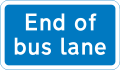 End of bus lane
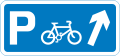 Junction ahead leading to a parking place for pedal cycles
 With flow cycle lane
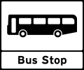 Stopping place for buses
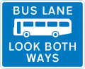 Bus lane with traffic proceeding from both ways (reminder for pedestrians)
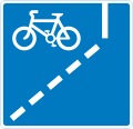 With-flow cycle lane ahead
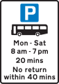 Parking place for buses only during the times shown
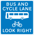 Contra-flow bus lane which pedal cycles may also use with traffic approaching from the right (reminder for pedestrians)
Pedestrian zone signs
Areas such as high streets and shopping areas may be signed as "pedestrian zones". Restrictions are detailed on zone entry signs and repeater plates. The entry signs may indicate that buses, taxis, disabled badge holders or permit holders may enter the zone. Examples of zone entry signs include:
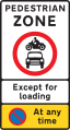 Entry to and waiting in pedestrian zone restricted except for loading during the period
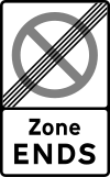
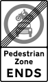 End of restrictions associated with a pedestrian zone
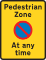 Waiting restriction repeater signs within the pedestrian zone
 A zebra crossing in the United Kingdom
Loading bays and Parking signs
Waiting restrictions are indicated by both signs and road markings. On-street parking places may be designated for a particular class of vehicle (e.g. solo motorcycles or car) or for a particular user (e.g. permit holders or disabled badge holders). Parking may be free or paid for (e.g. "pay and display" or parking meters).
There may be a time limit on the period of stay and a minimum time before returning to a particular parking place. Where a plate does not indicate the days of the week, the restrictions apply at the same times on every day, including Sunday. Where the time of day is not shown, the controls apply for 24 hours. If a bank holiday falls on a day when the controls are in operation, the controls apply in the normal way unless the plate states that they do not. Special controls may apply on days when a large event is being held.
 Waiting prohibited except for loading and unloading during the period indicated
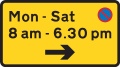 Waiting prohibited except for loading and unloading during the period and in the direction indicated
 Waiting prohibited in designated off-highway loading area during the period indicated
 Continuous prohibition on loading and unloading
 Bay reserved for loading and unloading only
 Waiting prohibited in the direction indicated (upper panel), and loading and unloading prohibited in the direction indicated (lower panel)
 Parking place
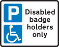 Parking place reserved for disabled badge holders only
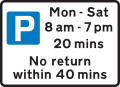 Free parking for all vehicles, with restrictions on length of waiting time and return period
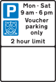 Parking place reserved for voucher parking during the period indicated
 Direction to a parking place available only on the day specified
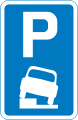 Vehicles may be parked partially on the verge or footway
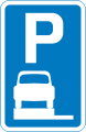 Vehicles may be parked wholly on the verge or footway
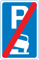 End of area where vehicles may be parked partially on the verge or footway
Motorway signs
For use on busy motorways and other wide roads where verge mounted signs would be frequently obstructed by other traffic.[18]
An advance direction sign (ADS)[18] generally has blue, green or white as its background colour to indicate the status of road (motorway, primary or non-primary) on which it is placed. Except on the main carriageway of a motorway, coloured panels are used to indicate routes from the junction being signed that have a different status. A direction sign (DS)[18] should always be a single colour indicating the status of the road to be joined, although there are a few rare exceptions to this rule.
The Heavy and Medium typefaces were designed to compensate for the optical illusion that makes dark lines on pale backgrounds appear narrower than pale lines on dark backgrounds. Hence destinations are written in mixed case white Transport Medium on green and blue backgrounds, and in black Transport Heavy on white backgrounds. Route numbers are coloured yellow when placed directly on a green background. Some signs logically show the closest destination on the route first (i.e., on top), while others show the most distant settlement first. On a roundabout DS, the route locations are usually listed with the closest destination at the bottom and the furthest away at the top when going straight ahead, and likewise going left and right. However, many left-right signs more logically indicate the closest destination at the top with further afield destinations listed in descending order.
Destinations/roads which cannot be directly accessed on a driver's current actual route, but can be accessed via an artery route of that carriageway, are displayed in brackets.
All types of ADS (but not DS) may optionally have the junction name at the top of the sign in capital letters in a separate panel.
A route confirmatory sign is placed either after a junction where distances were not shown on the ADS or DS or is placed on an overhead information sign but does not show distances to the destinations along that route.[19]
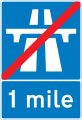 End of motorway regulations, including the national speed limit in 1 mile
 Start of motorway regulations, including the national speed limit
 Number of route reached from a motorway exit road
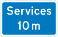 10 miles to the next motorway service area
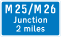 Junction ahead with another motorway
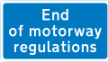 Entrance to motorway service area, or similar facility within the length of a motorway where motorway regulations cease to apply
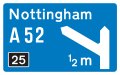 Motorway junction ahead, displaying the route number and destination reached by taking this route
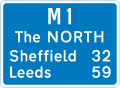 Route number of the motorway with destinations and distances to places along or reached from that route
 Direction to a motorway at the junction shown, indicating route number and destination reached
 Entrance to a motorway service area
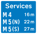 Availability of motorway service areas ahead with distances
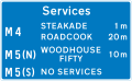 Availability of motorway service areas ahead with distances and names of operators
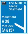
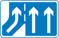 Additional traffic lane joining from the right ahead
Motorway Signals
Motorway conditions
.svg.png) Leave motorway at next exit
Leave motorway at next exit Risk of Fog ahead. Proceed with caution
 Risk of Ice ahead. Proceed with caution
 End of temporary restrictions
Temporary Speed Advisories
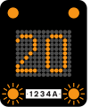 Temporary Speed advised of 20 miles per hour (32 km/h) due to prevailing traffic or weather conditions.
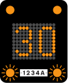 Temporary Speed advised of 30 miles per hour (48 km/h) due to prevailing traffic or weather conditions.
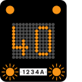 Temporary Speed advised of 40 miles per hour (64 km/h) due to prevailing traffic or weather conditions.
 Temporary Speed advised of 50 miles per hour (80 km/h) due to prevailing traffic or weather conditions.
Lane Restrictions
 Lane 2 and 3 closed ahead. Use lane 1 and proceed with caution.
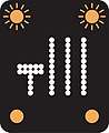 Lane 1 closed. Use lanes 2, 3 and 4. Proceed with caution
Motorway Closed
 All 4 lanes closed. Do not enter the motorway when the red lamps are flashing in pairs from side to side
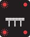 All 3 lanes closed Do not enter the motorway when the red lamps are flashing in pairs from side to side
 Both lanes closed. Do not enter the motorway when the red lamps are flashing in pairs from side to side
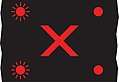
^ A previous signal may direct you into an adjacent lane. More than one lane may be closed to traffic. If all lanes display a red cross, the motorway ahead is closed. Motorists caught using the traffic lane are subject to a fine of £100 and will receive points on their licence.[20]
Directional road signs
The term "directional sign" covers both Advance Direction Signs (ADS), placed on the approach to a junction,[18] and Direction Signs (DS) at the junction itself, showing where to turn.[18] A DS has a chevron (pointed) end, and this type is also referred to as a flag-type sign.[19]
 300 yards to a roundabout or the next point at which traffic may leave a non-primary route
 200 yards to a roundabout or the next point at which traffic may leave a non-primary route
 100 yards to a roundabout or the next point at which traffic may leave a non-primary route
 Junction ahead of a primary route with non-primary route through a town or village that has been by-passed
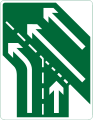 Additional traffic lanes joining from the right ahead. Traffic in the right hand lane joins the main carriageway. Traffic on the main carriageway has priority over joining traffic (primary route)
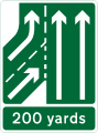 Additional traffic lane joining from the left in 200 yards. Traffic on main carriageway had priority over joining traffic from the right hand lane of the slip road (primary routes)
Tourist Destinations
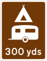 Camping and caravan site 300 yards ahead
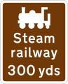 Steam railway tourist attraction 300 yards ahead
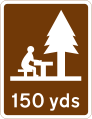 Picnic area 150 yards ahead
 Direction to tourist attraction indicated by a symbol
 Direction along a route passing through places of interest recognised by a regional tourist
 Direction and distance to picnic area
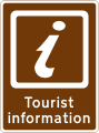
 Direction and distance to a Tourist Information point or centre
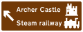 Junction ahead from a motorway exit slip road to the tourist attractions shown
 Direction of route to a tourist attraction for pedestrians
 Junction ahead leading to a tourist attraction
 Youth hostel 200 yards in the direction indicated
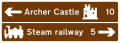 Junction ahead from a motorway exit slip road to the tourist attractions shown
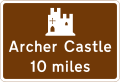 Historic castle tourist attraction 10 miles ahead
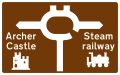 Tourist information
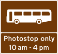 Stopping place for buses used for carrying tourists to allow passengers to take photographs
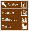 Motorway junction ahead leading to a town or geographical area containing several tourist attractions and a Tourist Information Point or Centre
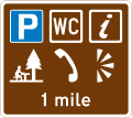 Distance ahead to parking place with a Tourist Information Point, picnic site, public telephone, public toilets and viewpoint
Diversion routes
Diversion routes are marked with black symbols on a yellow patch (square, triangle, circle, or diamond). These mark diversionary routes in the event that the road ahead is closed for any reasons. Motorists can navigate following the symbol, and can find their way back to the original road at a junction above the closure. The four symbols may be filled (solid) or outlines. They are most commonly placed on directional signs, following the route number (e.g. A 25) but may be free standing.
Motorway exits have trigger signs that are normally covered. In the event of a closure, the sign is uncovered and will say, for instance, "To rejoin M6 follow (symbol)". Following the symbol will allow rejoining at a later junction.[21]
On minor roads a simple black on yellow sign with an arrow and the word Diversion is used, as here.
 Solid Circle - Emergency diversion route for motorway and other main road traffic
 Solid Triangle - Emergency diversion route for motorway and other main road traffic
 hollow Square - Emergency diversion route for motorway and other main road traffic
 hollow Diamond - Emergency diversion route for motorway and other main road traffic
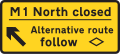 Diversion trigger sign - Main road closed, follow diversion to arrive at the same location
 For triangle diversion, turn right
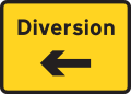 Diversion sign on minor roads or for road works starting to left.
Informational signs
Informational signs are mainly rectangular (square or oblong) but, strictly speaking, this category also covers directional signs. They are often coloured to match the directional signing for the status of road in question, but where this is not necessary they are generally blue with white text. Examples include "lane gain" and "lane drop" signs on grade-separated roads, and "IN" and "OUT" indications for accesses to private premises from the highway.
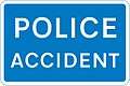 Police accident
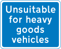 Unsuitable for heavy goods vehicles
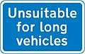 Unsuitable for long vehicles
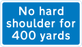 No hard shoulder for 400 yards
Roadworks and temporary signs
Roadworks are normally signalled with a triangular, red-bordered warning format is used to indicate that there are works ahead. The graphic is of a man digging. Within the roadworks, diversions and other instructions to drivers are normally given on yellow signs with black script.[22]
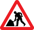 Road works
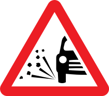 Loose chippings
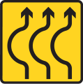 Lanes bend ahead
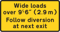 Restrictions apply. No vehicles over width shown
 Diversion for motorists travelling to destination
 Temporary Advisory speed limit in Miles per hour (mph)
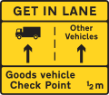 Get in Lane. HGV use left lane, all other vehicles use right lane
Street name signs
Legally these are not defined as traffic signs in the UK. This gives authorities flexibility on the design and placement of them. They can be fixed to a signpost, wall, lamp column, or building. The text is usually in the Transport typeface used on road signs. It is also common for street nameplates to use the serif font designed by David Kindersley.
Location identifiers
Numbered location markers of one type or another are used to identify specific locations along a road. Historically, milestones were used, but since the early 20th century they fell into disuse. However, for administrative and maintenance purposes, distance marker posts and driver location signs have been erected on motorways and certain dual carriageways.[23] The numbers on distance marker posts are embedded into emergency roadside telephone numbers and are used by the emergency services to pinpoint incidents.[24] The advent of the mobile phone meant that location information embedded into motorway emergency telephone systems was not being accessed by drivers and since 2007 driver location signs have been erected on many motorways. These contain important information about the location and carriageway direction, and the reference number should be quoted in full when contacting the emergency services.
Retired signs (post-Worboys)
.svg.png) Stop (until 1975)
Stop (until 1975).svg.png) Crossroads ahead (until 1975)
Crossroads ahead (until 1975).svg.png) T-junction ahead (until 1975)
T-junction ahead (until 1975).svg.png) Side road ahead (until 1975)
Side road ahead (until 1975).svg.png) Staggered crossroads ahead (until 1975)
Staggered crossroads ahead (until 1975)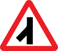 Traffic merges from the left (until 1994)
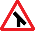 Traffic merges onto main carriageway (until 1994)
.svg.png) Change of carriageway ahead (1975-1994)
Change of carriageway ahead (1975-1994)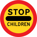 Stop - children crossing (until 1994)
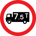 Vehicles exceeding the indicated gross weight in tons prohibited (replaced with metric tonne equivalent in 2011)
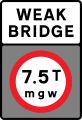 Vehicles exceeding a indicated gross weight prohibited from crossing bridge (until 2011)
Northern Ireland, Crown Dependencies and overseas territories
.JPG)
The designs of road signs in Great Britain as prescribed in the Traffic Signs Regulations and General Directions (TSRGD) apply specifically to England, Scotland and Wales.[25] These regulations do not extend to other territories that come under the jurisdiction of the Crown. Road signs in Northern Ireland, the Channel Islands and the Isle of Man are under the jurisdiction of their local legislatures. Although the policy in these territories is to align their road signs with those prescribed in the TSRGD, small variations may be seen.
Traffic signs in Northern Ireland are prescribed by The Traffic Signs Regulations (Northern Ireland) 1997 and are administered by the Northern Ireland Assembly. The Tynwald (Isle of Man Parliament), through its Traffic Signs (Application) Regulations 2003, explicitly included Part I of the TSRGD into Manx law, but not the other parts of that legislation. One of the consequences of this partial incorporation is that while in England and Wales speed limit signs had to appear on both sides of a carriageway until 2016, this was not necessary in the Isle of Man.[26]
Road signs in Gibraltar and the British Sovereign Base Areas in Cyprus are controlled by the Ministry of Defence. In the SBA road signs are modelled on Cypriot road signs rather than British Road signs[27] including the use of metric speed limits[28] while in Gibraltar the signs are similar in appearance to the UK, but in line with the rest of the Iberian Peninsula, road signs use metric units and traffic drives on the right. However, height and width clearance warning and regulatory signs are both in imperial and metric.[29]
Road signs are modelled on U.S. road signs in the British Virgin Islands and British Indian Ocean Territory, whilst signs in other overseas territories such as the Falkland Islands and Cayman Islands are modelled on UK signs.
See also
References

- ↑ Oddy, N 'This Hill is Dangerous' in 'Technology and Culture' 56/2, April 2015 pp335-369
- ↑ "Google Street View of location". Retrieved 28 February 2014.
- ↑ Description of the work done by Kinneir and Calvert
- 1 2 3 4 "Chapter 7". Traffic Signs Manual (PDF). London: The Stationery Office. 19 October 2005. p. 8. ISBN 978-0-11-552480-6. Retrieved 19 October 2014.
- ↑ "KeySIGN". KeySIGN Product Specification. Key Traffic Systems. Archived from the original on 13 July 2011. Retrieved 17 August 2011.
- ↑ "Q&A: Pounds, pints and the EU". BBC News. British Broadcasting Corporation. 11 September 2007. Retrieved 29 December 2007.
- ↑ "Call for metric road sign switch". BBC News. British Broadcasting Corporation. 23 February 2006. Retrieved 29 December 2007.
- ↑ "Height and width road signs to display metric and imperial". BBC News. 2014-11-08. Retrieved 2014-11-08.
- ↑ "Impact Assessment of the Traffic Signs (Amendment) Regulations and General Directions 2010 and of the Traffic Signs (Temporary Obstructions) (Amendment) Regulations 2010" (PDF). Department for Transport. Retrieved 19 October 2014.
- ↑ "The Traffic Signs (Amendment) Regulations and General Directions 2010" (PDF). Department for Transport. Retrieved 19 October 2014.
- ↑ "Height and width road signs to display metric and imperial". BBC News. 2014-11-08. Retrieved 2014-11-08.
- ↑ Department of Transport: "Local Transport Note 1/94", page 1. HMSO, July 1994.
- 1 2 3 4 5 6 "Chapter 7". Traffic Signs Manual (PDF). London: The Stationery Office. 19 October 2005. p. 16. ISBN 978-0-11-552480-6. Retrieved 19 October 2014.
- ↑ UK Statutory Instrument:"The Traffic Signs Regulations and General Directions 2002", The Stationery Office, 2002
- ↑ "Dartmoor Leaflet Part 2" (PDF). Dartmoor National Park Authority. Retrieved 16 September 2011.
- ↑ Road Safety GB 31 March 2016
- ↑ "Reflectorisation of Traffic Signs" (PDF). www.dft.gov.uk. Highways Agency, etc. Retrieved 19 October 2014.
- 1 2 3 4 5 "Chapter 7". Traffic Signs Manual (PDF). London: The Stationery Office. 19 October 2005. p. 14. ISBN 978-0-11-552480-6. Retrieved 19 October 2014.
- 1 2 "Chapter 7". Traffic Signs Manual (PDF). London: The Stationery Office. 19 October 2005. p. 15. ISBN 978-0-11-552480-6. Retrieved 19 October 2014.
- ↑ "£100 fine for flouting red X motorway signs planned". www.msn.com. Retrieved 2017-10-20.
- ↑ CBRD: Emergency Diversion Routes
- ↑ "Chapter 7". Traffic Signs Manual (PDF). London: The Stationery Office. 19 October 2005. pp. 116–117. ISBN 978-0-11-552480-6. Retrieved 19 October 2014.
- ↑ Highway Agency. "Identification of Incident Locations". Archived from the original on 17 March 2010. Retrieved 25 July 2009.
- ↑ Highway Agency. "Driver Location Signs (March 2007)". Archived from the original on 8 June 2009. Retrieved 25 July 2009.
- ↑ "Statutory Instrument 2002 No. 3113; The Traffic Signs Regulations and General Directions 2002". Controller of HMSO. 16 December 2002.
- ↑ "THE CHIEF CONSTABLE v MITCHELL & OTRS". The Isle of Man Courts. 11 June 2009. Retrieved 2 February 2010.
- ↑ "Website of the Sovereign British Area, Cyprus". Administration of the Sovereign British Area, Cyprus. Retrieved 8 December 2009.
- ↑ "Public Instrument 41 of 2008, MOTOR VEHICLES AND ROAD TRAFFIC (MOTORWAY AND SPEED LIMITS ORDER 2008), Published 2 December 2008" (PDF). Administration of the Sovereign British Area, Cyprus. Retrieved 8 December 2009.
- ↑ "Getting Around - Driving". Gibraltar.gi Tourism. Retrieved 8 December 2009.
External links
| Wikimedia Commons has media related to Road signs in the United Kingdom. |
- Official government websites
- Department for Transport traffic signs and signals index page
- The Traffic Signs Regulations and General Directions 2002
- The Highway Code: traffic signs
- Know your traffic signs
- UK motoring
- The Traffic Signs Regulations and General Directions 2016
- History
- Other resources
- Institute of Highway Engineers sign design technical gateway
- Spot the deliberate errors on 5 incorrectly designed signs (Morelock Signs)
- Project curated by Patrick Murphy, celebrating the 50th Anniversary of the British Road Sign at the Design Museum, London